- Fort Raleigh National Historic Site
-
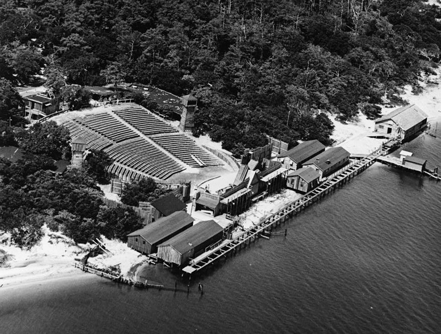
 Waterside Theatre
Fort Raleigh National Historic Site ist eine durch die Vereinigten Staaten von Amerika unter Schutz gestellte historische Stätte im Bundesstaat North Carolina. Auf dem Gelände, das durch den National Park Service verwaltet wird, wurde die erste englische Siedlung in Nordamerika errichtet: Roanoke, die sogenannte verlorene Kolonie (Lost Colony)
Die sich über 2,8 Quadratkilometer ausdehnende historische Stätte liegt neben dem U.S. Highway 64 am Nordende der Insel Roanoke in North Carolina, etwa 5 Kilometer nördlich des Ortes Manteo bei den Koordinaten N 35°56'317"und W 75°42'33"35.93818-75.70904Koordinaten: 35° 56′ 17″ N, 75° 42′ 33″ W. Das Schicksal der Verlorenen Kolonie Sir Walter Raleighs bleibt ein Rätsel. Pro Jahr besuchen über 270.000 Menschen die historische Stätte (2005), die in der Gemarkung Dare County liegt.Die Stätte ist außerdem Aufführungsort des symphonischen Dramas von Paul Green: "The Lost Colony", dass seit 1937 jeden Sommer im Freilufttheater Waterside Theatre aufgeführt und von der Roanoke Island Historical Association präsentiert wird. Darüber hinaus gehören die Elisabethan Gardens zur historischen Stätte, diese werden durch den Garden Club of North Carolina betreut und gedenken der ersten Siedler mit der Anlage eines Gartens aus jener Zeit.
Verwaltung des Parks
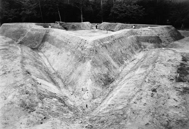
 Fort Raleigh während des Wiederaufbaus (1950)
Fort Raleigh National Historic Site wurde am 5. April 1941, durch einer Übertragung des Geländes an den National Park Service in Zusammenarbeit mit der Roanoke Island Historical Association (RIHA) und dem Staatssekretär Alvin J. Wirtz eingerichtet und durch den Historic Sites Act von 1935 ermöglicht. Wie alle historischen Stätten, die der National Park Service verwaltet ist auch diese iseit 15. Oktober 1966 im nationalen Register historische bedeutsamer Orte (National Register of Historic Places) aufgeführt. Fort Raleigh wird gemeinsam mit zwei weiteren historischen Stätten in den Outer Banks betreut, dem Wright Brothers National Memorial und dem Cape Hatteras National Seashore. Der Sitz der Verwaltung aller drei Gebiete liegt am nördlichen Ende der Insel Roanoke. Die 1941 getroffene Vereinbarung erlaubt der RIHA sowohl das Theater als auch den Park selbst für Theateraufführungen zu nutzen. Das Stück "The Lost Colony" wird, abgesehen von einer Unterbrechung im Zweiten Weltkrieg seit 1937 jährlich aufgeführt.
Die Stätte wird aufgrund ihrer Bedeutung bei der ersten englischen Besiedlung Nordamerikas im Jahre 1587 bewahrt und durch den Staatenbund geschützt, auch wenn die Kolonie und die Besiedlung in den Jahren zwischen 1587 und 1590 durch Verzögerung in der Versorgung mit Vorräten aus bis heute ungeklärten Gründen scheiterte.
Literatur
- Cameron Binkley and Steve Davis: Preserving the Mystery: An Administrative History of Fort Raleigh National Historic Site, National Park Service, 2003.
- The National Parks: Index 2001–2003. Washington: U.S. Department of the Interior.
Weblinks
Kategorie:- National Historic Site (Vereinigte Staaten)
Wikimedia Foundation.