- Eurobodalla Shire
-
Shire of Eurobodalla 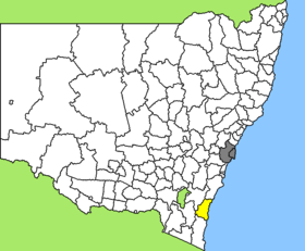
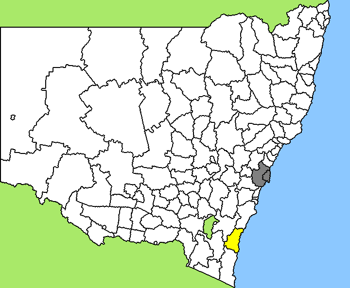
Lage des Eurobodalla Shire in New South WalesGliederung Staat:  Australien
Bundesstaat:  New South Wales
Verwaltungssitz: Moruya Daten und Zahlen Fläche: 3.422 km² Einwohner: 35.009 (2006) [1] Bevölkerungsdichte: 10 Einwohner je km² -35.916666666667150.1Koordinaten: 35° 55′ S, 150° 6′ OEurobodalla Shire ist ein lokales Verwaltungsgebiet (LGA) im australischen Bundesstaat New South Wales. Das Gebiet ist 3.422 km² groß und hat etwa 35.000 Einwohner.
Eurobodalla liegt am südlichen Küstenabschnitt des Staates etwa 190 km östlich der australischen Hauptstadt Canberra und 300 km südlich der Metropole Sydney. Das Gebiet umfasst 106 Ortsteile und Ortschaften, darunter Batehaven, Batemans Bay, Bergalia, Bodalla, Broulee, Congo, Dalmeny, Durras, Eurobodalla, Horuya Heads, Kiora, Long Beach, Malua Bay, Mogo, Moruya, Mossy Point, Narooma, Nelligen, Nerrigundah, Potato Point, Tilba Tilba, Central Tilba, Tomakin, Turlinjah und Tuross Head. Der Sitz des Shire Councils befindet sich in der Küstenstadt Moruya, wo etwa 2.400 Einwohner leben.
Verwaltung
Der Eurobodalla Shire Council hat neun Mitglieder, die von den Bewohnern der LGA gewählt werden. Eurobodalla ist nicht in Bezirke untergliedert. Aus dem Kreis der Councillor rekrutiert sich auch der Mayor (Bürgermeister) des Councils.
Weblinks
Einzelnachweise
- ↑ Australian Bureau of Statistics (25. Oktober 2007): Eurobodalla (A) (Local Government Area) (Englisch). 2006 Census QuickStats. Abgerufen am 6. April 2010.
Kategorie:- Local Government Area in New South Wales
Wikimedia Foundation.