Dirk Hartog Island

Dirk Hartog Island

Vorlage:Infobox Insel/Wartung/Höhe fehlt

Dirk Hartog Island
Karte der Shark Bay auf der auch die Dirk-Hartog-Insel zu erkennen ist
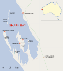
Gewässer Indischer Ozean
Geographische Lage 25° 30′ S, 113° 30′ O-25.5113.5Koordinaten: 25° 30′ S, 113° 30′ O
Dirk Hartog Island (Westaustralien)
Dirk Hartog Island
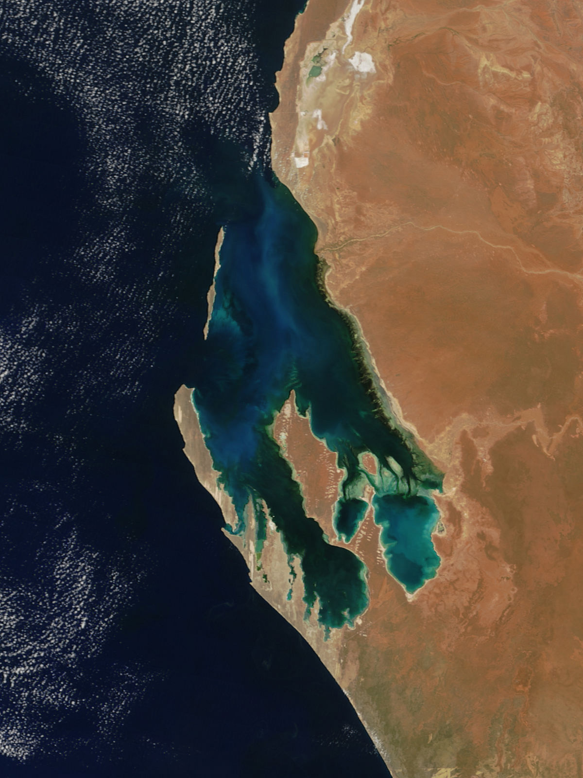
Länge 80 km
Breite 15 km
Fläche 620 km²
Satellitenbild der Shark Bay

Dirk Hartog Island ist eine Insel im Gebiet der Shark Bay an der Westküste Australiens.

Die Insel ist ca. 80 Kilometer lang und zwischen 3 und 15 Kilometern breit. Sie ist die längste und westlichste Insel Westaustraliens, etwa 850 km nördlich von Perth im Bundesstaat Western Australia.

Der holländische Seefahrer Dirk Hartog betrat am 25. Oktober 1616 erstmals australischen Boden. Er war damit der zweite Europäer in Australien.

Dirk Hartog Island liegt in der Shark Bay und zählt aufgrund optimaler ökologischer Bedingungen seit 1991 zum UNESCO-Welterbe. Im Gebiet um die Insel besteht das größte Seegrasvorkommen der Welt, weshalb sich Delfine, Haie, Seekühe und weitere Meeresbewohner in der Bucht tummeln. Über zehn Prozent der weltweiten Seekuhpopulation ist hier anzutreffen.

Die Insel ist erst seit zehn Jahren offiziell über die westaustralische Stadt Denham zugänglich und unbewohnt. Sie gehört zur politischen Gemeinde Shire of Shark Bay. Besitzer der Insel sind Kieran und Tory Wardle.

Besonderheiten der Insel sind die Dünenlandschaft, die Buschlandschaft und weiße Sandstrände. Die Felsküste gilt als einer der besten australischen Angelplätze.

Weblinks


Wikimedia Foundation.

Игры ⚽ Нужно сделать НИР?

Schlagen Sie auch in anderen Wörterbüchern nach:

  • Dirk Hartog Island — Dirk Hartog …   Wikipedia

  • Dirk Hartog Island — Île Dirk Hartog Île Dirk Hartog Carte de la baie Shark montrant l île Dirk Hartog Géographie Pays …   Wikipédia en Français

  • Dirk Hartog Island — ▪ island, Western Australia, Australia       Australian island in the Indian Ocean, just north of Edel Land Peninsula, Western Australia. Naturaliste Channel passes north to enter Denham Sound (which washes the eastern shore), and Shark Bay lies… …   Universalium

  • Dirk Hartog Island — /dɜk ˈhatɒg/ (say derk hahtog) noun a long narrow island in the Indian Ocean off the coast of WA at the entrance to Shark Bay. 77 km long …  

  • Dirk Hartog — s plate in the Rijksmuseum Amsterdam Map of Shark Bay …   Wikipedia

  • Dirk Hartog — (1580 1621) était un marin et explorateur hollandais dont une expédition en fit le commandant du deuxième groupe d Européens à mettre le pied sur le continent australien. Il utilisa un stratagème comme preuve de son passage : la célèbre… …   Wikipédia en Français

  • Dirk Hartog Landing Site 1616 — Die Shark Bay, Dirk Hartog Island und Cape Inscription (mittig links) …   Deutsch Wikipedia

  • Île Dirk Hartog — Carte de la baie Shark montrant l île Dirk Hartog Géographie Pays …   Wikipédia en Français

  • Isla Dirk Hartog — Dirk Hartog Island Imagen de satélite Localización País …   Wikipedia Español

  • Hartog Plate — or Dirk Hartog s Plate is either of two plates, although primarily the first, which were left on Dirk Hartog Island during a period of European exploration of the western coast of Australia prior to European settlement there. The first plate,… …   Wikipedia

Share the article and excerpts

Direct link
Do a right-click on the link above
and select “Copy Link”