Courtenay (British Columbia)

Courtenay (British Columbia)
Courtenay
Lage in British Columbia
Courtenay (British Columbia)
Courtenay
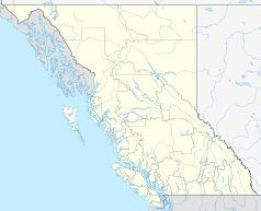
Courtenay
Staat: Kanada
Provinz: British Columbia
Regionaldistrikt: Comox Valley
Koordinaten: 49° 41′ N, 124° 59′ W49.6841-124.9902513Koordinaten: 49° 41′ N, 124° 59′ W
Höhe: 13 m
Fläche: 26,68 km²
Einwohner: 21.940 (Stand: 2006)
Bevölkerungsdichte: 822,3 Einw./km²
Zeitzone: Pacific Time (UTC−8)
Postleitzahl: V9J, VJN
Bürgermeister: Greg Phelps

Courtenay ist eine Stadt an der Ostküste von Vancouver Island. Sie liegt in der Provinz British Columbia in Kanada. Sie ist die größte Stadt im Comox Valley und Verwaltungssitz von Comox Valley.

Inhaltsverzeichnis

Geschichte

Courtenay existiert offiziell seit dem 1. Januar 1915. Die Stadt wurde nach dem Fluss Courtenay River benannt, welcher wiederum nach George William Courtenay, Kapitän der HMS Constance benannt wurde, welche zwischen 1846 und 1849 in diesem Gebiet vor Anker lag.

Geografie

Courtenay liegt 4 km westlich von Comox, 7 km nordöstlich von Cumberland, 5 km nordwestlich von Royston und 108 km nordwestlich von Nanaimo. Nach kanadischen Statistiken hat die Stadt eine Fläche von 17,02 km². Durch Courtenay läuft die british-columbianische Landstraße 19A. Die Stadt befindet sich im nördlichen Gebiet der Eisenbahnlinie von Esquimalt and Nanaimo Railway.

Demografie

Nach der Zählung von 2001 leben in der Stadt 18.305 Menschen in 7.995 privaten Haushalten und 5.160 Familien. Die Bevölkerungsdichte beträgt 1.075,3/km². In der Stadt stehen 8.549 Gebäude. 93,9 % der Bevölkerung sind Weiße, 4,9 % Asiaten, 4 % amerikanische Urbevölkerung, 0,5 % Schwarze und 0,2 % anderer Abstammung. 13.880 Einwohner von Courtenay haben ein jährliches Durchschnittseinkommen von 19,716 US-Dollar.

Weblinks


Wikimedia Foundation.

Игры ⚽ Нужно сделать НИР?

Schlagen Sie auch in anderen Wörterbüchern nach:

  • Courtenay, British Columbia — City of Courtenay Coat of arms of City of Courtenay Coat of arms …   Wikipedia

  • British Columbia — Colombie Britannique (French) …   Wikipedia

  • British Columbia — Colombie Britannique Britisch Kolumbien Wappen Flagge (Details) …   Deutsch Wikipedia

  • Comox, British Columbia — For other uses, see Comox (disambiguation). Town of Comox Comox Flag …   Wikipedia

  • British Columbia — Colombie Britannique 54° N 125° W / 54, 125 …   Wikipédia en Français

  • British Columbia Coast — Howe Sound, along British Columbia s South Coast. The British Columbia Coast or BC Coast is Canada s western continental coastline on the Pacific Ocean. The usage is synonymous with the term West Coast of Canada. In a sense excluding the urban… …   Wikipedia

  • British Columbia municipal elections, 2005 — The Canadian province of British Columbia held its triannual municipal elections on November 19, 2005. Voters in each of BC s 157 municipalities elected mayors and councillors, and rural voters elected directors for their regional district… …   Wikipedia

  • Union Bay, British Columbia — Union Bay in British Columbia, Canada is a small community approximately 15 kilometres (9 mi) south of Courtenay, British Columbia, the largest city in the Comox Valley. Union Bay is populated by about 1200 people and is an unincorporated site… …   Wikipedia

  • Victoria, British Columbia — For other uses, see Victoria (geographical disambiguation). This article is about the city of Victoria. For electoral districts with the name Victoria, or in the area of Greater Victoria, see Victoria (electoral districts). City of Victoria… …   Wikipedia

  • Duncan, British Columbia — City of Duncan   City   City Hall Motto: City of Totems …   Wikipedia

Share the article and excerpts

Direct link
Do a right-click on the link above
and select “Copy Link”