- Żelazków
-
Żelazków 
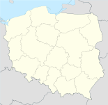

Żelazków Basisdaten Staat: Polen Woiwodschaft: Großpolen Landkreis: Kalisz Geographische Lage: 51° 51′ N, 18° 10′ O51.85388888888918.1725Koordinaten: 51° 51′ 14″ N, 18° 10′ 21″ O Einwohner: -
(31. Dez. 2010)[1]Postleitzahl: 62-817 Telefonvorwahl: (+48) 62 Kfz-Kennzeichen: PKA Gemeinde Gemeindeart: Landgemeinde Gemeindegliederung: 36 Ortschaften 25 Schulzenämter Fläche: 113,6 km² Einwohner: 9111
(31. Dez. 2010) [2]Bevölkerungsdichte: 80 Einw./km² Gemeindenummer (GUS): 3007112 Verwaltung Bürgermeister: Andrzej Nowak Adresse: Żelazków 138
62-817 ŻelazkówŻelazków (deutsch 1943–1945 Eisen)[3] ist ein Dorf und Sitz der gleichnamigen Gemeinde im Powiat Kaliski der Woiwodschaft Großpolen, Polen.
Gemeinde
Zur Landgemeinde Żelazków gehören 25 Ortsteile (deutscher Name bis 1945)[3] mit einem Schulzenamt:
Weitere Ortschaften in der Gemeinde sind:
- Biernatki (1943–1945 Bornhufen)[3]
- Chrusty
- Góry Zborowskie
- Góry Złotnickie
- Koronka
- Michałów
- Niedźwiady (1943–1945 Bärenhagen)[3]
- Russówek
- Strugi
- Witoldów
Verweise
Fußnoten
- ↑ Population. Size and Structure by Territorial Division. As of December 31, 2010. Główny Urząd Statystyczny (GUS), abgerufen am 23. Juni 2011.
- ↑ Population. Size and Structure by Territorial Division. As of December 31, 2010. Główny Urząd Statystyczny (GUS), abgerufen am 23. Juni 2011.
- ↑ a b c d e f g h i j k l m n o p q r s Deutsche Topograph. Karte, 4175 Kamin (1:25000), Ausgabe 1 vom XI. 1944
Städte und Gemeinden im Powiat KaliskiBlizanów | Brzeziny | Ceków-Kolonia | Godziesze-Wielkie | Koźminek | Lisków | Mycielin | Opatówek | Stawiszyn-Land | Stawiszyn | Szczytniki | Żelazków
Wikimedia Foundation.
Schlagen Sie auch in anderen Wörterbüchern nach:
Zelazkow — Original name in latin elazkw Name in other language State code PL Continent/City Europe/Warsaw longitude 51.85418 latitude 18.1743 altitude 124 Population 1250 Date 2010 09 09 … Cities with a population over 1000 database
Gmina Żelazków — Infobox Settlement name = Gmina Żelazków other name = Żelazków Commune settlement type = Gmina total type = Total image shield = image shield = subdivision type = Country subdivision name = POL subdivision type1 = Voivodeship subdivision name1 =… … Wikipedia
Chrusty, Gmina Żelazków — For other places with the same name, see Chrusty. Chrusty Village Country Poland Voivodeship … Wikipedia
Гмина Желязкув — Gmina Żelazków Страна: Польша Повят: Калишский повят Глава: Анджей Новак (2006) Площадь: 113,57 км² Население: 8934 чел. Год переписи: 2004 Плотность населения … Википедия
Czartki, Kalisz County — For other places with the same name, see Czartki (disambiguation). Czartki Village … Wikipedia
Dębe, Kalisz County — For other places with the same name, see Dębe (disambiguation). Dębe Village … Wikipedia
Michałów, Kalisz County — For other places with the same name, see Michalow. Michałów Village … Wikipedia
Niedźwiady, Kalisz County — For other places with the same name, see Niedźwiady (disambiguation). Niedźwiady Village … Wikipedia
Nowy Borków — Village Country Poland Voivodeship Greater Poland … Wikipedia
Gmina Opatówek — Opatówek Commune Gmina Coat of arms … Wikipedia
Żelazków


18+
© Academic, 2000-2024
- Kontaktieren Sie uns: Unterstützung, Werbung
Wörterbücher Export, schritte mit PHP, Joomla, Drupal, WordPress, MODx.