- Yarmouth (Isle of Wight)
-
Yarmouth Blick auf Yarmouth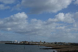
Koordinaten 50° 42′ N, 1° 30′ W50.7048-1.495Koordinaten: 50° 42′ N, 1° 30′ W 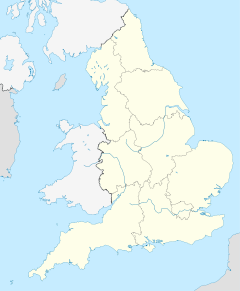

Yarmouth Bevölkerung 855 (Stand: 1991) Verwaltung Post town YARMOUTH Postleitzahlenabschnitt 41 Vorwahl 01983 Landesteil England Region South East England Zeremonielle Grafschaft Isle of Wight Unitary authority Isle of Wight Britisches Parlament Isle of Wight Yarmouth ist ein Hafen und Civil parish an der Nordwestküste der südenglischen Isle of Wight. Der Ort liegt an der Mündung des Flusses Western Yar in die Meerenge Solent. Yarmouth ist der kleinste Town im Vereinigten Königreich.
Inhaltsverzeichnis
Geschichte
Yarmouth gilt als eine der frühesten Siedlungen der Isle of Wight und besteht seit mehr als tausend Jahren. Die erste urkundliche Erwähnung der Ortes unter dem Namen Eremue (was so viel wie "schlammiger Ästuar" bedeutet) stammt aus dem Jahre 991 in einer Urkunde des Königs Æthelred über das Danegeld. Der Ort erhielt im Jahre 1135 das Recht, sich "town" zu nennen.
Während des Mittelalters war der Ort ein Parliamentary Borough und bis 1832 auch ein Wahlkreis. Vor dem Bau einer Burg wurde der Ort immer wieder von Franzosen überfallen und schließlich 1544 abgebrannt. Die Kirchenglocken wurden dabei laut einer Legende nach Cherbourg oder Boulogne-sur-Mer gebracht. Drei Jahre später wurde eine Burg unter dem Namen Yarmouth Castle gebaut, die heute Teil der English Heritage ist. Sie diente der Überwachung der Meerenge Solent und dem Schutz der Isle of Wight sowie der Verhinderung von Invasionen.
1863 wurde eine Brücke über die Mündung des Flusses Western Yar gebaut, die die vorher genutzte Fähre ersetzte. Der Pier von Yarmouth wurde 1876 gebaut und ist noch heute der längste öffentlich zugängliche Holzpier Englands.
Wirtschaft
In Yarmouth gibt es einige Schiffswerften sowie für die Einwohnerzahl relativ viele Geschäfte, Hotels, Pubs und Restaurants. Durch Bauarbeiten an der Straße nach Newport sowie Reparaturen an der Brücke der Straße nach Totland und Problemen mit dem Fährverkehr zum Festland ging der Umsatz der Geschäfte im Jahr 2009 um 30 % zurück.
Verkehr
Yarmouth ist über die Wightlink-Fähre nach Lymington mit dem Festland verbunden. Als einzige Straße führt die A3054 durch den Ort. Sie verbindet die Inselhauptstadt Newport über Shallfleet, Yarmouth und Freshwater mit Totland. Bis 1953 fuhren Personenzüge nach Newport. Danach wurde der Schienenverkehr eingestellt und die Schienen wurden entfernt.
Sehenswürdigkeiten
Yarmouth liegt am Isle of Wight Coastal Path. Außerdem gibt es die SSSI Yar Estuary und Boulnor and Hamstead Cliffs.
Weblink
 Commons: Yarmouth, Isle of Wight – Sammlung von Bildern, Videos und AudiodateienKategorie:
- Ort auf der Isle of Wight


Wikimedia Foundation.