Rock Creek (British Columbia)
- Rock Creek (British Columbia)
-
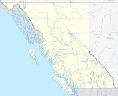
Rock Creek ist ein Ort im Boundary Country in British Columbia in Kanada am Zusammenfluss des Rock Creek mit dem Kettle River.
Geschichte
Der Ort entstand 1860 durch den Rock Creek-Goldrausch.
Verkehr
Rock Creek liegt an der Kreuzung des Crowsnest Highway mit dem Highway 33.
Siehe auch
Wikimedia Foundation.
Schlagen Sie auch in anderen Wörterbüchern nach:
Rock Creek — may refer to:Communities;In Canada *Rock Creek, British Columbia, a town in the Boundary Country **Rock Creek Gold Rush;In the United States *Rock Creek, Alabama, a census designated place (CDP) in Jefferson County *Rock Creek, Minnesota, a city… … Wikipedia
Rock Creek — ist die Bezeichnung mehrerer Orte in den USA: Rock Creek (Alabama) Rock Creek (Iowa) Rock Creek (Minnesota) Rock Creek (Ohio) Rock Creek (Texas) Rock Creek (Wisconsin) in Kanada: Rock Creek (British Columbia) Rock Creek ist auch der Name… … Deutsch Wikipedia
Rock Creek Gold Rush — The Rock Creek Gold Rush was a gold rush in the Boundary Country region of the Colony of British Columbia (now part of a Canadian province). The rush was touched off in 1859 when two US soldiers were driven across the border to escape pursuing… … Wikipedia
British Columbia — Colombie Britannique (French) … Wikipedia
Greenwood, British Columbia — Infobox Settlement official name = City of Greenwood other name = native name = nickname = settlement type = City motto = imagesize = image caption = flag size = image seal size = image shield = shield size = city logo = citylogo size = mapsize … Wikipedia
Marble Canyon (British Columbia) — For other places with the same name, see Marble Canyon (disambiguation). Marble Canyon is a small canyon in the south central Interior of British Columbia, Canada a few kilometres east of the Fraser River and the community of Pavilion, British… … Wikipedia
British Columbia Highway 5 — Highway 5 Southern Yellowhead Highway Coquihalla Highway Route information Length: 524 km (326 mi) … Wikipedia
British Columbia Highway 97 — Infobox road province=BC name notes= type=Hwy route=97 alternate name= length mi= length round= length ref= length notes= established=1953 direction a=South starting terminus= border junction=Hwy 3 in Osoyoos Hwy 3A in Kaleden Hwy 97C in… … Wikipedia
British Columbia Yukon Railway — White Pass Yukon Rwy., Stand 2006[1] Legende … Deutsch Wikipedia
Rock Creek Cemetery — Infobox nrhp | name =Rock Creek Cemetery (Rock Creek Church Yard and Cemetery) (Adams Memorial) Rock Creek Church Road, N.W. Washington, D.C. nrhp type = |thumb caption =Adams Memorial (grave marker)|Adams Memorial location= Rock Creek Church… … Wikipedia