- River Winster
-
Winster 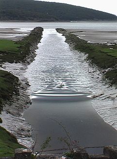
Gezeitenwelle an der Mündung des River Winster in den River Kent
Daten Lage Cumbria, England Flusssystem River Kent Abfluss über River Kent → Morecambe Bay Flussgebietseinheit North West Ursprung Undermillbeck Common unterhalb von Capple Barrow
54° 20′ 33″ N, 2° 54′ 32″ W54.3425-2.908988Mündung in den River Kent 54.201236-2.869713Koordinaten: 54° 12′ 4″ N, 2° 52′ 11″ W
54° 12′ 4″ N, 2° 52′ 11″ W54.201236-2.869713
Der River Winster ist ein Fluss in Cumbria, England. Der Winster war die historische Grenze zwischen den historischen Grafschaften Lancashire und Westmoreland.Der Winster entspringt im Lake District auf den Bergen zwischen den Orten Winster und Bowness-on-Windermere. Der Fluss fließt in südlicher Richtung an den Siedlungen Ludderburn, Hartbarrow und Bowland Bridge vorbei. Bei Bridge House geht der Fluss in ein Tal zwischen dem Whitbarrow und dem Cartmel Fell über. Der Fluss fließt an den Orten Meathop und Lindale vorbei, bevor er östlich von Grange-over-Sands in den Mündungstrichter des River Kent an der Morecambe Bay mündet.
Kategorien:- Flusssystem River Kent
- Fluss in Europa
- Fluss in England
- Lake District
- Cumbria

Wikimedia Foundation.