- Połajewo
-
Połajewo 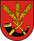
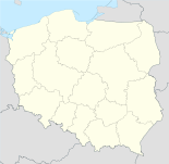

Połajewo Basisdaten Staat: Polen Woiwodschaft: Großpolen Landkreis: Czarnków-Trzcianka Geographische Lage: 52° 48′ N, 16° 44′ O52.79666666666716.739166666667Koordinaten: 52° 47′ 48″ N, 16° 44′ 21″ O Einwohner: 2237 (2006)
Postleitzahl: 64-710 Telefonvorwahl: (+48) 67 Kfz-Kennzeichen: PCT Gemeinde Gemeindeart: Landgemeinde Gemeindegliederung: 8 Schulzenämter Fläche: 142 km² Einwohner: 6182
(31. Dez. 2010) [1]Bevölkerungsdichte: 44 Einw./km² Gemeindenummer (GUS): 3002062 Verwaltung Bürgermeister: Stanisław Pochyluk Adresse: ul. Obornicka 6a
64-710 PołajewoPołajewo (deutsch: Güldenau) ist ein Dorf und Sitz einer Landgemeinde in Polen. Der Ort liegt im Powiat Czarnkowsko-Trzcianecki der Wojewodschaft Großpolen.
Gemeinde
Zur Landgemeinde Połajewo gehören 8 Ortsteile (deutsche Namen bis 1945)[2] mit einem Schulzenamt:
- Boruszyn (Boruschin)
- Krosin
- Krosinek
- Młynkowo
- Połajewo (Güldenau)
- Przybychowo
- Sierakówko
- Tarnówko (Tarnowko)
Einzelnachweise
- ↑ Population. Size and Structure by Territorial Division. As of December 31, 2010. Główny Urząd Statystyczny (GUS), abgerufen am 23. Juni 2011.
- ↑ Das Genealogische Orts-Verzeichnis
 Städte und Gemeinden im Powiat Czarnkowsko-Trzcianecki (Kreis Scharnikau-Schönlanke)
Stadtgemeinde: Czarnków
Stadt- und Landgemeinden: Krzyż Wielkopolski | Trzcianka | Wieleń
Landgemeinden: Czarnkow-Gmina | Drawsko | Lubasz | Połajewo
Wikimedia Foundation.
Schlagen Sie auch in anderen Wörterbüchern nach:
Połajewo, Kuyavian-Pomeranian Voivodeship — Infobox Settlement name = Połajewo settlement type = Village total type = image shield = subdivision type = Country subdivision name = POL subdivision type1 = Voivodeship subdivision name1 = Kuyavian Pomeranian subdivision type2 = County… … Wikipedia
Polajewo — Original name in latin Poajewo Name in other language State code PL Continent/City Europe/Warsaw longitude 52.79923 latitude 16.73347 altitude 76 Population 2237 Date 2011 07 31 … Cities with a population over 1000 database
Gmina Połajewo — Infobox Settlement name = Gmina Połajewo other name = Połajewo Commune settlement type = Gmina total type = Total image shield = POL gmina Połajewo COA.svg subdivision type = Country subdivision name = POL subdivision type1 = Voivodeship… … Wikipedia
Młynkowo, Czarnków-Trzcianka County — For other places with the same name, see Młynkowo. Młynkowo Village … Wikipedia
Czarnków-Trzcianka County — Powiat czarnkowsko trzcianecki County … Wikipedia
Гмина Полаево — Gmina Połajewo Герб Флаг Страна: Польша Повят: Чарнковско Тшчанецкий повят … Википедия
Gmina Czarnków — Czarnków Commune Gmina … Wikipedia
Czarnków — Czarnków … Deutsch Wikipedia
Kreis Obornik — Der Kreis Obornik im Nordwesten der preußischen Provinz Posen bestand in der Zeit von 1815 bis 1919. Landkreis Obornik war außerdem während des Zweiten Weltkrieges der Name einer deutschen Verwaltungseinheit im besetzten Polen (1939 45).… … Deutsch Wikipedia
Landkreis Obornik — Der Kreis Obornik im Nordwesten der preußischen Provinz Posen bestand in der Zeit von 1815 bis 1919. Landkreis Obornik war außerdem während des Zweiten Weltkrieges der Name einer deutschen Verwaltungseinheit im besetzten Polen (1939 45).… … Deutsch Wikipedia
Połajewo


18+
© Academic, 2000-2024
- Kontaktieren Sie uns: Unterstützung, Werbung
Wörterbücher Export, schritte mit PHP, Joomla, Drupal, WordPress, MODx.