Perenjori Shire

Perenjori Shire
Shire of Perenjori
Perenjori LGA WA.png
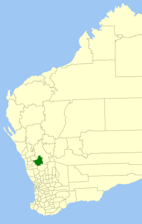
Lage des Perenjori Shire in Westaustralien
Gliederung
Staat: Australien Australien
Bundesstaat: Flag of Western Australia.svg Western Australia
Verwaltungssitz: Perenjori
Daten und Zahlen
Fläche: 8.313,0 km²
Einwohner: 528 (2006) [1]
Bevölkerungsdichte: 0,06 Einwohner je km²
Wards: 5
-29.433333333333116.28333333333

Das Shire of Perenjori ist ein lokales Verwaltungsgebiet (LGA) im australischen Bundesstaat Western Australia. Das Gebiet ist 8313 km² groß und hat etwa 530 Einwohner.

Perenjori liegt im Westen des Staats etwa 280 km nördlich der Hauptstadt Perth. Der Sitz des Shire Councils befindet sich in der Ortschaft Perenjori, wo etwa 210 Einwohner leben[2].

Verwaltung

Der Perenjori Council hat neun Mitglieder. Die Councillor werden von den Bewohnern der fünf Wards (drei aus Perenjori, je zwei aus Bowgada und Latham/Caron und je einer aus Caron und Maya Ward) gewählt. Aus dem Kreis der Councillor rekrutiert sich auch der Ratsvorsitzende und Shire President.

Quellen

  1. Australian Bureau of Statistics (25. Oktober 2007): Perenjori (S) (Local Government Area) (Englisch). 2006 Census QuickStats. Abgerufen am 24. Juli 2010.
  2. Australian Bureau of Statistics (25. Oktober 2007): Perenjori (L) (Urban Centre/Locality) (Englisch). 2006 Census QuickStats. Abgerufen am 24. Juli 2010.

Weblinks


Wikimedia Foundation.

Игры ⚽ Поможем сделать НИР

Schlagen Sie auch in anderen Wörterbüchern nach:

  • Shire of Murchison — Western Australia Location in Western Australia Population …   Wikipedia

  • Shire of Derby-West Kimberley — Western Australia Population: 7,9 …   Wikipedia

  • Shire of Christmas Island — Population: 1,440(2009)[1] …   Wikipedia

  • Shire of Ngaanyatjarraku — Western Australia Location in Western Australia Population …   Wikipedia

  • Shire of Perenjori — Infobox Australian Place | type = lga name =Shire of Perenjori state =wa region =Mid West area =8313.0 seat =Perenjori pop =528 (2006 census) density = imagesize = 180 caption = Location in Western Australia logo =Perenjori logo.png logosize =96… …   Wikipedia

  • Shire of Morawa — Infobox Australian Place | type = lga name =Shire of Morawa state =wa region =Mid West area =3515.8 seat =Morawa pop =824 (2006 census) density = imagesize = 180 caption = Location in Western Australia logo = logosize = url… …   Wikipedia

  • Perenjori, Western Australia — Infobox Australian Place type = town name = Perenjori state = wa caption = lga = Shire of Perenjori postcode = 6620 est = 1916 pop = 260 (2006 Census) [Census 2006 AUS|id=SSC55271|name=Perenjori (State Suburb)|quick=on|accessdate=2008 09 16]… …   Wikipedia

  • Shire of Carnamah — Infobox Australian Place | type = lga name = Shire of Carnamah state = wa region = Mid West imagesize= 180 caption = Location in Western Australia pop = 749 (2006 census) area = 2876.4 est = 1923 seat = Carnamah url =… …   Wikipedia

  • Shire of Murray — This article is about the Western Australian Shire of Murray. For the New South Wales shire, see Murray Shire. Shire of Murray Western Australia Location in …   Wikipedia

  • Shire of Donnybrook-Balingup — This article is about a local government area. For the town, see Donnybrook, Western Australia. Shire of Donnybrook Balingup Western Australia …   Wikipedia

Share the article and excerpts

Direct link
Do a right-click on the link above
and select “Copy Link”