- Pakosław
-
Pakosław 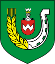
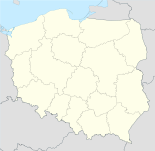

Pakosław Basisdaten Staat: Polen Woiwodschaft: Großpolen Landkreis: Rawicz Geographische Lage: 51° 37′ N, 17° 3′ O51.61416666666717.057777777778Koordinaten: 51° 36′ 51″ N, 17° 3′ 28″ O Einwohner: -
(31. Dez. 2010)[1]Postleitzahl: 63-920 Telefonvorwahl: (+48) 65 Kfz-Kennzeichen: PRA Gemeinde Gemeindeart: Landgemeinde Gemeindegliederung: 19 Ortschaften 15 Schulzenämter Fläche: 77,5 km² Einwohner: 4741
(31. Dez. 2010) [2]Bevölkerungsdichte: 61 Einw./km² Gemeindenummer (GUS): 3022042 Verwaltung Gemeindevorsteher: Kazimierz Chudy Adresse: ul. Kolejowa 2
63-920 PakosławWebpräsenz: www.pakoslaw.pl Pakosław (deutschPakoslaw, 1908-18 Pakoswalde, 1939-43 Pakswalde, 1943-45 Packswalde) ist ein Dorf und Sitz der gleichnamigen Landgemeinde in Polen und liegt im Powiat Rawicki der Wojewodschaft Großpolen.
Gemeinde
Zur Landgemeinde Pakosław gehören 15 Ortsteile (deutsche Namen bis 1945)[3] mit einem Schulzenamt:
- Białykał (Weißkehle)
- Chojno (Chojno, 1939-45 Kiefernrode)
- Golejewko (Golejewko, 1939-45 Flexau)
- Golejewo (Golejewo, 1939-45 Flexau)
- Góreczki Wielkie (Friedrichsort)
- Kubeczki (Kubeczki, 1939-45 Sandhofen)
- Niedźwiadki (Niedzwiadki, 1939-45 Bärwald)
- Osiek (Osiek, 1939-45 Kamphausen)
- Ostrobudki (Ostrobudki, 1939-45 Scharfenort)
- Pakosław (Pakoslaw, 1908-18 Pakoswalde, 1939-43 Pakswalde, 1943-45 Packswalde)
- Podborowo (Podborowo, 1939-45 Waldhufen)
- Pomocno (Pomotzno, 1939-45 Helfen)
- Sowy (Sowy, 1939-45 Scholzhufen)
- Sworowo (Sworowo, 1939-45 Böhmenau)
- Zaorle (Zaorle, 1939-45 Adlerweide)
Weitere Ortschaften der Gemeinde sind Dębionka, Halin, Skrzyptowo und Zielony Dąb.
Einzelnachweise
- ↑ Population. Size and Structure by Territorial Division. As of December 31, 2010. Główny Urząd Statystyczny (GUS), abgerufen am 23. Juni 2011.
- ↑ Population. Size and Structure by Territorial Division. As of December 31, 2010. Główny Urząd Statystyczny (GUS), abgerufen am 23. Juni 2011.
- ↑ Das Genealogische Orts-Verzeichnis
Kategorien:- Gmina in der Woiwodschaft Großpolen
- Ort der Woiwodschaft Großpolen


Wikimedia Foundation.