- Oyster Bay (New York)
-
Oyster Bay 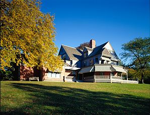
Theodore Roosevelts Sommerhaus Sagamore HillLage in New York 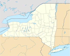

Oyster Bay Basisdaten Gründung: 1667 Staat: Vereinigte Staaten Bundesstaat: New York County: Koordinaten: 40° 46′ N, 73° 30′ W40.759444444444-73.50277777777855Koordinaten: 40° 46′ N, 73° 30′ W Zeitzone: EST UTC-5 Einwohner: 293.214 (Stand: 2010) Bevölkerungsdichte: 1.084,8 Einwohner je km² Fläche: 439 km² (ca. 169 mi²)
davon 270,3 km² (ca. 104 mi²) LandHöhe: 55 m Postleitzahl: 11771 Vorwahl: +1 516 FIPS: 36-56000 GNIS-ID: 0979336 Webpräsenz: www.oysterbaytown.com Bürgermeister: John Venditto Oyster Bay ist eine Town im Osten des Nassau County auf Long Island im US-Bundesstaat New York.
Geschichte
Die Stadt war ursprünglich (ab spätetens 1640) ein Teil von New Amsterdam. 1667 wurde sie im Zuge der Auflösung von Nieuw Nederland selbstständig. Bis 1898 gehörte sie dem Queens County an, löste sich dann aber bei dessen Übertritt nach New York City zusammen mit Hempstead, North Hempstead, Glen Cove und Long Beach in das neu formierte Nassau County.
Gliederung
Oyster Bay umfasst die folgenden je 18 Villages und Towns:
- Bayville (1919)
- Brookville (1931)
- Centre Island (1926)
- Cove Neck (1927)
- East Hills (1931) (zum Teil zu North Hempstead)
- Farmingdale (1904)
- Lattingtown (1913)
- Laurel Hollow (1926)
- Massapequa Park (1931)
- Matinecock (1928)
- Mill Neck (1925)
- Muttontown (1931)
- Old Brookville (1929)
- Old Westbury (1924) (zum Teil zu North Hempstead)
- Oyster Bay Cove (1931)
- Roslyn Harbor (1931) (zum Teil zu North Hempstead)
- Sea Cliff (1883)
- Upper Brookville (1932)
Hamlets:
- Bethpage
- East Massapequa
- East Norwich#Glen Head
- Glenwood Landing (teilweise)
- Greenvale
- Hicksville
- Jericho
- Locust Valley
- Massapequa
- North Massapequa
- Old Bethpage
- Oyster Bay Cove
- Plainedge
- Plainview
- South Farmingdale
- Syosset
- Woodbury
Persönlichkeiten
- John Barry (* 1933 † 2011 in Glen Cove), Filmkomponist
- Theodore Roosevelt (* 1858 † 1919 ), US-Präsident und Friedensnobelpreisträger
Kategorien:- Ort in New York
- Nassau County (New York)


Wikimedia Foundation.