Obrowo

Obrowo
Obrowo
Wappen von Obrowo
Obrowo (Polen)
Obrowo
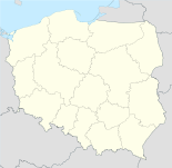
Obrowo
Basisdaten
Staat: Polen
Woiwodschaft: Kujawien-Pommern
Landkreis: Toruń
Geographische Lage: 52° 58′ N, 18° 53′ O52.97166666666718.878333333333Koordinaten: 52° 58′ 18″ N, 18° 52′ 42″ O
Höhe: 89 m n.p.m
Einwohner:

1410 (2009)

Postleitzahl: 87-148
Telefonvorwahl: (+48) 56
Kfz-Kennzeichen: CTR
Gemeinde
Gemeindeart: Landgemeinde
Gemeindegliederung: 21 Schulzenämter
Fläche: 162 km²
Einwohner:

12.504
(31. Dez. 2010) [1]

Bevölkerungsdichte: 77 Einw./km²
Gemeindenummer (GUS): 0415072
Verwaltung
Gemeindevorsteher: Andrzej Wieczyński
Webpräsenz: www.obrowo.pl

Obrowo (deutsch 1942–1945 Obrau) ist ein Dorf und Sitz der gleichnamigen Landgemeinde in Polen. Der Ort liegt im Powiat Toruński der Wojewodschaft Kujawien-Pommern.

Gemeinde

Zur Landgemeinde Obrowo gehören 21 Ortsteile (deutsche Namen bis 1945)[2] mit einem Schulzenamt:

  • Bartoszewo (1942–1945 Bartelsriege)[2]
  • Brzozówka (1942–1945 Birkheide)
  • Dobrzejewice (Dobrzejewice, 1942–1945 Godenfeld)
  • Dzikowo (1942–1945 Sickau)[2]
  • Głogowo (1942–1945 Glogen)
  • Kawęczyn (1942–1945 Plagenfeld)[2]
  • Kazimierzewo (1942–1945 Kaßmersboden)
  • Kuźniki (1942–1945 Eisenhammer)
  • Łążyn
  • Łążynek
  • Obory (1942–1945 Oberforst)
  • Obrowo (1942–1945 Obrau)[2]
  • Osiek (1942–1945 Schanzfeld)[2]
  • Sąsieczno
  • Silno (Schillno)
  • Skrzypkowo (1942–1945 Halmbruch)
  • Smogorzewiec (1942–1945 Schmögers)
  • Stajenczynki (1942–1945 Steinwiese)
  • Szembekowo (1942–1945 Schembeck)
  • Zawały (1942–1945 Hinterwall)
  • Zębowo
  • Zębówiec

Eine weitere Ortschaft der Gemeinde ist Łęk-Osiek (1940–1942 Leng-Osiek, 1942–1945 Lengden).

Weblinks

Fußnoten

  1. Population. Size and Structure by Territorial Division. As of December 31, 2010. Główny Urząd Statystyczny (GUS), abgerufen am 9. Juli 2011.
  2. a b c d e f Vgl. Amtsbezirk Czernikowo/ Schwarzendorf, Gemeindeumbenennungen (1942)

Wikimedia Foundation.

Игры ⚽ Нужно решить контрольную?

Schlagen Sie auch in anderen Wörterbüchern nach:

  • Obrowo — may refer to the following places: Obrowo, Toruń County in Kuyavian Pomeranian Voivodeship (north central Poland) Obrowo, Tuchola County in Kuyavian Pomeranian Voivodeship (north central Poland) Obrowo, Gmina Czarna Dąbrówka in Pomeranian… …   Wikipedia

  • Obrowo — Original name in latin Obrowo Name in other language Obrovo, Obrowo, Оброво State code PL Continent/City Europe/Warsaw longitude 52.97149 latitude 18.87863 altitude 90 Population 1410 Date 2010 09 16 …   Cities with a population over 1000 database

  • Obrowo, Tuchola County — For other places with the same name, see Obrowo (disambiguation). Obrowo   Village   …   Wikipedia

  • Obrowo, Toruń County — For other places with the same name, see Obrowo (disambiguation). Obrowo   Village   …   Wikipedia

  • Obrowo, Gmina Miastko — For other places with the same name, see Obrowo (disambiguation). Obrowo   Village   …   Wikipedia

  • Obrowo, Gmina Czarna Dąbrówka — For other places with the same name, see Obrowo (disambiguation). Obrowo   Village   …   Wikipedia

  • Obrowo, Greater Poland Voivodeship — For other places with the same name, see Obrowo (disambiguation). Obrowo   Village   …   Wikipedia

  • Gmina Obrowo — Obrowo Commune   Gmina   …   Wikipedia

  • Łążyn, Gmina Obrowo — Infobox Settlement name = Łążyn settlement type = Village total type = image shield = subdivision type = Country subdivision name = POL subdivision type1 = Voivodeship subdivision name1 = Kuyavian Pomeranian subdivision type2 = County subdivision …   Wikipedia

  • Łążynek, Gmina Obrowo — Infobox Settlement name = Łążynek settlement type = Village total type = image shield = subdivision type = Country subdivision name = POL subdivision type1 = Voivodeship subdivision name1 = Kuyavian Pomeranian subdivision type2 = County… …   Wikipedia

Share the article and excerpts

Direct link
Do a right-click on the link above
and select “Copy Link”