- Moonie River
-
Moonie River 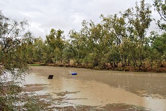
Moonie River in Nindigully
Daten Lage Queensland / New South Wales (Australien) Flusssystem Murray River Abfluss über Barwon River → Darling River → Murray River → Indischer Ozean Quelle östlich von Tara (QLD)
28° 59′ 59″ S, 148° 42′ 58″ O-28.9997128148.71598478347Quellhöhe 347 m[1] Mündung Barwon River -29.31265141148.71229109149Koordinaten: 29° 18′ 46″ S, 148° 42′ 44″ O
29° 18′ 46″ S, 148° 42′ 44″ O-29.31265141148.71229109149Mündungshöhe 149 m[1] Höhenunterschied 198 m Länge 542 km[1] Einzugsgebiet 14.812 km² Rechte Nebenflüsse Hayes Creek, Parrie Moolan Creek, Wongle Wongle Creek, Bandicoot Creek, Farawell Creek, Teelba Creek, Thomby Creek, Ballandoon Creek Linke Nebenflüsse Finch Creek, Paget Creek, Middle Creek, Toombilla Creek, Stephens Creek Durchflossene Stauseen Thallon-Wehr Kleinstädte Southwood QLD, Kinkora QLD, Flinton QLD, Chelmer QLD, Nindigully QLD, Thallon QLD, Currawong QLD, Gundablouie NSW Der Moonie River ist ein Fluss in den westlichen Darling Downs im Osten Australiens. Er entspringt westlich von Dalby in Queensland und fließt dann nach Süden über die Grenze nach New South Wales. Südwestlich Mungindi mündet er in den Barwon River. Im Einzugsgebiet des Flusses befinden sich keine größeren Städte und es ist sehr flach[2]. Es gibt einen Stausee am Fluss, das Thallon-Wehr mit einer Kapazität von 185.000 m³[2].
Die Quelle des Flusses liegt östlich von Tara. Er durchfließt die Städte Flinton und Nindigully und passiert dann Thallon im Westen. Der größte Nebenfluss des Moonie River ist der Teelba Creek, weitere sind der Farawell Creek und der Toombilla Creek[2].
Sowohl der Moonie Highway als auch der Carnarvon Highway kreuzen den Fluss.
Einzelnachweise
- ↑ a b c Map of Moonie River. Bonzle.com
- ↑ a b c Water Resources – Overview – Queensland – Surface Water Management Area: Moonie River (Qld). Australian Natural Rescources Atlas. Department of the Environment, Water, Heritage and the Arts
Kategorien:- Flusssystem Darling River
- Fluss in Queensland
- Fluss in New South Wales
- Fluss in Australien und Ozeanien

Wikimedia Foundation.