- Miękinia
-
Miękinia 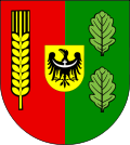

Miękinia Basisdaten Staat: Polen Woiwodschaft: Niederschlesien Landkreis: Środa Śląska Geographische Lage: 51° 10′ N, 16° 46′ O51.16666666666716.766666666667Koordinaten: 51° 10′ 0″ N, 16° 46′ 0″ O Einwohner: -
(31. Dez. 2010)[1]Postleitzahl: 55-330 Telefonvorwahl: (+48) 71 Kfz-Kennzeichen: DSR Wirtschaft und Verkehr Nächster int. Flughafen: Breslau Gemeinde Gemeindeart: Landgemeinde Gemeindegliederung: 28 Schulzenämter Fläche: 179,5 km² Einwohner: 12.661
(31. Dez. 2010) [2]Bevölkerungsdichte: 71 Einw./km² Gemeindenummer (GUS): 0218032 Verwaltung (Stand: 2010) Gemeindevorsteher: Jan Grzegorczyn Adresse: ul. Kościuszki 41
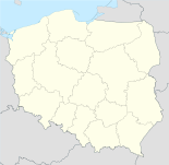
55-330 MiękiniaWebpräsenz: www.miekinia.pl Miękinia (deutsch: Nimkau) ist ein Ort im Powiat Średzki in der Woiwodschaft Niederschlesien in Polen.
Inhaltsverzeichnis
Geschichte
Die Niederschlesisch-Märkische Eisenbahn hatte im Ort eine Haltestelle. Bis 1945 war Nimkau eine Gemeinde im Landkreis Neumarkt, Regierungsbezirk Breslau der Provinz Schlesien.
Gemeinde
Die Landgemeinde Miękinia besteht aus 28 Ortsteile (deutsche Namen bis 1945)[3] mit einem Schulzenamt::
- Białków (Belkau, 1939–1945: Weißenfeld)
- Błonie (Groß Heidau)
- Brzezina (Groß Bresa)
- Brzezinka Średzka (Klein Bresa)
- Czerna (Tschirnau)
- Gałów (Groß Gohlau)
- Głoska (Gloschkau)
- Gosławice (Gniefgau)
- Kadłub (Kadlau)
- Krępice (Krampitz)
- Księginice (Kniegnitz)
- Lenartowice (Leonhardwitz)
- Lubiatów
- Lutynia (Leuthen)
- Łowęcice (Lobetinz)
- Miękinia (Nimkau)
- Mrozów (Nippern)
- Pisarzowice (Schreibersdorf)
- Piskorzowice (Peiskerwitz)
- Prężyce
- Radakowice (Radaxdorf)
- Wilkostów (Wolfsdorf)
- Wilkszyn (Wilxen)
- Wojnowice (Wohnwitz)
- Wróblowice (Frobelwitz)
- Zabór Wielki (Groß Saabor, 1939–1945: Hirschwerder)
- Zakrzyce (Sagschütz)
- Źródła (Borne)
- Żurawiniec
Persönlichkeiten
- Franz Lugan (* 1864 in Nimkau), deutscher Maler
Verweise
Weblinks
Fußnoten
- ↑ Population. Size and Structure by Territorial Division. As of June 30, 2010. Główny Urząd Statystyczny (GUS), abgerufen am 30. Juli 2011.
- ↑ Population. Size and Structure by Territorial Division. As of June 30, 2010. Główny Urząd Statystyczny (GUS), abgerufen am 30. Juli 2011.
- ↑ Das Genealogische Orts-Verzeichnis
Städte und Gemeinden im Powiat ŚredzkiKostomłoty (Kostenblut) | Malczyce (Maltsch) | Miękinia (Nimkau) | Środa Śląska (Neumarkt in Schlesien) – Stadt | Udanin (Gäbersdorf)
Wikimedia Foundation.
Schlagen Sie auch in anderen Wörterbüchern nach:
Miękinia — may refer to the following places in Poland: Miękinia, Lower Silesian Voivodeship (south west Poland) Miękinia, Lesser Poland Voivodeship (south Poland) This disambiguation page lists articles about distinct geographical locations with the same… … Wikipedia
Miekinia — 1 Original name in latin Mikinia Name in other language Miekinia, Mikinia State code PL Continent/City Europe/Warsaw longitude 51.18844 latitude 16.73595 altitude 120 Population 2500 Date 2010 10 21 2 Original name in latin Mikinia Name in other… … Cities with a population over 1000 database
Miękinia, Lower Silesian Voivodeship — Miękinia Village … Wikipedia
Miękinia, Lesser Poland Voivodeship — For other places with the same name, see Miękinia (disambiguation). Miękinia Village … Wikipedia
Gmina Miękinia — Miękinia Commune Gmina … Wikipedia
Lutynia (Miękinia) — Lutynia Hilfe zu Wappen … Deutsch Wikipedia
Czerna, Środa Śląska County — Czerna Village … Wikipedia
Mrozów — Village … Wikipedia
Гмина Менкиня — Gmina Miękinia Герб Страна: Польша Повят: Сьродский повят (Нижнесилезское воеводство) Глава: Ян Гжегорчин (2006) Площадь: 179,48 км² … Википедия
Pisarzowice, Środa Śląska County — Infobox Settlement name = Pisarzowice settlement type = Village total type = image shield = subdivision type = Country subdivision name = POL subdivision type1 = Voivodeship subdivision name1 = Lower Silesian subdivision type2 = County… … Wikipedia
Miękinia


18+
© Academic, 2000-2024
- Kontaktieren Sie uns: Unterstützung, Werbung
Wörterbücher Export, schritte mit PHP, Joomla, Drupal, WordPress, MODx.