- Krypno
-
Krypno 

Krypno Basisdaten Staat: Polen Woiwodschaft: Podlachien Landkreis: Mońki Geographische Lage: 53° 17′ N, 22° 52′ O53.275522.871916666667Koordinaten: 53° 16′ 32″ N, 22° 52′ 19″ O Einwohner: -
(31. Dez. 2010)[1]Postleitzahl: 19-111 Telefonvorwahl: (+48) 85 Kfz-Kennzeichen: BMN Gemeinde Gemeindeart: Landgemeinde Fläche: 112,7 km² Einwohner: 4005
(31. Dez. 2010) [2]Bevölkerungsdichte: 36 Einw./km² Gemeindenummer (GUS): 2008052 Verwaltung Gemeindevorsteher: Marek Stankiewicz Adresse: Krypno Kościelne 23B,
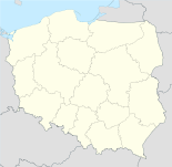
19-111 KrypnoWebpräsenz: www.gminakrypno.republika.pl Krypno ist eine Gmina (Landgemeinde) im Zentrum der im nordöstlichen Polen liegenden Woiwodschaft Podlachien mit 4354 Einwohnern. Die Gmina Krypno liegt rund 30 km nordwestlich von Białystok.[3]
Inhaltsverzeichnis
Gemeinde
Die Landgemeinde liegt umfasst 15 Orte:
- Krypno Kościelne
- Krypno Wielkie
- Ruda
- Góra
- Kulesze-Chobotki
- Kruszyn
- Białobrzeskie
- Rekle
- Bajki Zalesie
- Morusy
- Długołęka
- Zastocze
- Dębina
- Peńskie
- Zygmunty
Bildung
 Hauptstraße
In Krypno gibt es einen Schulkomplex: Grundschule und Gymnasium namens Johannes Paulus II. Zur Gemeinde gehört auch die Grundschule im Ortsteil Długołęka.
Nicht öffentliche Schulen:
- Grundschule in Góra
- Kindergarten in Góra
- Grundschule namens Jana Kobylański in Ruda
Bibliothek:
- Kunst und Unterhaltungsbibliothek Gminny Osrodek Kutury
Weblinks
-
 Commons: Gmina Krypno – Sammlung von Bildern, Videos und Audiodateien
 - Offizielle Webseite der Gmina Krypno
- Grundschule in Krypno
- Gymnasium in Krypno
- Grundschule in Długołęka
Fußnoten
- ↑ Population. Size and Structure by Territorial Division. As of December 31, 2010. Główny Urząd Statystyczny (GUS), abgerufen am 31. Juli 2011.
- ↑ Population. Size and Structure by Territorial Division. As of December 31, 2010. Główny Urząd Statystyczny (GUS), abgerufen am 31. Juli 2011.
- ↑ Google Maps
Kategorien:- Gmina in der Woiwodschaft Podlachien
- Ort der Woiwodschaft Podlachien


Wikimedia Foundation.