- Castle Morpeth
-
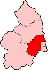
Borough of Castle Morpeth 
Lage in NorthumberlandStatus Borough Region North West England Verw.grafschaft Northumberland Verwaltungssitz Morpeth Fläche 618,23 km² (72.) Einwohner 49.800 (342.) Stand 2008 ONS-Code 35UE Website - Gründung 1974 Auflösung 2009 Castle Morpeth war ein District mit dem Status eines Borough in der Grafschaft Northumberland in England. Verwaltungssitz war die Stadt Morpeth. Zum District gehörten auch die Orte Pegswood und Ponteland.
Der District wurde am 1. April 1974 gebildet und entstand aus der Fusion des Borough Morpeth, des Rural District Morpeth und eines Teils des Rural District Castle Ward. Am 1. April 2009 wurde der Verwaltungsbezirk aufgelöst und mit den restlichen Districts in Northumberland zu einer einzigen Unitary Authority Northumberland vereinigt.
Kategorien:- Ehemaliger District (North East England)
- Northumberland
Wikimedia Foundation.