- Góra Świętej Małgorzaty
-
Góra Świętej Małgorzaty 
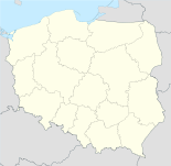

Góra Świętej Małgorzaty Basisdaten Staat: Polen Woiwodschaft: Łódź Landkreis: Łęczycki Geographische Lage: 52° 3′ N, 19° 19′ O52.05583333333319.319722222222Koordinaten: 52° 3′ 21″ N, 19° 19′ 11″ O Höhe: 136 m n.p.m Einwohner: -
(31. Dez. 2010)[1]Postleitzahl: 99-122 Telefonvorwahl: (+48) 63 Kfz-Kennzeichen: ELE Wirtschaft und Verkehr Nächster int. Flughafen: Łódź Gemeinde Gemeindeart: Landgemeinde Gemeindegliederung: 20 Schulzenämter Fläche: 90,3 km² Einwohner: 4477
(31. Dez. 2010) [2]Bevölkerungsdichte: 50 Einw./km² Gemeindenummer (GUS): 1004032 Verwaltung Bürgermeister: Włodzimierz Frankowski Adresse: Góra Św. Małgorzaty 44
99-122 Góra Świętej MałgorzatyWebpräsenz: www.goraswmalgorzaty.pl Góra Świętej Małgorzaty (deutsch Gora sw. Malgorzaty, 1943–1945 Margretenberg)[3] ist ein Dorf und Sitz der gleichnamigen Gemeinde im Powiat Łęczycki der Woiwodschaft Łódź, Polen.
Gemeinde
Zur Landgemeinde Góra Świętej Małgorzaty gehören 20 Ortsteile mit einem Schulzenamt:
- Ambrożew
- Bogdańczew
- Bryski
- Bryski-Kolonia
- Czarnopole
- Góra Świętej Małgorzaty
- Karsznice
- Kosin
- Marynki
- Mętlew
- Moraków
- Nowy Gaj
- Orszewice
- Podgórzyce
- Rogulice
- Sługi
- Stawy
- Tum
- Witaszewice
- Zagaj
Weitere Ortschaften der Gemeinde sind Gaj, Głupiejew, Janów, Konstancin, Kosiorów, Kwiatkówek, Łętków, Maciejów, Mierczyn und Stary Gaj.
Verweise
Fußnoten
- ↑ Population. Size and Structure by Territorial Division. As of December 31, 2010. Główny Urząd Statystyczny (GUS), abgerufen am 16. Juli 2011.
- ↑ Population. Size and Structure by Territorial Division. As of December 31, 2010. Główny Urząd Statystyczny (GUS), abgerufen am 16. Juli 2011.
- ↑ Vgl. "Anordnung über Ortsnamenänderung im Reichsgau Wartheland, Nr.62" vom 18. Mai 1943
Kategorien:- Gmina in der Woiwodschaft Łódź
- Ort der Woiwodschaft Łódź


Wikimedia Foundation.