Green Island (Saba)

Green Island (Saba)

Vorlage:Infobox Insel/Wartung/Bild fehltVorlage:Infobox Insel/Wartung/Fläche fehltVorlage:Infobox Insel/Wartung/Höhe fehlt

Green Island
Gewässer Karibisches Meer
Inselgruppe Inseln über dem Winde
Geographische Lage 17° 38′ 56″ N, 63° 13′ 48″ W17.648888888889-63.23Koordinaten: 17° 38′ 56″ N, 63° 13′ 48″ W
Green Island (Niederländische Antillen (Inseln über dem Winde))
Green Island
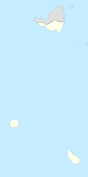
Einwohner (unbewohnt)

Green Island (niederländisch Groeneiland) ist eine kleine niederländische Felseninsel in der Karibik. Sie liegt 250 m nördlich der Insel Saba.

Die Insel ist unbewohnt und teilweise von niedrigen subtropischen Pflanzen bewachsen. Laut einer Untersuchung aus dem Jahr 1997 wurden auf Green Island Braunpelikane, Noddiseeschwalben (Anous stolidus), Weißbauchtölpel und die relativ seltenen Rotschnabel-Tropikvögel beobachtet. Von diesen nisten die drei letztgenannten Arten vermutlich auch auf der Insel[1]

Auf Green Island befindet sich eine kleine Anlegestelle für Boote.

Einzelnachweise

  1. Biologische Bestandsaufnahme von St. Marteen und Saba (englisch)

Wikimedia Foundation.

Игры ⚽ Нужен реферат?

Schlagen Sie auch in anderen Wörterbüchern nach:

  • Green Island — oder Greenisland heißen folgende Inseln und Orte: in Asien: Green Island (Hongkong) (chinesisch 青洲 Qīng Zhōu) in Europa: Green Island (Dorset) im Poole Harbour in Dorset Green Island (Scilly Inseln), eine der Scilly Inseln Green Island… …   Deutsch Wikipedia

  • Green Island (Niederländische Antillen) — Green Island ist eine unbewohnte Insel in der Gruppe der Niederländischen Antillen. Sie liegt 250 m südlich der Insel Saba. Weblinks Photos vom Unterwasserleben 17.648888888889 63.237Koordinaten …   Deutsch Wikipedia

  • Saba (Insel) — Saba Weltraumfoto von Saba Gewässer Karibisches Meer Inselgruppe …   Deutsch Wikipedia

  • Saba — Para otros usos de este término, véase Saba (desambiguación). Openbaar lichaam Saba Public entity Saba Entidad pública Saba …   Wikipedia Español

  • Green Cay — est une île inhabitée des îles Vierges britanniques dans les Caraïbes. 18°27′N 64°42′W / 18.45, 64.7 …   Wikipédia en Français

  • Ascension Island — Ascension Island …   Wikipedia

  • Necker Island (British Virgin Islands) — Necker Island. Necker Island is a small island in the British Virgin Islands just north of Virgin Gorda, located at …   Wikipedia

  • Ducie Island — A beach on Acadia Islet …   Wikipedia

  • Norman Island — For the island in Australia, see Norman Island (Victoria). Norman Island, view from Sage Mountain on Tortola Norman Island is located at the southern tip of the British Virgin Islands archipelago. It is reputed to be the inspiration for Robert… …   Wikipedia

  • Dead Chest Island, British Virgin Islands — Dead Chest Island. Dead Chest is little more than a large rock outcropping located just under one half mile north east (0.4 miles at 27 degrees true) of Deadman s Bay on Peter Island, British Virgin Islands.[1] It is uninhabited, has no fresh… …   Wikipedia

Share the article and excerpts

Direct link
Do a right-click on the link above
and select “Copy Link”