- Carmarthenshire
-
Carmarthenshire Principal Area 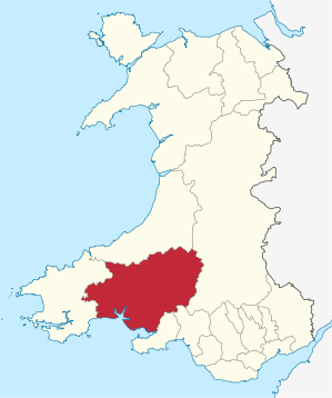
Verwaltungssitz Carmarthen Fläche 2.395 km² Einwohner 180.800[1] (2009) Walisischsprachige 63,6 % ISO 3166-2 GB-CMN ONS-Code 00NU Website www.carmarthenshire.gov.uk Carmarthenshire (walisisch: Sir Gaerfyrddin) ist eine Unitary Authority und eine traditionelle Grafschaft im Südwesten von Wales. Verwaltungssitz und namensgebender Ort ist die Stadt Carmarthen. Weitere bedeutende Orte sind Ammanford, Burry Port, Kidwelly, Llanelli, Llandeilo, Newcastle Emlyn, Llandovery, St. Clears, Whitland und Pendine.
Verwaltungsgeschichte
Carmarthenshire ist eine der dreizehn traditionellen Grafschaften. Bis 1974 war Carmarthenshire auch eine Waliser Verwaltungsgrafschaft und wurde dann auf die drei Districts Carmarthen, Llanelli und Dinefwr der neugebildeten Grafschaft Dyfed aufgeteilt. Bei der Verwaltungsreform von 1996 wurden die drei Districts zur Unitary Authority Carmarthenshire zusammengeschlossen. Die Unitary Authorities werden in Wales auch Principal Area genannt. Carmarthenshire besitzt heute wieder den Status eines County.
Einzelnachweise

Anglesey | Blaenau Gwent | Bridgend | Caerphilly | Cardiff | Carmarthenshire | Ceredigion | Conwy | Denbighshire | Flintshire | Gwynedd | Merthyr Tydfil | Monmouthshire | Neath Port Talbot | Newport | Pembrokeshire | Powys | Rhondda Cynon Taf | Swansea | Torfaen | Vale of Glamorgan | Wrexham
Wikimedia Foundation.
Schlagen Sie auch in anderen Wörterbüchern nach:
Carmarthenshire — Saltar a navegación, búsqueda Ubicación de Carmarthenshire en Gales. Carmarthenshire es una autoridad unitaria situada en Gales, en la zona occidental de Gran Bretaña. Fue asimismo uno de los trece condados históricos de Gales … Wikipedia Español
Carmarthenshire — (welsch Caersyrddin), Grafschaft im südlichen Wales, liegt zwischen Pembroke und Glamorganshire an der Carmarthenbai des Kanals von Bristol und grenzt im Innern an Cardiganshire und Brecknockshire. Sie hat ein Areal von 2405 qkm (43,7 QM.) mit… … Meyers Großes Konversations-Lexikon
Carmarthenshire — a ↑county in southwestern Wales … Dictionary of contemporary English
Carmarthenshire — [kär mär′thən shir΄, kär mär′thənshər] former county of SW Wales, now part of Dyfed … English World dictionary
Carmarthenshire — Not to be confused with Caernarfonshire. County of Carmarthenshire Sir Gaerfyrddin Geography Area Total % Water … Wikipedia
Carmarthenshire — 51°51′22″N 4°18′38″O / 51.85611, 4.31056 … Wikipédia en Français
Carmarthenshire — /kahr mahr dheuhn shear , sheuhr/, n. a historic county in Dyfed, in S Wales. * * * ▪ county, Wales, United Kingdom also called Carmarthen , Welsh Sir Gaerfyrddin county of southwestern Wales, extending inland from the Bristol Channel.… … Universalium
Carmarthenshire — Sp Karmárdenšyras Ap Carmarthenshire angliškai Ap Sir Gaerfyrddin vališkai L Velso grafystė, Jungtinė Karalystė … Pasaulio vietovardžiai. Internetinė duomenų bazė
Carmarthenshire — Sp Karmárdenšyras Ap Carmarthenshire angliškai Ap Sir Gaerfyrddin vališkai L Velso grafystė, D. Britanija … Pasaulio vietovardžiai. Internetinė duomenų bazė
Carmarthenshire — Admin ASC 2 Code Orig. name Carmarthenshire Country and Admin Code GB.WLS.X7 GB … World countries Adminstrative division ASC I-II
- Kontaktieren Sie uns: Unterstützung, Werbung
Carmarthenshire

18+
© Academic, 2000-2024
Wörterbücher Export, schritte mit PHP, Joomla, Drupal, WordPress, MODx.