East Pilbara Shire

East Pilbara Shire
Shire of East Pilbara
East pilbara LGA WA.png
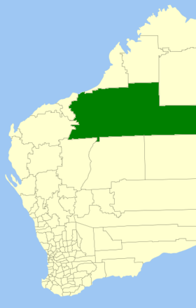
Lage des East Pilbara Shire in Westaustralien
Gliederung
Staat: Australien Australien
Bundesstaat: Flag of Western Australia.svg Western Australia
Verwaltungssitz: Newman
Daten und Zahlen
Fläche: 379.571 km²
Einwohner: 6.544 (2006) [1]
Bevölkerungsdichte: 0,02 Einwohner je km²
Wards: 6
-23.35119.73333333333

Das Shire of East Pilbara ist ein lokales Verwaltungsgebiet (LGA) im australischen Bundesstaat Western Australia. Mit 379.571 km² ist es die größte LGA in Australien. Sie hat etwa 6500 Einwohner.

East Pilbara liegt im Norden des Staates etwa 1000 bis 1600 km nordöstlich der Hauptstadt Perth. Der Sitz des Shire Councils befindet sich in der Stadt Newman, wo etwa 4250 Einwohner leben[2].

Verwaltung

Der East Pilbara Council hat elf Mitglieder, die von den Bewohnern der sechs Wards (sechs aus dem South Ward und je eines aus dem North, North West, East, Central und Lower Central Ward) gewählt werden. Aus dem Kreis der Councillor rekrutiert sich auch der Ratsvorsitzende und Shire President.

Quellen

  1. Australian Bureau of Statistics (25. Oktober 2007): East Pilbara (S) (Local Government Area) (Englisch). 2006 Census QuickStats. Abgerufen am 24. Juli 2010.
  2. Australian Bureau of Statistics (25. Oktober 2007): Newman (Urban Centre/Locality) (Englisch). 2006 Census QuickStats. Abgerufen am 24. Juli 2010.

Weblinks


Wikimedia Foundation.

Игры ⚽ Поможем написать реферат

Schlagen Sie auch in anderen Wörterbüchern nach:

  • Shire of East Pilbara — Infobox Australian Place | type = lga name = Shire of East Pilbara state = wa imagesize= 180 caption = Location in Western Australia pop = 6,544 (2001 census) density = area = 379571 est = seat = Newman mayor = Lynne Craigie region = Pilbara url …   Wikipedia

  • Pilbara newspapers — Pilbara newspapersThis is a selection of newspapers published in the Pilbara region of Western Australia. The rise and fall of some of the newspapers reflect the shifts and changes in population in various localities of the region as mining… …   Wikipedia

  • Pilbara — Regionen nach dem Regional Development Commissions Act von 1993 (Pilbara zweitnördlichste) …   Deutsch Wikipedia

  • Shire of Ngaanyatjarraku — Western Australia Location in Western Australia Population …   Wikipedia

  • Shire of Derby-West Kimberley — Western Australia Population: 7,9 …   Wikipedia

  • Shire of Murchison — Western Australia Location in Western Australia Population …   Wikipedia

  • Shire of Christmas Island — Population: 1,440(2009)[1] …   Wikipedia

  • Shire of Ashburton — Infobox Australian Place | type = lga name = Shire of Ashburton state = wa imagesize= 180 caption = Location in Western Australia pop = 6,078 (2006 census) area = 101240 est = 1972 seat = Tom Price mayor = Leanne Corker region = Pilbara url =… …   Wikipedia

  • Shire of Wiluna — Infobox Australian Place | type = lga name =Shire of Wiluna state =wa region =Mid West area =182155.8 seat =Wiluna pop =1,640 (2001 census) 681 (2006 census) density = imagesize = 180 caption = Location in Western Australia logo = logosize = url …   Wikipedia

  • Shire of Broome — Infobox Australian Place | type = lga name = Shire of Broome state = wa imagesize= 180 caption = Location in Western Australia pop = 13,059 (2006 census) area = 55795.6 est = 1918 seat = Broome mayor = Graeme Campbell region = Kimberley url =… …   Wikipedia

Share the article and excerpts

Direct link
Do a right-click on the link above
and select “Copy Link”