Duddon Valley

Duddon Valley
54.404781-3.161831
Duddon Valley, Cumbria

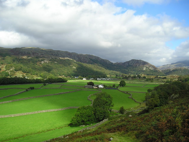
Das Duddon Valley ist ein Tal im Lake District in Cumbria, England. Das Tal wird gelegentlich auch mit Dunnerdale bezeichnet.

Der River Duddon fließt vom Wrynose Pass hinab zum Weiler Cockley Beck, das zusammen mit der Straße zwischen dem Hardknott Pass und dem Wrynose Pass die nördliche Grenze des Tals markiert, das sich in südlicher Richtung über etwa 20 km erstreckt.
Das Tal wird im Osten vom Old Man of Coniston und im Westen vom Harter Fell, Ulpha Fell, Whitfell, Bootle Fell und Black Combe begrenzt.
Das Tal endet mit der Mündung des Duddon bei Broughton-in-Furness an der Morecambe Bay.


Wikimedia Foundation.

Игры ⚽ Нужно сделать НИР?

Schlagen Sie auch in anderen Wörterbüchern nach:

  • Duddon Valley — looking towards Eskdale The Duddon Valley is a valley in the Lake District National Park in Cumbria, England. The River Duddon flows through the valley, rising in the mountains between Eskdale and Langdale, before flowing into the Irish Sea near… …   Wikipedia

  • Seathwaite, Duddon Valley — infobox UK place country = England latitude = 54.3541 longitude = 3.1882 official name= Seathwaite population = 1045cite web url=http://neighbourhood.statistics.gov.uk/dissemination/NeighbourhoodProfile.do;jsessionid=ac1f930bce69abbd356deaa43aeb75… …   Wikipedia

  • River Duddon — Duddon Der River Duddon auf dem Wrynose PassVorlage:Infobox Fluss/KARTE fehlt …   Deutsch Wikipedia

  • River Duddon — The Duddon is a river of north west England. It rises at a point 1289 feet (393 m) above sea level near the Three Shire Stone at the highest point of Wrynose Pass (gbmapping|NY277028). The river descends to the sea over a course of about 15 miles …   Wikipedia

  • Wasdale, Eskdale and Duddon — is a National Trust property located in south western Cumbria, England. WasdaleIn Wasdale, the National Trust owns both the country s highest mountain, Scafell Pike, as well as its deepest lake, Wastwater. The majority of the surrounding… …   Wikipedia

  • Brim Fell — Infobox Mountain Name = Brim Fell Photo = Brim fell summit.jpg Caption = Brim Fell summit Elevation = 796 m (2,611 ft) Location = Cumbria, ENG Range = Lake District, Southern Fells Prominence = c 25 m Parent peak = The Old Man of Coniston… …   Wikipedia

  • Grey Friar — Infobox Mountain Name = Grey Friar Photo = Grey Friar and harter Fell from Great Carrs.jpg Caption = Grey Friar from Great Carrs, one km to the east, Harter Fell is in the background. Location = Cumbria, ENG Range = Lake District, Southern Fells… …   Wikipedia

  • Swirl How — Infobox Mountain Name = Swirl How Photo = Swirl how.jpg Caption = Swirl How from Great Carrs Elevation = 804 m, (2,637 ft)(disputed) Location = Cumbria, ENG Range = Lake District, Southern Fells Prominence = c 411 m (disputed) Coordinates =… …   Wikipedia

  • Thwaites, Cumbria — Thwaites is a small village near Duddon Valley and on the edge of the Duddon Estuary in the Lake District National Park in Cumbria, England. The River Duddon flows through the valley, rising in the mountains between Eskdale and Langdale, before… …   Wikipedia

  • Dow Crag — from the Old Man of Coniston summit Elevation 778 m (2,552 ft) …   Wikipedia

Share the article and excerpts

Direct link
Do a right-click on the link above
and select “Copy Link”