Dorset Municipality

Dorset Municipality
Dorset
LGATasmania Dorset.png
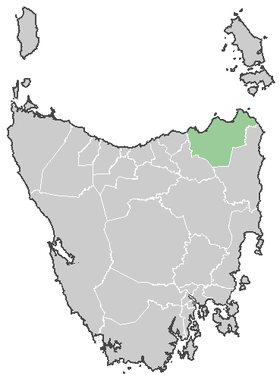
Lage der Dorset Municipality in Tasmanien
Gliederung
Staat: Australien Australien
Bundesstaat: Flag Australia tasmania.png Tasmanien
Verwaltungssitz: Scottsdale
Daten und Zahlen
Fläche: 3.196 km²
Einwohner: 7.001 (2006) [1]
Bevölkerungsdichte: 2,2 Einwohner je km²
-41.166666666667147.51666666667

Die Dorset Municipality ist ein lokales Verwaltungsgebiet (LGA) im australischen Bundesstaat Tasmanien. Das Gebiet ist 3.196 km² groß und hat etwa 7.000 Einwohner.

Dorset liegt in der Nordostecke der tasmanischen Insel etwa 200 km nördlich der Hauptstadt Hobart. Das Gebiet umfasst 40 Ortsteile und Ortschaften: Alberton, Blumont, Boobyalla, Branxholm, Bridport, Cape Portland, Cladstone, Cuckoo, Derby, Dorset, Forester, Goloonda, Herrick, Jetsonville, Kamona, Legerwood, Lietinna, Lisle, Maurice, Moorina, South Mt Cameron, Musselroe Bay, Nabowla, Pioneer, Ringarooma, Rushy Lagoon, Scottsdale, North Scottsdale, West Scottsdale, Springfield, South Springfield, Talawa, Telita, Tomahawk, Tonganah, Trenah, Tulendeena, Warrentinna, Waterhouse und Winnaleah[2]. Der Sitz des Councils befindet sich in Scottsdale im Südwesten der LGA, wo etwa 2500 Einwohner leben.[3]

Verwaltung

Der Dorset Council hat neun Mitglieder. Der Mayor (Bürgermeister), sein Deputy (Stellvertreter) und sieben Councillor werden direkt von den Bewohnern der LGA gewählt. Dorset ist nicht in Bezirke untergliedert.

Quellen

  1. Australian Bureau of Statistics (25. Oktober 2007): Dorset (M) (Local Government Area) (Englisch). 2006 Census QuickStats. Abgerufen am 6. April 2010.
  2. Localities by Council, Local Government Association of Tasmania
  3. Australian Bureau of Statistics (25. Oktober 2007): Scottsdale (State Suburb) (Englisch). 2006 Census QuickStats. Abgerufen am 23. März 2010.

Weblinks


Wikimedia Foundation.

Игры ⚽ Поможем написать курсовую

Schlagen Sie auch in anderen Wörterbüchern nach:

  • Dorset, Ontario — Dorset Dorset is a small community located on the boundary between the Lake of Bays Municipality in Muskoka District and the Algonquin Highlands Township in Haliburton County, Ontario, Canada. Dorset was originally called Cedar Narrows. In 1859… …   Wikipedia

  • Dorset (disambiguation) — Dorset is a county in England. Dorset may also refer to: Dorset (UK Parliament constituency) Dorset, Vermont Dorset, Ontario, a small community in the Muskoka and Haliburton regions of Ontario Dorset culture, a prehistoric culture that preceded… …   Wikipedia

  • Dorset Park —   Neighbourhood   Houses in Dorset Park …   Wikipedia

  • Cape Dorset, Nunavut — Infobox Settlement official name = Pagename other name = Kinngait native name = nickname = settlement type = Hamlet motto = imagesize = image caption = Part of the village with characteristic Kinngait hill, May 1997 flag size = image seal size =… …   Wikipedia

  • Beauce-Sartigan Regional County Municipality, Quebec — Beauce Sartigan Regional County Municipality is a regional county municipality in southeastern Quebec, Canada. The regional county municipality seat is Saint Georges.The area, has proven to be a hotbed of business development producing a large… …   Wikipedia

  • District Municipality of Muskoka — For the Muskoka beer brand, see Lakes of Muskoka Cottage Brewery. Muskoka District Municipality Map showing Muskoka District Municipality location in Ontario Country Canada P …   Wikipedia

  • Muskoka District Municipality, Ontario — Infobox Settlement official name = Muskoka District Municipality nickname = motto = imagesize = image caption = image imagesize = image caption = image mapsize = 300px map caption = Map showing Muskoka District Municipality location in Ontario… …   Wikipedia

  • Historical U.S. Census totals for Bennington County, Vermont — This article shows U.S. Census totals for Bennington County, Vermont, broken down by municipality, from 1900 to 2000.Most areas of New England are entirely divided into incorporated municipalities, with no unincorporated territory. In the three… …   Wikipedia

  • Dysart et al, Ontario — Dysart et al   United Township   Corporation of the United Townships of Dysart, Dudley, Harcourt, Guilford, Harburn, Bruton, Havelock, Eyre and Clyde …   Wikipedia

  • Sisimiut — 66° 56′ 20″ N 53° 40′ 20″ W / 66.938889, 53.672222 …   Wikipédia en Français

Share the article and excerpts

Direct link
Do a right-click on the link above
and select “Copy Link”