- Derwent Valley Municipality
-
Derwent Valley 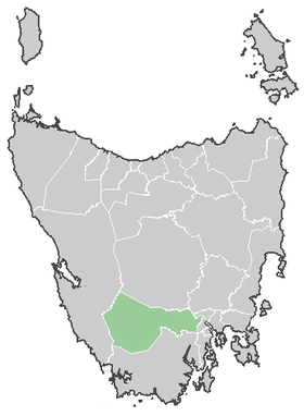
Lage des Derwent Valley in TasmanienGliederung Staat:  Australien
Bundesstaat:  Tasmanien
Verwaltungssitz: New Norfolk Daten und Zahlen Fläche: 4.111 km² Einwohner: 9.479 (2006) [1] Bevölkerungsdichte: 2,3 Einwohner je km² -42.783333333333147.06666666667Koordinaten: 42° 47′ S, 147° 4′ ODie Derwent Valley Municipality ist ein lokales Verwaltungsgebiet (LGA) im australischen Bundesstaat Tasmanien. Das Gebiet ist 4.111 km² groß und hat etwa 9.500 Einwohner.
Derwent Valley liegt im Süden der Insel etwa 26 km nordwestlich des Stadtzentrums von Hobart. Das Gebiet umfasst 27 Ortsteile und Ortschaften: Black Hills, Boyer, Bushy Park, Fitzgerald, Glen Fern, Glenfern, Glenora, Hayes, Karania, Lachlan, Lawitta, Macquarie Plains, Magra, Malbina, Maydena, Molesworth, Moogara, Mount Lloyd, National Park, New Norfolk, Plenty, Rosegarland, Sorell Creek, Strathgordon, Tyenna, Uxbridge und Westerway[2]. Der Sitz des Councils befindet sich in New Norfolk am östlichen Ende der LGA, wo etwa 5.200 Einwohner leben.[3]
Verwaltung
Der Derwent Valley Council hat neun Mitglieder. Der Mayor (Bürgermeister), sein Deputy (Stellvertreter) und sieben Councillor werden direkt von den Bewohnern der LGA gewählt. Derwent Valley ist nicht in Bezirke untergliedert.
Quellen
- ↑ Australian Bureau of Statistics (25. Oktober 2007): Derwent Valley (M) (Local Government Area) (Englisch). 2006 Census QuickStats. Abgerufen am 6. April 2010.
- ↑ Localities by Council, Local Government Association of Tasmania
- ↑ Australian Bureau of Statistics (25. Oktober 2007): New Norfolk (State Suburb) (Englisch). 2006 Census QuickStats. Abgerufen am 23. März 2010.
Weblinks
Kategorie:- Local Government Area in Tasmanien

Wikimedia Foundation.