- Capovalle
-
Capovalle 

Staat: Italien Region: Lombardei Provinz: Brescia (BS) Koordinaten: 45° 45′ N, 10° 33′ O45.7510.551000Koordinaten: 45° 45′ 0″ N, 10° 33′ 0″ O Höhe: 1.000 m s.l.m. Fläche: 23 km² Einwohner: 401 (31. Dez. 2010)[1] Bevölkerungsdichte: 17 Einw./km² Postleitzahl: 25070 Vorwahl: 0365 ISTAT-Nummer: 017036 Schutzpatron: S. Giovanni Battista Website: Capovalle Capovalle ist eine Gemeinde der Provinz Brescia zwischen dem Idro- und dem Gardasee in Italien mit 401 Einwohnern (Stand 31. Dezember 2010).
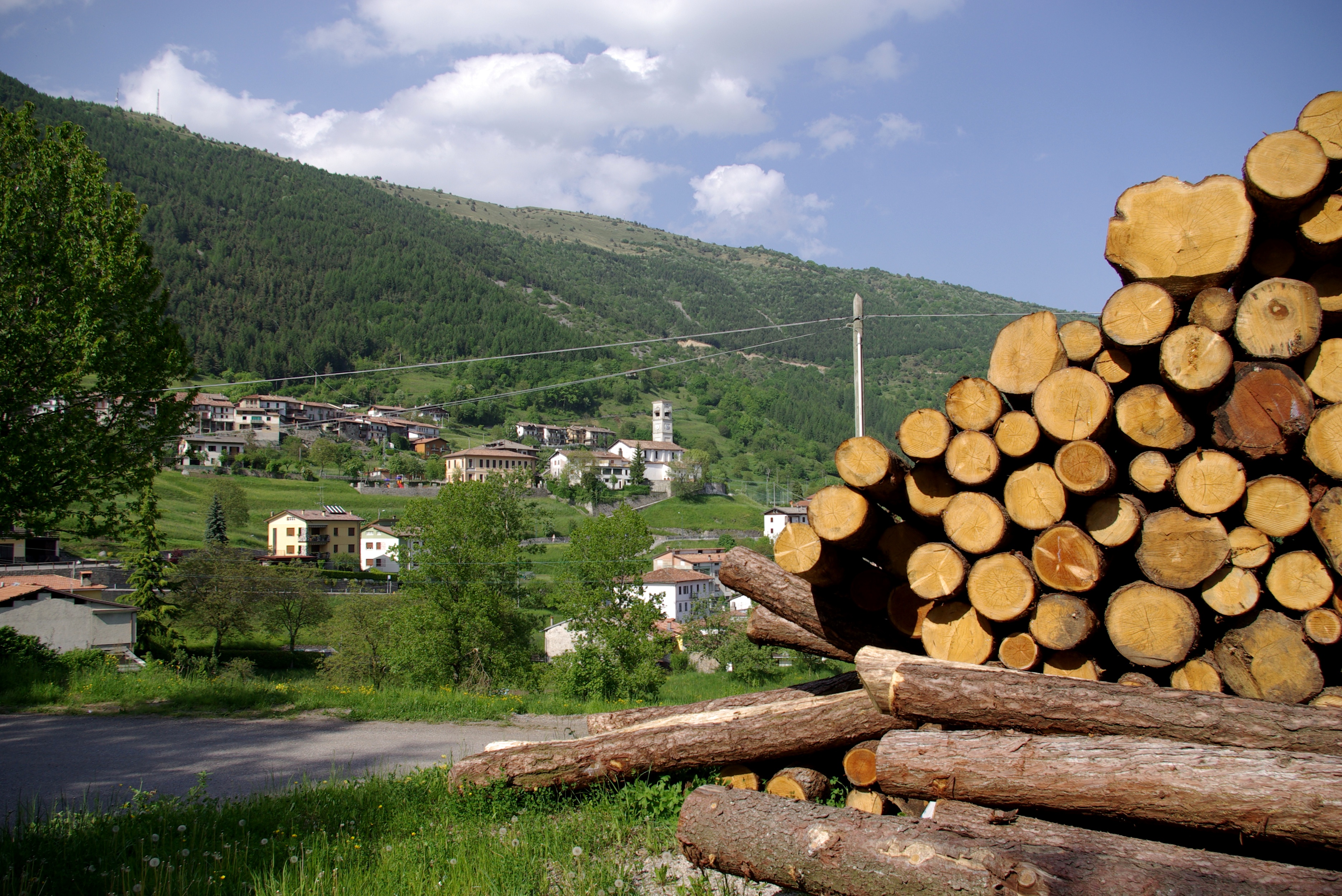
Capovalle liegt in den Gardaseebergen an der Verbindungsstraße SP58 von Idro über Bollone (ab hier SP9) durch das Val di Valvestino nach Gargnano. Der Hauptort ist Zumiè, weitere Orte sind Persone und Moerna.
-
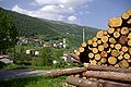
Blick auf Zumiè, Mai 2009
Weblinks
 Commons: Capovalle – Album mit Bildern und/oder Videos und Audiodateien
Einzelnachweise
- ↑ Statistiche demografiche ISTAT. Bevölkerungsstatistiken des Istituto Nazionale di Statistica vom 31. Dezember 2010.
 Gemeinden in der Provinz Brescia in der Region Lombardei (A–M)
Acquafredda | Adro | Agnosine | Alfianello | Anfo | Angolo Terme | Artogne | Azzano Mella | Bagnolo Mella | Bagolino | Barbariga | Barghe | Bassano Bresciano | Bedizzole | Berlingo | Berzo Demo | Berzo Inferiore | Bienno | Bione | Borgo San Giacomo | Borgosatollo | Borno | Botticino | Bovegno | Bovezzo | Brandico | Braone | Breno | Brescia | Brione | Caino | Calcinato | Calvagese della Riviera | Calvisano | Capo di Ponte | Capovalle | Capriano del Colle | Capriolo | Carpenedolo | Castegnato | Castel Mella | Castelcovati | Castenedolo | Casto | Castrezzato | Cazzago San Martino | Cedegolo | Cellatica | Cerveno | Ceto | Cevo | Chiari | Cigole | Cimbergo | Cividate Camuno | Coccaglio | Collebeato | Collio | Cologne | Comezzano-Cizzago | Concesio | Corte Franca | Corteno Golgi | Corzano | Darfo Boario Terme | Dello | Desenzano del Garda | Edolo | Erbusco | Esine | Fiesse | Flero | Gambara | Gardone Riviera | Gardone Val Trompia | Gargnano | Gavardo | Ghedi | Gianico | Gottolengo | Gussago | Idro | Incudine | Irma | Iseo | Isorella | Lavenone | Leno | Limone sul Garda | Londrino | Lograto | Lonato del Garda | Longhena | Losine | Lozio | Lumezzane | Maclodio | Magasa | Mairano | Malegno | Malonno | Manerba del Garda | Manerbio | Marcheno | Marmentino | Marone | Mazzano | Milzano | Moniga del Garda | Monno | Monte Isola | Monticelli Brusati | Montichiari | Montirone | Mura | Muscoline |
Wikimedia Foundation.
Schlagen Sie auch in anderen Wörterbüchern nach:
Capovalle — Administration Pays Italie Région … Wikipédia en Français
Capovalle — is a town and comune in the Italian province of Brescia, in Lombardy in the upper valley of the Vestino (the Valvestino) … Wikipedia
Capovalle — Original name in latin Capovalle Name in other language State code IT Continent/City Europe/Rome longitude 45.75339 latitude 10.54447 altitude 902 Population 452 Date 2012 02 15 … Cities with a population over 1000 database
Idro — Idro … Deutsch Wikipedia
Каповалле — Коммуна Каповалле Capovalle Страна ИталияИталия … Википедия
Roncobello — Infobox CityIT img coa = official name = Roncobello name = Roncobello region = Lombardy province = Province of Bergamo (BG) elevation m = 1007 area total km2 = 25.5 population as of = Dec. 2004 population total = 481 population density km2 = 19… … Wikipedia
Amandola — Infobox CityIT img coa = official name = Amandola name = Amandola region = Marche province = Province of Ascoli Piceno (AP) elevation m = 550 area total km2 = 69.4 population as of = 2005 population total = 3931 population density km2 = 57… … Wikipedia
Desenzano — del Garda … Deutsch Wikipedia
Gargnano — Gargnano … Deutsch Wikipedia
Iseo (BS) — Iseo … Deutsch Wikipedia
-
- Kontaktieren Sie uns: Unterstützung, Werbung
Capovalle


18+
© Academic, 2000-2024
Wörterbücher Export, schritte mit PHP, Joomla, Drupal, WordPress, MODx.