Czastary

Czastary
Czastary
Wappen von Czastary
Czastary (Polen)
Czastary
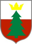
Czastary
Basisdaten
Staat: Polen
Woiwodschaft: Łódź
Landkreis: Wieruszów
Geographische Lage: 51° 16′ N, 18° 19′ O51.25916666666718.319444444444Koordinaten: 51° 15′ 33″ N, 18° 19′ 10″ O
Einwohner:

-
(31. Dez. 2010)[1]

Postleitzahl: 98-410
Telefonvorwahl: (+48) 62
Kfz-Kennzeichen: EWE
Wirtschaft und Verkehr
Nächster int. Flughafen: Łódź
Gemeinde
Gemeindeart: Landgemeinde
Fläche: 62,7 km²
Einwohner:

3959
(31. Dez. 2010) [2]

Bevölkerungsdichte: 63 Einw./km²
Gemeindenummer (GUS): 1018022
Verwaltung
Bürgermeister: Paweł Głowacki
Adresse: ul. Wolności 29
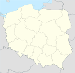
98-410 Czastary
Webpräsenz: www.czastary.pl

Czastary (deutsch Czastary, 1943–1945 Wildenbach) ist ein Dorf und Sitz der gleichnamigen Gemeinde im Powiat Wieruszowski der Woiwodschaft Łódź, Polen.

Gemeinde

Zur Landgemeinde Czastary gehören folgende Ortsteile mit einem Schulzenamt:

Czastary I
Czastary II
Jaworek
Józefów
Kąty Walichnowskie
Kniatowy
Krajanka
Krzyż
Parcice
Przywory
Radostów

Weitere Ortschaften der Gemeinde sind Chorobel, Dolina, Nalepa, Radostów Drugi und Stępna.

Verweise

Fußnoten

  1. Population. Size and Structure by Territorial Division. As of December 31, 2010. Główny Urząd Statystyczny (GUS), abgerufen am 16. Juli 2011.
  2. Population. Size and Structure by Territorial Division. As of December 31, 2010. Główny Urząd Statystyczny (GUS), abgerufen am 16. Juli 2011.

Wikimedia Foundation.

Игры ⚽ Поможем сделать НИР

Schlagen Sie auch in anderen Wörterbüchern nach:

  • Czastary —   Village   …   Wikipedia

  • Czastary — Original name in latin Czastary Name in other language State code PL Continent/City Europe/Warsaw longitude 51.25869 latitude 18.31953 altitude 190 Population 1024 Date 2010 10 15 …   Cities with a population over 1000 database

  • Gmina Czastary — Czastary Commune   Gmina   …   Wikipedia

  • Chorobel —   Settlement   …   Wikipedia

  • Dolina, Łódź Voivodeship — For other places with the same name, see Dolina. Dolina   Settlement   …   Wikipedia

  • Nalepa, Łódź Voivodeship — Nalepa   Settlement   …   Wikipedia

  • Гмина Частары — Gmina Czastary Герб Страна:  Польша Повят:  Верушувский повят Глава:  Павел Гловацкий Площадь:  62,67 км² …   Википедия

  • Parcice — Infobox Settlement name = Parcice settlement type = Village total type = image shield = subdivision type = Country subdivision name = POL subdivision type1 = Voivodeship subdivision name1 = Łódź subdivision type2 = County subdivision name2 =… …   Wikipedia

  • Radostów Drugi — Infobox Settlement name = Radostów Drugi settlement type = Village total type = image shield = subdivision type = Country subdivision name = POL subdivision type1 = Voivodeship subdivision name1 = Łódź subdivision type2 = County subdivision name2 …   Wikipedia

  • Radostów Pierwszy — Infobox Settlement name = Radostów Pierwszy settlement type = Village total type = image shield = subdivision type = Country subdivision name = POL subdivision type1 = Voivodeship subdivision name1 = Łódź subdivision type2 = County subdivision… …   Wikipedia

Share the article and excerpts

Direct link
Do a right-click on the link above
and select “Copy Link”