- Coburg Island
-
Coburg Island Gewässer Arktischer Ozean Inselgruppe Königin-Elisabeth-Inseln Geographische Lage 75° 58′ N, 79° 20′ W75.959722222222-79.336666666667823Koordinaten: 75° 58′ N, 79° 20′ W 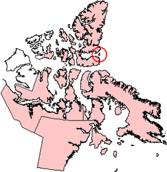
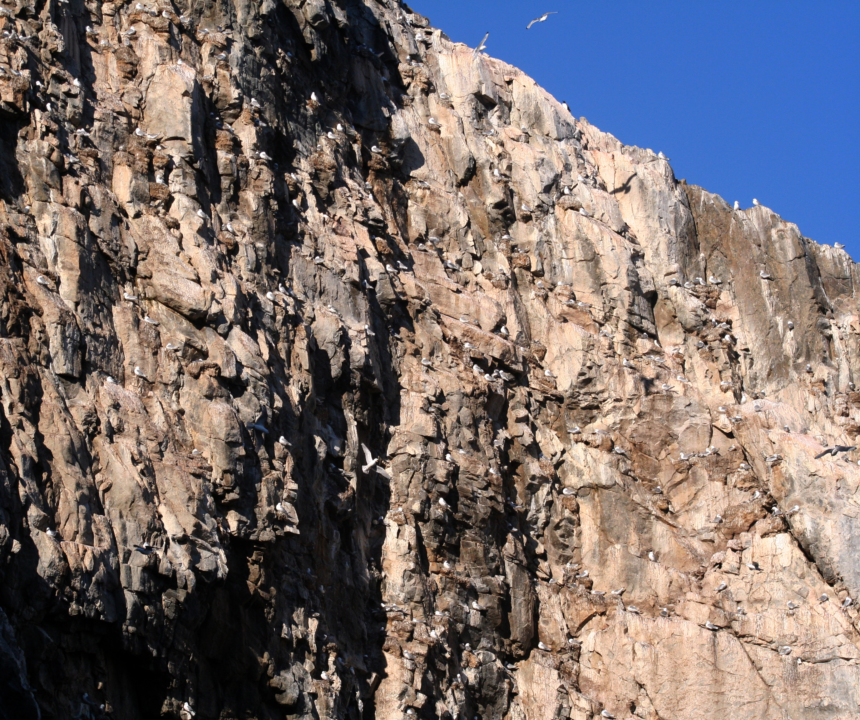
Länge 38 km Breite 23 km Fläche 344 km² Höchste Erhebung 823 m Einwohner (unbewohnt) Felsen mit Seevögeln auf Coburg Island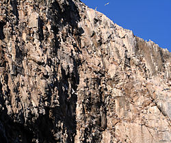
Coburg Island (auch Cobourg Island) liegt in der Baffin Bay am Eingang des Jones Sounds zwischen Ellesmere Island im Norden und Devon Island im Süden. Sie gehört zum kanadischen Territorium Nunavut und ist eine der Königin-Elisabeth-Inseln. Der 76. nördliche Breitengrad schneidet die Insel in der Mitte.
Die Insel ist 344 km² (nach anderen Quellen 367 km²) groß und hat zwischen Phillips Point im Norden und Cambridge Point im Süden eine Ausdehnung von 38 km. Coburg Island ist zwischen 6 und 23 km breit und erreicht eine Höhe von 823 m über dem Meeresniveau. 65% der Insel sind von Gletschern bedeckt.
Die Durchschnittstemperaturen liegen bei –28 °C im Februar und 4 °C im Juli.
Im Seegebiet um Coburg Island gibt es zwei Polynjas, die Lady-Ann-Polynja südlich der Insel in der Lady-Ann-Straße und das Nordwasser (englisch North Water Polynya) in der Baffin Bay. Das hier fast immer eisfreie Meer bietet vielen Tieren gute Lebensbedingungen. Auf Coburg Island brüten über 300.000 Seevögel, darunter hauptsächlich Dreizehenmöwen (Rissa tridactyla) und Dickschnabellummen (Uria lomvia), außerdem auch Eiderenten (Somateria mollissima), Prachteiderenten (Somateria spectabilis) und Eisenten (Clangula hymenalis). Auf dem der Insel südöstlich vorgelagerten Felsen Princess Charlotte Monument gibt es eine Kolonie von etwa 300 Paaren des Eissturmvogels (Fulmarus glacialis). In den Buchten an der Südspitze der Insel findet man im Sommer Walrosse, Ringelrobben und Bartrobben. Die Polynias werden im Winter auch von zahlreichen Walen, besonders Weißwalen, Narwalen und Grönlandwalen, aufgesucht. Auch Eisbären sind hier häufig anzutreffen.
Die Insel wurde wahrscheinlich von John Ross während seiner Expedition 1818 entdeckt, auf der er die Nordwestpassage suchte. Sie wurde nach dem deutschen Prinzen Leopold von Sachsen-Coburg benannt, der mit Prinzessin Charlotte, der Tochter König Georg IV. des Vereinigten Königreichs, verheiratet war.
Die Insel gehört heute zur Nirjutiqavvik National Wildlife Area. Cambridge Point ist als Important Bird Area (IBA Code 272) ausgewiesen.
Weblinks
- Coburg Island auf der Website der Insel-Enzyklopädie oceandots.com (englisch)
- Cambridge Point, Coburg Island, Nunavut auf der Liste der Important Bird Area
Hauptinseln der Königin-Elisabeth-InselnEllesmere Island
Parry-Inseln: Devon Island | Melville-Insel | Bathurst Island | Prinz-Patrick-Insel | Cornwallis Island | Mackenzie-King-Insel | Borden-Insel | Cornwall Island | Eglinton Island | Graham Island | Lougheed Island | Byam Martin Island | Île Vanier | Cameron Island | Meighen Island | Brock-Insel | North Kent Island | Emerald Isle | Alexander Island | Massey Island | Little Cornwallis Island | Coburg Island | Helena Island | Baillie-Hamilton Island | Griffith Island | Hoved Island | Lowther Island | Buckingham Island
Sverdrup-Inseln: Axel Heiberg Island | Ellef Ringnes Island | Amund Ringnes Island | King Christian Island | Stor Island
Wikimedia Foundation.
Schlagen Sie auch in anderen Wörterbüchern nach:
Coburg Island — Native name: Nirjutiqavvik Seabirds are nesting at Coburg Island Geography Location Lady Ann Strait … Wikipedia
Coburg Island — Sp Kòbergo salà Ap Coburg Island L Bafino įl., tarp Devono ir Elsmyro ss., Kanada (Nunavutas) … Pasaulio vietovardžiai. Internetinė duomenų bazė
Coburg (disambiguation) — Coburg could refer to: Places in Germany Coburg, a town in Germany Coburg (district), a district of Bavaria, Germany Saxe Coburg, a German duchy Saxe Coburg Gotha, a German duchy Places named after one of the above Coburg, Iowa, a city in the… … Wikipedia
Coburg-Insel — Die Coburg Insel (engl. Coburg Island, auch Cobourg Island) liegt in der Baffin Bay am Eingang des Jones Sunds zwischen der Ellesmere Insel im Norden und der Devon Insel im Süden. Sie gehört zum Territorium Nunavut, Kanada und ist eine Insel der… … Deutsch Wikipedia
Karl-Alexander Island — Russian: Остров Карла Александра Location of Karl Alexander Island in the Franz Josef Archipelago. Geography Location … Wikipedia
Isla Coburg — (Coburg Island) Isla Coburg, es la isla pequeña que aparece en la imagen a la derecha, en la boca del Jones Sound … Wikipedia Español
Rudolf Island — at the northern end of Franz Josef Land. Prince Rudolf Land, Crown Prince Rudolf Land, Prince Rudolf Island or Rudolf Island (Russian: Остров Рудольфа) is the northernmost island of the Franz Josef Archipelago, Russia. The island was named by the … Wikipedia
Northbrook Island — Location of Northbrook Island in the Franz Josef Archipelago A coastal view o … Wikipedia
Graham Bell Island — Graham Bell Native name: Остров Греэм Белл Location of Graham Bell Island in the Franz Josef Archipelago … Wikipedia
Hooker Island — Location of Hooker Island in the Franz Josef Archipelago Hooker Island (Russian: остров Гукера; Ostrov Gukera) is one of the most important islands of Franz Josef Land. It is located in the central area of the archipelago at … Wikipedia
Coburg Island

18+
© Academic, 2000-2024
- Kontaktieren Sie uns: Unterstützung, Werbung
Wörterbücher Export, schritte mit PHP, Joomla, Drupal, WordPress, MODx.