- Carrington (North Dakota)
-
Carrington 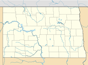

Carrington Lage in North DakotaBasisdaten Staat: Vereinigte Staaten Bundesstaat: North Dakota County: Koordinaten: 47° 27′ N, 99° 7′ W47.449444444444-99.124444444444484Koordinaten: 47° 27′ N, 99° 7′ W Zeitzone: Central Standard Time (UTC−6) Einwohner: 2268 (Stand: 2000) Bevölkerungsdichte: 596,8 Einwohner je km² Fläche: 3,8 km² (ca. 1 mi²)
davon 3,8 km² (ca. 1 mi²) LandHöhe: 484 m Postleitzahl: 58421 FIPS: 38-12340 GNIS-ID: 1028287 Webpräsenz: www.carringtonnd.com Carrington ist eine Stadt im US-Bundesstaat North Dakota mit 2268 Einwohnern. Sie ist County Seat (Verwaltungssitz) des Foster County.
Inhaltsverzeichnis
Geschichte
Die Besiedelung des Ortes begann in den 1880er Jahren und wurde begünstigt durch den Bau einer Eisenbahnlinie der Northern Pacific Railway im Jahr 1882. Erst mit diesem Anschluss an das Eisenbahnnetz gelangten Güter und Baumaterialien, vor allem Holz, in die Region, und nach den ursprünglich aus Grassoden errichteten Unterkünften entstanden Häuser und erste Geschäfte. Seit Einrichtung des Foster County 1883 ist Carrington dessen Verwaltungssitz.[1]
Wirtschaft und Infrastruktur
 Getreidespeicher inmitten der Stadt
Die Wirtschaft in Carrington ist bis heute vornehmlich landwirtschaftlich geprägt. Zugleich ist der Ort Firmensitz der Dakota Growers Pasta Company, Inc, einem überregional agierenden Hersteller von Pastaprodukten.[1]
Durch Carrington verläuft der U.S. Highway 52, knapp 2 Kilometer westlich des Stadtzentrums liegt der Carrington Municipal Airport[2]. Der Ort beherbergt eine Elementary School und eine High School.
Einzelnachweise
- ↑ a b History. City of Carrington, abgerufen am 16. September 2009 (englisch).
- ↑ 46D-Carrington Municipal Airport. www.airnav.com, abgerufen am 16. September 2009 (englisch).
Weblinks
- www.cgtn-nd.com Webseite der örtlichen Handelskammer
Kategorien:- Ort in North Dakota
- County Seat in North Dakota


Wikimedia Foundation.