Carnarvon Shire

Carnarvon Shire
Shire of Carnarvon
Carnarvon LGA WA.png
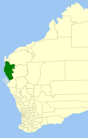
Lage des Carnarvon Shire in Westaustralien
Gliederung
Staat: Australien Australien
Bundesstaat: Flag of Western Australia.svg Western Australia
Verwaltungssitz: Carnarvon
Daten und Zahlen
Fläche: 46.663,5 km²
Einwohner: 5.681 (2006) [1]
Bevölkerungsdichte: 0,1 Einwohner je km²
Wards: 4
-24.883333333333113.65

Das Shire of Carnarvon ist ein lokales Verwaltungsgebiet (LGA) im australischen Bundesstaat Western Australia. Das Gebiet ist 46.664 km² groß und hat etwa 5700 Einwohner.

Carnarvon liegt im Westen des Staates an der australischen Westküste etwa 810 km nördlich der Hauptstadt Perth. Der Sitz des Shire Councils befindet sich in der Ortschaft Carnarvon, wo etwa 5300 Einwohner leben[2].

Verwaltung

Der Carnarvon Council hat acht Mitglieder, sieben Councillor werden von den Bewohnern der vier Wards (vier aus dem Town Ward, je einer aus dem Plantation, Coral Bay und Gascoyne/Minilya Ward) gewählt. Der Vorsitzende des Councils (Shire President) wird zusätzlich von allen Bewohnern des Shires gewählt.

Quellen

  1. Australian Bureau of Statistics (25. Oktober 2007): Carnarvon (S) (Local Government Area) (Englisch). 2006 Census QuickStats. Abgerufen am 23. Juli 2010.
  2. Australian Bureau of Statistics (25. Oktober 2007): Carnarvon (Urban Centre/Locality) (Englisch). 2006 Census QuickStats. Abgerufen am 23. Juli 2010.

Weblinks


Wikimedia Foundation.

Игры ⚽ Поможем сделать НИР

Schlagen Sie auch in anderen Wörterbüchern nach:

  • Carnarvon — and Caernarvon are anglicised forms of the name of the Welsh town Caernarfon. The anglicised spellings have become largely obsolete in Wales since the 1970s, but persist elsewhere. The name may also refer to:PlacesAustralia * Carnarvon Highway,… …   Wikipedia

  • Carnarvon (Western Australia) — Carnarvon Staat …   Deutsch Wikipedia

  • Shire of Murchison — Western Australia Location in Western Australia Population …   Wikipedia

  • Shire of Derby-West Kimberley — Western Australia Population: 7,9 …   Wikipedia

  • Shire of Christmas Island — Population: 1,440(2009)[1] …   Wikipedia

  • Shire of Ngaanyatjarraku — Western Australia Location in Western Australia Population …   Wikipedia

  • Shire of Carnarvon — Infobox Australian Place | type = lga name = Shire of Carnarvon state = wa imagesize= 180 caption = Location in Western Australia pop = 5,681 (2006 census) area = 46663.5 est = 1890s seat = Carnarvon mayor = Dudley Maslen region = Gascoyne url =… …   Wikipedia

  • Carnarvon, Western Australia — Infobox Australian Place | type = town name = Carnarvon state = wa caption = Location of Carnarvon in Western Australia (red) lga = Shire of Carnarvon postcode = 6701 est = 1883 pop = 5,283 (2006 census) elevation= 4 maxtemp = 27.1 mintemp = 17.2 …   Wikipedia

  • Shire of Exmouth — Infobox Australian Place | type = lga name = Shire of Exmouth state = wa imagesize= 180 caption = Location in Western Australia pop = 2,063 (2006 census) density = area = 6502.8 est = 1964 seat = Exmouth mayor = V M (Ronnie) Fleay region =… …   Wikipedia

  • Shire of Upper Gascoyne — Infobox Australian Place | type = lga name = Shire of Upper Gascoyne state = wa imagesize= 180 caption = Location in Western Australia pop = 285 (2006 census) area = 57939 est = 1887 seat = Gascoyne Junction mayor = Ross Collins region = Gascoyne …   Wikipedia

Share the article and excerpts

Direct link
Do a right-click on the link above
and select “Copy Link”