- California State Route 14
-
Karte 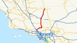
Basisdaten Gesamtlänge: 118 mi/190 km Anfangspunkt:  I-5 bei Santa Clarita
Endpunkt:  US 395 bei Inyokern
Countys: Los Angeles County
Kern CountyWichtige Städte: Palmdale
Lancaster
Mojave
California CityVerlauf
24.788 I-5
27.048 Santa Clarita, San Fernando Road 28.080 Placerita Canyon Road 29.675 Golden Valley Road 30.811 Sierra Hwy 33.423 Sand Canyon Road 35.712 Shadow Pines Blvd., Soledad Road 39.854 Agua Dulce Canyon Road 43.288 Escondido Canyon Road 46.759 Ward Road 48.607 Crown Valley Road 50.746 Santiago Road 52.172 Soledad Canyon Road, Sierra Hwy 54.543 Angeles Forest Hwy 58.172 Palmdale, Avenue S 59.803 South Jct.  CA 138 Palmdale Blvd.
61.766 10th Street West 63.671 Ave N 64.678 Lancaster, Columbia Way, Ave M 65.683 Ave L 66.730 Ave K 67.390 Ave J-8, 20th Street West 67.957 Ave J 68.965 Ave I 69.991 Ave H 70.992 Ave G 71.995 Ave F 74.003 North Jct. CA 138 Ave D77.008 Ave A, Los Angeles/Kern County Line 
3.018 Rosamond Blvd. 12.147 Silver Queen Road 16.070 South Jct.  CA 58 Mojave
19.239 North Jct. CA 58 Mojave21.290 Randsburg Cut-off Road, California City/Bakersfield Road 35.560 Randsburg Road 57.767 West Jct.  CA 178
60.571 Homestead South Jct. CA 178 East64.559 Homestead North Jct. US 395Die California State Route 14 (kurz CA 14) ist eine State Route im US-Bundesstaat Kalifornien, die in Nord-Süd-Richtung verläuft.
Die State Route beginnt an der Interstate 5 nahe Santa Clarita und endet nahe Inyokern am U.S. Highway 395. Sie verläuft durch die Mojave-Wüste und ist deshalb als High Desert bekannt. Zusammen mit dem U.S. 395 verbindet sie die das Greater Los Angeles Area mit großen Orten wie Reno. Während der südliche Teil der Straße durch ländliche Schluchten und Vororten führt, bietet der nördliche Abschnitt eine gute Sicht auf die Sierra Nevada Bergkette. Teilweise verläuft die State Route durch wüstenartiges Gebiet und besonders um Mojave durch sehr dünn besiedeltes Gebiet.
Am 13. Oktober 2007 gab es einen schweren Unfall mit mehreren Toten und Verletzten am Newhall Pass Interchange mit der Interstate 5. Die Unfallstelle lag etwa 48 km nördlich der Innenstadt von Los Angeles, in einem etwa 170 m langen Umgehungstunnel für LKWs.[1]
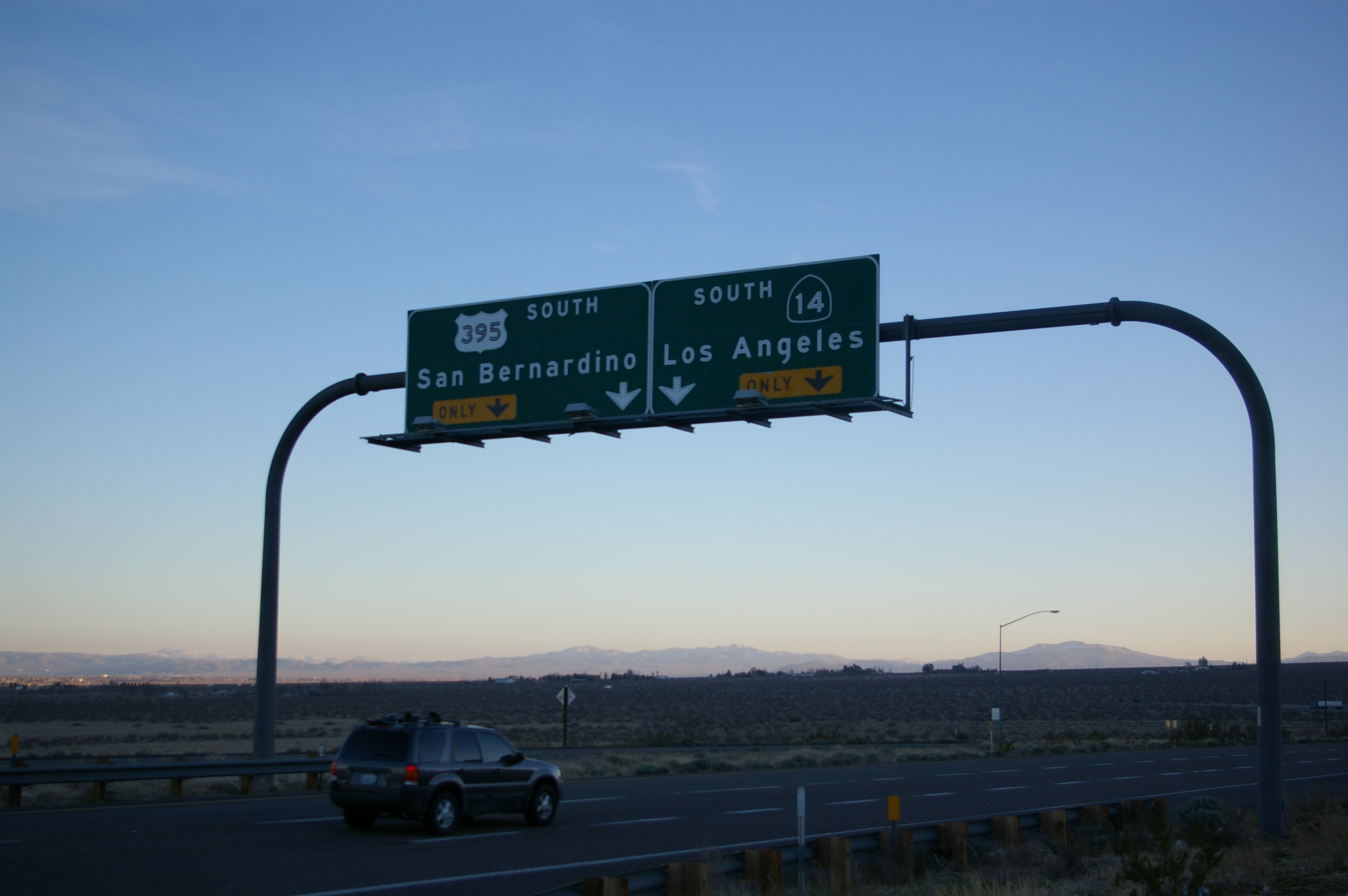
 Das nördliche Ende der CA14 nahe Inyokern
Quellen
- ↑ New York Times: Pileup in California Freeway Tunnel Kills at Least 3, 14. Oktober 2007
Siehe auch
Weblinks
Kategorie:- California State Route


Wikimedia Foundation.