California State Route 115

California State Route 115
Straßenschild der California State Route 115
Karte
Karte der California State Route 115
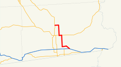
Basisdaten
Gesamtlänge:  35 mi/57 km
Anfangspunkt:  Straßenschild der I-8 I-8 bei Holtville
Endpunkt:  California 111.svg CA 111 in Calipatria
County:  Imperial County

Die California State Route 115 (kurz CA 115) ist eine State Route im US-Bundesstaat Kalifornien, die in Nord-Süd-Richtung verläuft.

Die State Route beginnt an der Interstate 8 östlich von Holtville und endet nach 57 Kilometern in Calipatria an der California State Route 111.

Verlauf

Ab der Interstate 8 verläuft die State Route zunächst in westlicher Richtung, bis sie ab Holtville nordwärts weiterführt. Östlich von Brawley trifft die Straße auf die California State Route 78, bevor sie in Calipatria südöstlich des Saltonsees endet.

Siehe auch

Weblinks


Wikimedia Foundation.

Игры ⚽ Нужен реферат?

Schlagen Sie auch in anderen Wörterbüchern nach:

  • California State Route 115 — Infobox road state=CA type=SR route=115 section=415 maint=Caltrans length mi=35.24 length round=2 length ref= [ [http://www.dot.ca.gov/hq/structur/strmaint/brlog2.htm January 1, 2006 California Log of Bridges on State Highways] ] direction… …   Wikipedia

  • California State Route 78 — Karte …   Deutsch Wikipedia

  • California State Route 58 — State Route 58 Route information …   Wikipedia

  • California State Route 111 — Karte …   Deutsch Wikipedia

  • California State Route 1 — For other uses, see CA1 (disambiguation). State Route 1 Route information …   Wikipedia

  • California State Route 7 — Infobox road state=CA type=SR route=7 section=307 maint=Caltrans length mi=7 length ref= [http://www.dot.ca.gov/hq/tsip/HSEB/products/state highway routes selected information 1995 revised.pdf State Highway Routes, Selected Information 1994 with… …   Wikipedia

  • California State Route 78 — State Route 78 State Route 78 highlighted in red …   Wikipedia

  • California State Route 42 — CA 42 redirects here. For the congressional district, see California s 42nd congressional district. State Route 42 …   Wikipedia

  • California State Route 16 — Infobox road state=CA type=SR route=16 section=316 maint=Caltrans length mi=111.17 length ref= [http://www.dot.ca.gov/hq/structur/strmaint/brlog2.htm July 2007 California Log of Bridges on State Highways] ] length round=2 length notes=(includes… …   Wikipedia

  • California State Route 116 — Infobox road state=CA type=SR route=116 section=416 maint=Caltrans length mi=46.76 length round=2 length ref= [ [http://www.dot.ca.gov/hq/structur/strmaint/brlog2.htm January 1, 2006 California Log of Bridges on State Highways] ] direction a=West …   Wikipedia

Share the article and excerpts

Direct link
Do a right-click on the link above
and select “Copy Link”