Baruchowo

Baruchowo
Baruchowo
Wappen von Baruchowo
Baruchowo (Polen)
Baruchowo
Baruchowo
Basisdaten
Staat: Polen
Woiwodschaft: Kujawien-Pommern
Landkreis: Włocławek
Geographische Lage: 52° 29′ N, 19° 15′ O52.48333333333319.25Koordinaten: 52° 29′ 0″ N, 19° 15′ 0″ O
Einwohner:

-
(31. Dez. 2010)[1]

Postleitzahl: 87-821
Telefonvorwahl: (+48) 54
Kfz-Kennzeichen: CWL
Gemeinde
Gemeindeart: Landgemeinde
Gemeindegliederung: 15 Schulzenämter
Fläche: 107,1 km²
Einwohner:

3614
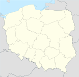
(31. Dez. 2010) [2]

Bevölkerungsdichte: 34 Einw./km²
Gemeindenummer (GUS): 0418022
Verwaltung
Gemeindevorsteher: Stanisław Bernard Sadowski
Webpräsenz: www.baruchowo.pl

Baruchowo (deutsch Baruchowo, 1943–1945 Barchau)[3] ist ein Dorf und Sitz der gleichnamigen Landgemeinde in Polen. Der Ort liegt im Powiat Włocławski der Wojewodschaft Kujawien-Pommern.

Gemeinde

Zur Landgemeinde Baruchowo gehören 15 Ortsteile mit einem Schulzenamt.

  • Baruchowo (1943–1945 Barchau)
  • Boża Wola
  • Goreń Duży
  • Grodno
  • Kłótno
  • Kurowo-Kolonia
  • Kurowo-Parcele
  • Lubaty (1943–1945 Lubingen)
  • Nowa Zawada
  • Okna
  • Patrówek
  • Skrzynki (1943–1945 Kastunggen)
  • Świątkowice (1943–1945 Dankstett)
  • Zakrzewo
  • Zawada Piaski

Weblinks

Fußnoten

  1. Population. Size and Structure by Territorial Division. As of December 31, 2010. Główny Urząd Statystyczny (GUS), abgerufen am 9. Juli 2011.
  2. Population. Size and Structure by Territorial Division. As of December 31, 2010. Główny Urząd Statystyczny (GUS), abgerufen am 9. Juli 2011.
  3. Vgl. Weblink Anordnung über Ortsnamenänderung im Reichsgau Wartheland - Kreis Leslau

Wikimedia Foundation.

Игры ⚽ Поможем написать реферат

Schlagen Sie auch in anderen Wörterbüchern nach:

  • Baruchowo — Infobox Settlement name = Baruchowo settlement type = Village total type = image shield = subdivision type = Country subdivision name = POL subdivision type1 = Voivodeship subdivision name1 = Kuyavian Pomeranian subdivision type2 = County… …   Wikipedia

  • Baruchowo — Original name in latin Baruchowo Name in other language State code PL Continent/City Europe/Warsaw longitude 52.49412 latitude 19.26496 altitude 75 Population 434 Date 2010 09 16 …   Cities with a population over 1000 database

  • Gmina Baruchowo — Infobox Settlement name = Gmina Baruchowo other name = Baruchowo Commune settlement type = Gmina total type = Total image shield = POL gmina Baruchowo COA.svg subdivision type = Country subdivision name = POL subdivision type1 = Voivodeship… …   Wikipedia

  • Zakrzewo, Gmina Baruchowo — Infobox Settlement name = Zakrzewo settlement type = Village total type = image shield = subdivision type = Country subdivision name = POL subdivision type1 = Voivodeship subdivision name1 = Kuyavian Pomeranian subdivision type2 = County… …   Wikipedia

  • Goreń Duży —   Village   …   Wikipedia

  • Nowa Zawada —   Village   …   Wikipedia

  • Okna, Kuyavian-Pomeranian Voivodeship — Okna   Village   …   Wikipedia

  • Гмина Барухово — Gmina Baruchowo Герб Страна:  Польша Повят:  Влоцлавский повят Глава:  Станислав Бернард Садовский Площадь:  107,05 км² …   Википедия

  • Skrzynki, Włocławek County — Infobox Settlement name = Skrzynki settlement type = Village total type = image shield = subdivision type = Country subdivision name = POL subdivision type1 = Voivodeship subdivision name1 = Kuyavian Pomeranian subdivision type2 = County… …   Wikipedia

  • Zawada-Piaski — Infobox Settlement name = Zawada Piaski settlement type = Village total type = image shield = subdivision type = Country subdivision name = POL subdivision type1 = Voivodeship subdivision name1 = Kuyavian Pomeranian subdivision type2 = County… …   Wikipedia

Share the article and excerpts

Direct link
Do a right-click on the link above
and select “Copy Link”