- Cabeça Santa
-
Cabeça Santa Wappen Karte 
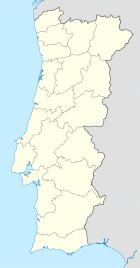

Basisdaten Region: Norte Unterregion: Tâmega Distrikt: Porto Concelho: Penafiel Koordinaten: 41° 8′ N, 8° 16′ W41.128888888889-8.27Koordinaten: 41° 8′ N, 8° 16′ W Einwohner: 2.537 (Stand: 2001) Fläche: 5,19 km² Bevölkerungsdichte: 489 Einwohner pro km² Cabeça Santa ist eine Gemeinde im Norden Portugals
Cabeça Santa gehört zum Kreis Penafiel im Distrikt Porto, besitzt eine Fläche von 5,19 km² und hat 2.537 Einwohner (2001).
Weblinks
- Karte der Freguesia Cabeça Santa beim Instituto Geográfico do Exército
 Freguesias im Concelho Penafiel
Abragão | Boelhe | Bustelo | Cabeça Santa | Canelas | Capela | Castelões | Croca | Duas Igrejas | Eja | Figueira | Fonte Arcada | Galegos | Guilhufe | Irivo | Lagares | Luzim | Marecos | Milhundos | Novelas | Oldrões | Paço de Sousa | Penafiel | Perozelo | Pinheiro | Portela | Rans | Rio de Moinhos | Santa Marta | Santiago de Subarrifana | São Mamede de Recezinhos | São Martinho de Recezinhos | São Miguel de Paredes | Sebolido | Urrô | Valpedre | Vila Cova
Wikimedia Foundation.
Schlagen Sie auch in anderen Wörterbüchern nach:
Cabeça Gorda — Wappen Karte … Deutsch Wikipedia
Santa Clara de Louredo — Wappen Karte … Deutsch Wikipedia
Santa Vitória (Beja) — Wappen Karte … Deutsch Wikipedia
Santa Cruz de Goiás — is a small town and municipality in southeast Goiás state, Brazil. GeographySanta Cruz is located in the southeastern part of the state, 33 km. west of regional center, Pires do Rio. The Rio dos Bois, a tributary of the Corumbá River flows from… … Wikipedia
Morro Cabeça no Tempo — Municipality and town Country Brazil Region … Wikipedia
Nova Santa Rita, Piauí — Municipality and town Country Brazil Region … Wikipedia
List of postal codes in Portugal — Aveiro districtMealhada municipality*3050 Antes *3050 Barcouço *3050 Casal Comba *3050 Luso *3050 Mealhada *3050 Pampilhosa *3050 Vacariça *3050 Ventosa do BairroMurtosa municipality*3870 Bunheiro *3870 Monte *3870 Murtosa *3870 TorreiraOliveira… … Wikipedia
Freguesias de Portugal — Anexo:Freguesias de Portugal Saltar a navegación, búsqueda Contenido 1 A 1.1 Abrantes 1.2 Águeda 1.3 … Wikipedia Español
Anexo:Freguesias de Portugal — Contenido 1 A 1.1 Abrantes 1.2 Águeda 1.3 Aguiar da Beira 1.4 … Wikipedia Español
Monuments of Portugal — The Monuments of Portugal were constructed throughout the Portuguese territory, and date back to the period of pre historic settlement of occupation. Subsequently, the region that is today Portugal has been colonized by many civilizations, which… … Wikipedia
Cabeça Santa


18+
© Academic, 2000-2024
- Kontaktieren Sie uns: Unterstützung, Werbung
Wörterbücher Export, schritte mit PHP, Joomla, Drupal, WordPress, MODx.