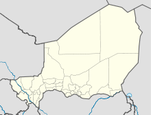
Ayérou

Ayérou
14.7166666666670.91666666666666
Ayérou (Niger)
Ayérou
Ayérou

Ayérou (amtliche Schreibweise[1]; auch Ayorou) ist eine Landgemeinde im Departement Tillabéri der gleichnamigen nigrischen Region Tillabéri. Sie hat 32.958 Einwohner (2010).[2]

Die Gemeinde liegt östlichen Ufer des Flusses Niger in der Sahelzone. Das Gemeindegebiet ist in 15 administrative Dörfer, drei traditionelle Dörfer, 62 Weiler, 20 Lager und 20 Wasserstellen gegliedert.[3] Die Altstadt liegt auf einer gleichnamigen Insel im Niger, die der Gemeinde ihren Namen gab. Am Flussabschnitt bei Ayérou leben Flusspferde und zumindest 33 verschiedene Wasservögel-Arten, darunter Höckerglanzgänse, Witwenpfeifgänse und Kronenkraniche.

Sonntag ist Markttag in Ayérou. Der Markt erstreckt sich dann über weite Teile der Stadt, vom Flussufer bis zur Hauptstraße. Ayérou liegt an der Nationalstraße N1, die entlang des Niger flussaufwärts bis zur Staatsgrenze mit Mali und flussabwärts Richtung der Hauptstadt Niamey verläuft. Der Fluss selbst ist mit Pirogen schiffbar.

Literatur

Einzelnachweise

  1. Website der Nigrischen Statistik: Annuaires Statistique, Edition 2008, abgerufen am 2. März 2010.
  2. Institut national de la statistique (Hrsg.): Annuaire statistique des cinquante ans d’indépendence du Niger. Niamey 2010 (Online-Version), S. 56.
  3. Répertoire National des Communes (RENACOM). Website des Institut National de la Statistique, abgerufen am 22. Januar 2011.

Wikimedia Foundation.

Игры ⚽ Поможем сделать НИР

Schlagen Sie auch in anderen Wörterbüchern nach:

  • Diffa —   Urban Commune   …   Wikipedia

  • Departments of Niger — the pre 2011 36 Departments of Niger. A further 27 were then carved out of existing divisions …   Wikipedia

  • N'guigmi — Nguigmi, Ngigmi Camel riders line up outside the residence of the traditional chief of Nguigmi …   Wikipedia

  • Dosso, Niger — Dosso Officials at the opening of the Regional Maternity hospital, 2008 …   Wikipedia

  • Djado Plateau — The ruined city of Djado, with nomadic women gathered in the foreground. October 1989. The Djado Plateau lies in the Sahara, in north eastern Niger. It is known for its cave art (often of large mammals long since absent from the area), but is now …   Wikipedia

  • Dakoro — is a town and commune located in the Maradi Region of Niger. Coordinates: 14°30′N 6°45′E /  …   Wikipedia

  • Dogondoutchi — Dogondoutchi …   Wikipedia

  • Mayahi — (var. Mayaki) is a town located in the Maradi Region of Niger. It is the seat of Mayahi Department and a Commune about 45km from Tessaoua. In the mid 1990s it had a population of 2,200.[1] The name Mayaki is also a rulers title among the Sudié… …   Wikipedia

  • Ouallam — is a town in southwestern Niger. It is around 300 km north of Niamey, is the capital of Ouallam Department, one of four in the Tillabery Region. Contents 1 Culture 2 Agricultural center 3 Intercommunal violence …   Wikipedia

  • Matankari — is a town in southwestern Niger. It is near the city of Niamey. Coordinates: 13°48′22″N 4°01′55″E / 13.806075°N 4.031982°E / 13.806075 …   Wikipedia

Share the article and excerpts

Direct link
Do a right-click on the link above
and select “Copy Link”