- Byron Shire
-
Shire of Byron 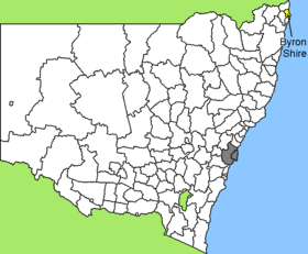
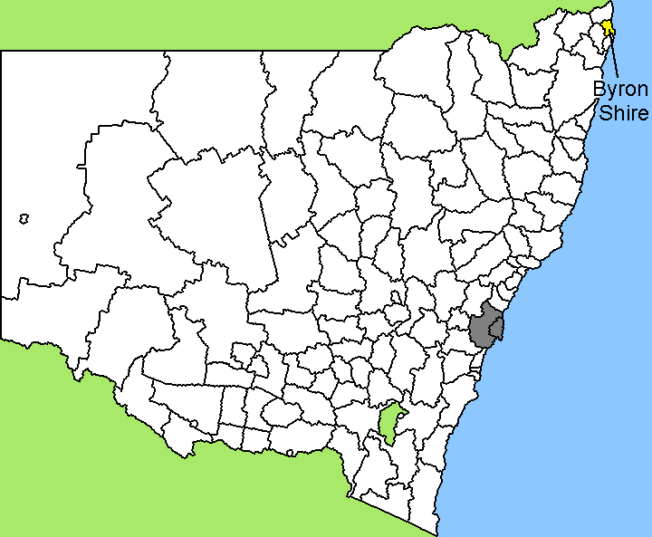
Lage des Byron Shire in New South WalesGliederung Staat:  Australien
Bundesstaat:  New South Wales
Verwaltungssitz: Mullumbimby Daten und Zahlen Fläche: 567 km² Einwohner: 28.766 (2006) [1] Bevölkerungsdichte: 51 Einwohner je km² -28.55153.5Koordinaten: 28° 33′ S, 153° 30′ OByron Shire ist ein lokales Verwaltungsgebiet (LGA) im australischen Bundesstaat New South Wales. Das Gebiet ist 567 km² groß und hat etwa 29.000 Einwohner.
Byron liegt im äußersten Nordosten des Staates an der Pazifikküste etwa 790 km nördlich der Metropole Sydney und 150 km südlich von Brisbane. Das Gebiet umfasst 58 Ortsteile und Ortschaften, darunter Bangalow, Billinudgel, Brunswick Heads, Byron Bay, Federal, Mullumbimby, Ocean Shores, South Golden Beach, Suffolk Park, Yelgun und Teile von Clunes und Newrybar. Der Sitz des Shire Councils befindet sich in der Stadt Mullumbimby, wo etwa 3.100 Einwohner leben.
Cape Byron ist der östlichste Punkt des australischen Kontinents.
Verwaltung
Der Byron Shire Council hat zehn Mitglieder, neun Councillor und ein Vorsitzender und Mayor (Bürgermeister), die von den Bewohnern der LGA gewählt werden. Byron ist nicht in Bezirke untergliedert.
Weblinks
Einzelnachweise
- ↑ Australian Bureau of Statistics (25. Oktober 2007): Byron (A) (Local Government Area) (Englisch). 2006 Census QuickStats. Abgerufen am 6. April 2010.
Kategorie:- Local Government Area in New South Wales
Wikimedia Foundation.