- Abbotsford (British Columbia)
-
Abbotsford Lage in British Columbia 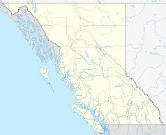

Abbotsford Staat: Kanada Provinz: British Columbia Regionaldistrikt: Fraser Valley Koordinaten: 49° 3′ N, 122° 17′ W49.04895-122.2903138Koordinaten: 49° 3′ N, 122° 17′ W Höhe: 38 m Fläche: 359,36 km² Einwohner: 123.864 (Stand: 2006) Bevölkerungsdichte: 344,7 Einw./km² Zeitzone: UTC−8 Postleitzahl: V2S–V2T, V3G, V4X Bürgermeister: George W. Peary Webpräsenz: www.abbotsford.ca 

Teilansicht der Stadt vom Mill Lake Abbotsford ist eine Stadt in Kanada, in der Provinz British Columbia. Ein anderer Name der Stadt ist Matsqui.
Inhaltsverzeichnis
Geographie
Abbotsford liegt im Westen des Landes, unmittelbar nördlich der Grenze zum US-Bundesstaat Washington. Die Entfernung nach Vancouver beträgt 70 km. Sie hat eine Fläche von 359,18 km².
Bevölkerung
Abbotsford hat 115.463 Einwohner (2001), mit Vororten beträgt die Einwohnerzahl 147.370.
Einwohnerentwicklung
Rund 15 % der Einwohner sind südasiatischen und rund 1,2 % chinesischen Ursprungs. 1,3 % der Einwohner haben Vorfahren in der Karibik oder Schwarzafrika. Damit liegt Abbotsford weit über dem Durchschnitt an schwarzer Bevölkerung in British Columbia.
Verkehr
Abbotsford liegt am Highway 1, dem Trans-Canada Highway. Weiterhin kann über Highway 11 nach Norden Mission und nach Süden die Vereinigten Staaten erreicht werden.
Rund vier Kilometer südwestlich des Stadtzentrums befindet sich der Flughafen Abbotsford, der von mehreren Charterfluggesellschaften angeflogen wird. Auf dem Flughafengelände findet seit 1962 jeweils im August die Abbotsford International Airshow statt, eine der bedeutendsten Flugschauen des Landes.
Partnerstädte
Söhne und Töchter der Stadt
- Ryan Craig, Eishockeyspieler
- Kyle Cumiskey, Eishockeyspieler
- Michael Funk, Eishockeyspieler
- Justin Kelly, Eishockeyspieler
- David Van der Gulik, Eishockeyspieler
- Chad Kroeger, Rocksänger
Sonstiges
In Maple Ridge wurde Teile des 2007 erschienenen Katastrophenfilms Meteor – Der Tod kommt vom Himmel (mit Sheree J. Wilson als Hauptdarstellerin) gedreht.[1]
Einzelnachweise
Weblinks
Kategorie:- Ort in British Columbia


Wikimedia Foundation.