- Burlington County
-
Verwaltung US-Bundesstaat: New Jersey Verwaltungssitz: Mount Holly Township Adresse des
Verwaltungssitzes:County Office Building
49 Rancocas Road, PO Box 6000
Mount Holly, NJ 08060-1388Gründung: 17. Mai 1694 Gebildet aus: West Jersey Vorwahl: +1 609 oder +1 856 Demographie Einwohner: 448.734 (2010) Bevölkerungsdichte: 215,3 Einwohner/km² Geographie Fläche gesamt: 2.122 km² Wasserfläche: 38 km² Karte 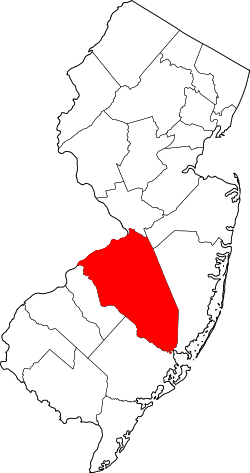
Website: www.co.burlington.nj.us Das Burlington County[1] ist ein County im US-amerikanischen Bundesstaat New Jersey. Bei der Volkszählung im Jahr 2010 hatte das County 448.734 Einwohner und eine Bevölkerungsdichte von 215,3 Einwohnern pro Quadratkilometer. Der Verwaltungssitz (County Seat) ist Mount Holly Township.[2]
Das Burlington County ist Bestandteil der Delaware Valley genannten Metropolregion um die Stadt Philadelphia.
Inhaltsverzeichnis
Geografie
Das County liegt im östlichen Vorortbereich von Philadelphia am linken Ufer des Delaware River, der die Grenze zu Pennsylvania bildet. Das Burlington County hat eine Fläche von 2.122 Quadratkilometern, wovon 38 Quadratkilometer Wasserfläche sind. Es grenzt an folgende Countys:
Philadelphia (Pennsylvania),
Bucks County (Pennsylvania)Mercer County Monmouth County Camden County 
Ocean County Atlantic County Geschichte
Das Burlington County wurde am 17. Mai 1694 als Originalcounty gebildet. Benannt wurde es nach dem alten Namen der Stadt Bridlington in England.
Historische Objekte
- Im Mount Holly Township befindet sich das historische ehemalige Gefängnisgebäude Burlington County Prison, das 1811 errichtet wurde.
Demografische Daten
Historische Einwohnerzahlen Census Einwohner ± in % 1790 18.095 — 1800 21.521 20 % 1810 24.979 20 % 1820 28.822 20 % 1830 31.107 8 % 1840 32.831 6 % 1850 43.203 30 % 1860 49.730 20 % 1870 53.639 8 % 1880 55.402 3 % 1890 58.528 6 % 1900 58.241 -0,5 % 1910 66.565 10 % 1920 81.770 20 % 1930 93.541 10 % 1940 97.013 4 % 1950 135.910 40 % 1960 224.499 70 % 1970 323.132 40 % 1980 362.542 10 % 1990 395.066 9 % 2000 423.394 7 % 2010 448.734 6 % Vor 1900[3] 1900–1990[4] 2000[5] 2010[6] Nach der Volkszählung im Jahr 2010 lebten im Burlington County 448.734 Menschen in 264.100 Haushalten. Die Bevölkerungsdichte betrug 215,3 Einwohner pro Quadratkilometer.
Ethnisch betrachtet setzte sich die Bevölkerung zusammen aus 73,8 Prozent Weißen, 16,6 Prozent Afroamerikanern, 0,2 Prozent amerikanischen Ureinwohnern, 4,3 Prozent Asiaten sowie aus anderen ethnischen Gruppen; 2,9 Prozent stammten von zwei oder mehr Ethnien ab. Unabhängig von der ethnischen Zugehörigkeit waren 6,4 Prozent der Bevölkerung spanischer oder lateinamerikanischer Abstammung.
In den 264.100 Haushalten lebten statistisch je 2,62 Personen.
23,2 Prozent der Bevölkerung waren unter 18 Jahre alt, 62,9 Prozent waren zwischen 18 und 64 und 13,9 Prozent waren 65 Jahre oder älter. 50,9 Prozent der Bevölkerung war weiblich.
Das jährliche Durchschnittseinkommen eines Haushalts lag bei 74.481 USD. Das Pro - Kopf - Einkommen betrug 34.165 USD. 6,1 Prozent der Einwohner lebten unterhalb der Armutsgrenze.[7]
Städte und Gemeinden
- Beverly
- Bordentown
- Browns Mills
- Burlington
- Country Lake Estates
- Fieldsboro
- Fort Dix
- Leisuretowne
- Marlton
- McGuire AFB
- Medford Lakes
- Palmyra
- Pemberton Heights
- Pemberton
- Presidential Lakes Estates
- Ramblewood
- Riverton
- Wrightstown
Townships
- Bass River Township
- Bordentown Township
- Burlington Township
- Chesterfield Township
- Cinnaminson Township
- Delanco Township
- Delran Township
- Eastampton Township
- Edgewater Park Township
- Evesham Township
- Florence Township
- Hainesport Township
- Lumberton Township
- Mansfield Township
- Maple Shade Township
- Medford Township
- Moorestown Township
- Mount Holly Township
- Mount Laurel Township
- New Hanover Township
- North Hanover Township
- Pemberton Township
- Riverside Township
- Shamong Township
- Southampton Township
- Springfield Township
- Tabernacle Township
- Washington Township
- Westampton Township
- Willingboro Township
- Woodland Township
Einzelnachweise
- ↑ GNIS-ID: 882272. Abgerufen am 22. Februar 2011 (englisch).
- ↑ National Association of Counties Abgerufen am 26. Oktober 2011
- ↑ U.S. Census Bureau _ Census of Population and Housing Abgerufen am 28. Februar 2011
- ↑ Auszug aus Census.gov Abgerufen am 28. Februar 2011
- ↑ Auszug aus factfinder.census.gov Abgerufen am 28. Februar 2011
- ↑ United States Census 2010 Abgerufen am 26. Oktober 2011
- ↑ U.S. Census Buero, State & County QuickFacts - Burlington County Abgerufen am 26. Oktober 2011
Weblinks
-
 Commons: Burlington County, New Jersey – Sammlung von Bildern, Videos und Audiodateien
 - Offizielle Webseite
- U.S. Census Buero, State & County QuickFacts - Burlington County
- Yahoo Bildersuche - Burlington County
- www.city-data.com - Burlington County
Schlagen Sie auch in anderen Wörterbüchern nach:
Burlington County — Admin ASC 2 Code Orig. name Burlington County Country and Admin Code US.NJ.005 US … World countries Adminstrative division ASC I-II
Burlington County Prison — (1937) Das Burlington County Prison (heute: Burlington County Prison Museum[1]) ist ein historisches, ehemaliges Gefän … Deutsch Wikipedia
Burlington County, New Jersey — Infobox U.S. County county = Burlington County state = New Jersey seallink = show map size = 100 founded = May 17, 1694 seat = Mount Holly largest city = Moorestown area total sq mi =819 area land sq mi =805 area water sq mi =15 area percentage … Wikipedia
Burlington County (New Jersey) — Verwaltung US Bundesstaat: New Jersey Verwaltungssitz: Mount Holly Township Adresse des Verwaltungssitzes: County Office Building 49 Rancocas Road, PO Box 6000 Mount Holly, NJ 08060 1388 Gründung … Deutsch Wikipedia
Burlington County College — Infobox University name = Burlington County College established = 1966 type = Community College president=Robert C. Messina, Jr campus = Suburban city = Pemberton / Mount Laurel state = New Jersey country = USA affiliations = Middle States… … Wikipedia
Burlington County Bridge Commission — The Burlington County Bridge Commission is a public agency responsible for the operation and maintenance of several bridges in Burlington County, New Jersey across the Delaware River. It now manages eight bridges, including the Tacony Palmyra… … Wikipedia
Burlington County Institute of Technology — The Burlington County Institute of Technology is a countywide public school district that serves the vocational and technical education needs of students at the high school and post secondary level in Burlington County, New Jersey, United States … Wikipedia
Burlington County Times — Infobox Newspaper name = Burlington County Times caption = type = Daily newspaper format = foundation = 1958, as Levittown Times ceased publication = price = owners = Calkins Media publisher = Stanley Ellis editor = Ronald Martin circulation = 33 … Wikipedia
Burlington County Prison — Infobox nrhp | name =Burlington County Prison nrhp type = nhl caption = Burlington County Prison location= 128 High Street, Mount Holly, New Jersey lat degrees = 39 lat minutes = 59 lat seconds = 47.4 lat direction = N long degrees = 74 long… … Wikipedia
Burlington County Scholastic League — The Burlington County Scholastic League (BCSL) is a New Jersey high school sports association under the jurisdiction of the New Jersey State Interscholastic Athletic Association (NJSIAA). The league consists of nineteen public and parochial high… … Wikipedia
Burlington County


18+
© Academic, 2000-2024
- Kontaktieren Sie uns: Unterstützung, Werbung
Wörterbücher Export, schritte mit PHP, Joomla, Drupal, WordPress, MODx.