- Bland Shire
-
Bland Shire 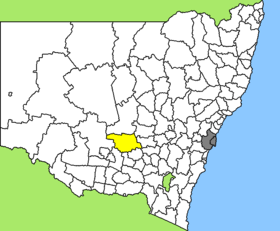
Lage des Bland Shire in New South WalesGliederung Staat:  Australien
Bundesstaat:  New South Wales
Verwaltungssitz: West Wyalong Daten und Zahlen Fläche: 8.560 km² Einwohner: 6.102 (2006) [1] Bevölkerungsdichte: 0,7 Einwohner je km² -33.933333333333147.25Koordinaten: 33° 56′ S, 147° 15′ ODas Bland Shire ist ein lokales Verwaltungsgebiet (LGA) im australischen Bundesstaat New South Wales. Das Gebiet ist 8.560 km² groß und hat etwa 6.100 Einwohner.
Bland liegt im Süden der Region Central West etwa 460 km westlich der Metropole Sydney und 280 km nordwestlich der australischen Hauptstadt Canberra. Das Gebiet umfasst 68 Ortsteile und Ortschaften, darunter Barmedman, Bland, Boddigower, Clear Ridge, Gubbata, Gunn, Hannan, Naradhan, Tallimba, Ungarie, Weethalle, Wyalong, West Wyalnong, Yalgogrin und Teile von Barellan, Mirrool, Quandialla und Weja. Der Sitz des Shire Councils befindet sich in West Wyalong in der Osthälfte der LGA, wo etwa 3.000 Einwohner leben.
Verwaltung
Der Bland Shire Council hat neun Mitglieder, die von den Bewohnern der LGA gewählt werden. Bland ist nicht in Bezirke untergliedert. Aus dem Kreis der Councillor rekrutiert sich auch der Mayor (Bürgermeister) des Councils.
Weblinks
Einzelnachweise
- ↑ Australian Bureau of Statistics (25. Oktober 2007): Bland (A) (Local Government Area) (Englisch). 2006 Census QuickStats. Abgerufen am 6. April 2010.
Kategorie:- Local Government Area in New South Wales

Wikimedia Foundation.