Bellshill

Bellshill
Belshill
Koordinaten 55° 49′ N, 4° 1′ W55.819444444444-4.0208333333333Koordinaten: 55° 49′ N, 4° 1′ W
Belshill (Schottland)
Belshill
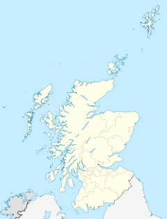
Belshill
Bevölkerung 20.705 (Zensus 2001)
Verwaltung
Post town BELLSHILL
Postleitzahlen­abschnitt ML4
Vorwahl 01698
Landesteil Scotland
Unitary authority North Lanarkshire
Britisches Parlament Coatbridge, Chryston and Bellshill
Schottisches Parlament Uddingston and Bellshill
Kirche in Bellshill

Bellshill ist ein Ort in North Lanarkshire, Schottland, der in den Vororten von Glasgow liegt, zwei Meilen nördlich von Motherwell. Bellshill hatte im Jahre 2006 20.200 Einwohner[1].

Die frühesten Zeugnisse einer Besiedlung in der Region von Bellshill ist ein Ort mit dem Namen Belmill, der auf einer Landkarte von Timothy Pont im Jahre 1654 festgehalten wurde. Der Ort bestand aus einer Reihe von Häusern, die einem Mr. Bell gehörten, der eine Steinmine südlich davon besaß. Als die Mine geschlossen wurde, verschwand auch der Ort und eine Siedlung entstand in der Nähe und wurde Crossgates genannt. Um 1810 nahm der Ort den Namen Bellshill an und wuchs weiter. Dabei wurden nahe gelegene Ortschaften wie Black Moss und Sykehead eingemeindet.

Mitte des 19. Jahrhunderts wurden große Kohle und Eisenvorkommen in der Nähe entdeckt und einige Minen wurden gegründet. Das rapide Wachstum brachte auch Emigranten von außerhalb nach Bellshill, teilweise sogar aus Litauen[2]. Zahlreiche Bahnhöfe in der Nähe entstanden, wie in Mossend, Fallside und Bell Cross.

In den 1870er Jahren wurde ein Krankenhaus errichtet. Im Ersten Weltkrieg spezialisierte sich das Krankenhaus auf Infektionskrankheiten.

Nach einem Bericht der Halifax Building Society war Bellshill im ersten Quartal 2005 der Ort in Großbritannien, an dem die Immobilienpreise mit 46 % am stärksten angestiegen sind.

Söhne und Töchter der Stadt

Quellen

  1. Mid-2006 localities popualtion
  2. http://www.bbc.co.uk/legacies/immig_emig/scotland/strathclyde/

Weblinks

 Commons: Bellshill – Sammlung von Bildern, Videos und Audiodateien

Wikimedia Foundation.

Игры ⚽ Поможем решить контрольную работу

Schlagen Sie auch in anderen Wörterbüchern nach:

  • Bellshill —    BELLSHILL, a village, in the parish of Bothwell, Middle ward of the county of Lanark, 1½ mile (E.) from Bothwell; containing 1013 inhabitants. It lies on the great road from Edinburgh to Glasgow, and the hill from which it is named attains an… …   A Topographical dictionary of Scotland

  • Bellshill — This article is about the town in North Lanarkshire, Scotland. For other places of the same name, see Bellshill (disambiguation). Coordinates: 55°48′59″N 4°01′34″W / 55.81647°N 4 …   Wikipedia

  • Bellshill — Localisation de Bellshill en Écosse Bellshill est une ville du North Lanarkshire en Écosse, située dans la banlieue nord de Motherwell et à l est de Glasgow. La population était de 30 000 habitants en 2001 …   Wikipédia en Français

  • Bellshill — Original name in latin Bellshill Name in other language Bellshill State code GB Continent/City Europe/London longitude 55.81667 latitude 4.01667 altitude 76 Population 20201 Date 2013 07 11 …   Cities with a population over 1000 database

  • Bellshill (disambiguation) — Bellshill is the name of a number of settlements: * Bellshill, is a suburb of Glasgow, Scotland. * Bellshill, Northumberland, is a village.See also Bell Hill …   Wikipedia

  • Bellshill, Northumberland — Bellshill is a village in Northumberland, in England. It is situated to the south west of Bamburgh, inland from the North Sea coast …   Wikipedia

  • Bellshill Athletic F.C. — Football club infobox clubname = Bellshill Athletic fullname = Bellshill Athletic Football Club nickname = B/Hill founded = 1897 | ground = New Brandon Park, Bellshill capacity = 2000 chairman = manager = league = Stagecoach Super League, Premier …   Wikipedia

  • Bellshill railway station — Infobox GB station| name = Bellshill other name = caption = code = BLH manager = First ScotRail locale = Bellshill borough = North Lanarkshire platforms = 2 latitude = 55.817 longitude = 4.025 usage0203 = 0.428 usage0405 = 0.469 usage0506 = 0.515 …   Wikipedia

  • Coatbridge, Chryston and Bellshill (UK Parliament constituency) — Coordinates: 55°53′06″N 4°03′36″W / 55.885°N 4.060°W / 55.885; 4.060 …   Wikipedia

  • Hamilton North and Bellshill (UK Parliament constituency) — UK former constituency infobox Name = Hamilton North and Bellshill Type = Burgh Year = 1997 Abolition = 2005 members = OneHamilton North and Bellshill was a burgh constituency represented in the House of Commons of the Parliament of the United… …   Wikipedia

Share the article and excerpts

Direct link
Do a right-click on the link above
and select “Copy Link”