- Wrangell Island
-
Wrangell Island Gewässer Pazifischer Ozean Inselgruppe Alexanderarchipel Geographische Lage 56° 27′ N, 132° 23′ W56.456388888889-132.37777777778Koordinaten: 56° 27′ N, 132° 23′ W 

Länge 48 km Breite 23 km Fläche 544 km² Einwohner 2.401 (2000)
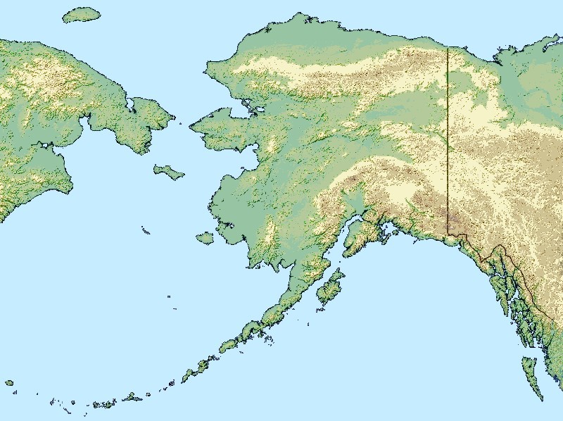
4,4 Einw./km²Hauptort Wrangell, AK Wrangell Island ist eine Insel im Alexanderarchipel im Alaska Panhandle. Die Insel ist ca. 48 km lang und zwischen 8 und 23 km breit. Ihre Landfläche beträgt 544 km². Sie ist vom Festland nur durch einen schmalen Kanal, den Blake Channel, getrennt.
Geschichte
Die Insel ist nach dem russischen Forscher und späteren Gouverneur von Russisch-Amerika, Ferdinand von Wrangel, benannt. 1834 gründete dieser auf der Insel ein Lagerhaus 20 km nördlich der großen Tlingit-Siedlung Kotzlitzna, an der Stelle des heutigen Wrangell, der einzigen Stadt der Insel. Die Insel ist somit die Heimat einer der ältesten Siedlungen Alaskas, die nicht von Ureinwohnern gegründet wurde.
Geografie
Wrangell Island liegt genau im Mündungsgebiet des Stikine River und bietet viele Freizeitmöglichkeiten. Sie ist stark bewaldet und hat noch nichts von ihrer ursprünglichen Wildnis verloren. Neben der einzigen Stadt (Wrangell) gibt es nur noch die kleine Siedlung Thoms Place auf der Insel. Die Bevölkerungszahl beträgt 2.401 (Stand 2000).
Inseln im AlexanderarchipelAdmiralty Island | Annette Island | Baranof Island | Chichagof Island | Dall Island | Etolin Island | Kuiu Island | Kupreanof Island | Prince-of-Wales-Insel | Revillagigedo Island | Wrangell Island
Wikimedia Foundation.
Schlagen Sie auch in anderen Wörterbüchern nach:
Wrangell Island — is in the Alexander Archipelago in the Alaska Panhandle of southeastern Alaska. It is 48 km (30 miles) long and 8 ndash;23 km (3 ndash;14 miles) wide. It has a land area of 544.03 km² (210.05 sq mi), making it the 29th largest island in the… … Wikipedia
Wrangell Island — Sp Vrángelio salà Ap Wrangell Island L Aleksandro ss., JAV (Aliaska) … Pasaulio vietovardžiai. Internetinė duomenų bazė
Wrangell (Alaska) — Wrangell Wrangel mit Mount Dewey im Hintergrund Lage in Alaska … Deutsch Wikipedia
Wrangell — steht für: Wrangell Mountains, Gebirgszug in Alaska Mount Wrangell, Vulkan in Alaska Wrangell St. Elias Nationalpark, Nationalpark in Alaska Wrangell (Alaska), Stadt in Alaska Wrangell Petersburg Census Area, geografisches Gebiet in Alaska… … Deutsch Wikipedia
Wrangell, Alaska — Coordinates: 56°23′06″N 132°05′11″W / 56.385°N 132.08639°W / 56.385; 132.08639 … Wikipedia
Wrangell-Petersburg Census Area — (seit 1. Juni 2008) Wrangell Petersburg Census Area (bis 1. Juni 2008) … Deutsch Wikipedia
Wrangell Narrows — The Wrangell Narrows is a winding, 35 km long (22 mi) channel between Mitkof Island and Kupreanof Island in the Alexander Archipelago in Southeast Alaska. The Wrangell Narrows is one of the six Listed narrows in South Esast Alaska. There are… … Wikipedia
Wrangell — geographical name island SE Alaska NE of Prince of Wales Island … New Collegiate Dictionary
Wrangell, Cape — geographical name cape SW Alaska on Attu Island in Aleutians … New Collegiate Dictionary
Woronkofski Island — is an island in the Alexander Archipelago of southeastern Alaska, United States. It lies near the northwest corner of Wrangell Island, just west of the city of Wrangell, between it and Zarembo Island to the west. To the south lies Etolin Island.… … Wikipedia
Wrangell Island
18+
© Academic, 2000-2024
- Kontaktieren Sie uns: Unterstützung, Werbung
Wörterbücher Export, schritte mit PHP, Joomla, Drupal, WordPress, MODx.