- Wollondilly Shire
-
Shire of Wollondilly 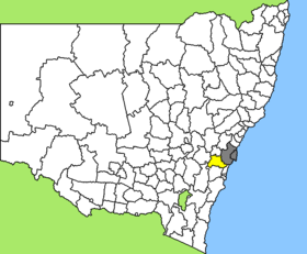
Lage des Wollondilly Shire in New South WalesGliederung Staat:  Australien
Bundesstaat:  New South Wales
Verwaltungssitz: Picton Daten und Zahlen Fläche: 2.557 km² Einwohner: 40.344 (2006) [1] Bevölkerungsdichte: 16 Einwohner je km² Wards: 3 -34.083333333333150.43333333333Koordinaten: 34° 5′ S, 150° 26′ OWollondilly Shire ist ein lokales Verwaltungsgebiet (LGA) im australischen Bundesstaat New South Wales. Das Gebiet ist 2.557 km² groß und hat etwa 40.000 Einwohner.
Wollondilly liegt in der Region um die Metropole Sydney etwa 80 km südwestlich des Stadtzentrums. Das Gebiet umfasst 41 Ortsteile und Ortschaften: Appin, Bargo, Bargo River, Belimbla Park, Brownlow Hill, Camden Park, Cataract Dam, Couridjah, Douglas Park, Glenmore, Lakesland, Linns Hill, Maldon, Menangle, Mowbray Park, Nattai, Nattai River, Oakdale, The Oaks, Orangeville, The Peaks, Pheasants Nest, Picton, Razorback, Scotts Hill, Silverdale, Tahmoor, Theresa Park, Thirlmere, Warragamba, Werombi, Werombi Road, Wilton, Yanderra und Yerranderie sowie Teile von Buxton, Camden South, Cawdor, Mount Hunter, Wallacia und Wallacia Heights. Der Sitz des Shire Councils befindet sich in der Ortschaft Picton im Osten der LGA, wo etwa 3.000 Einwohner leben.
Verwaltung
Der Wollondilly Shire Council hat neun Mitglieder, die von den Bewohnern der drei Wards gewählt werden (je drei aus North, East und Central Ward). Diese drei Bezirke sind unabhängig von den Ortschaften festgelegt. Aus dem Kreis der Councillor rekrutiert sich auch der Mayor (Bürgermeister) des Councils.
Weblinks
Einzelnachweise
- ↑ Australian Bureau of Statistics (25. Oktober 2007): Wollondilly (A) (Local Government Area) (Englisch). 2006 Census QuickStats. Abgerufen am 6. April 2010.
Kategorie:- Local Government Area in New South Wales

Wikimedia Foundation.