- Washington County (Iowa)
-
Verwaltung US-Bundesstaat: Iowa Verwaltungssitz: Washington Adresse des
Verwaltungssitzes:County Courthouse
P.O. Box 391
222 West Main Street
Washington, Iowa 52353Gründung: 18. Januar 1838 Gebildet aus: Henry County
Louisa County
Muscatine CountyVorwahl: 001 319 Demographie Einwohner: 21.704 (2010) Bevölkerungsdichte: 14,8 Einwohner/km² Geographie Fläche gesamt: 1.473 km² Wasserfläche: 5 km² Karte 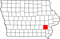
Website: co.washington.ia.us Das Washington County[1] ist ein County im Bundesstaat Iowa der Vereinigten Staaten von Amerika. Im Jahr 2010 hatte das County 21.704 Einwohner und eine Bevölkerungsdichte von 14,8 Einwohner pro Quadratkilometer. Der Verwaltungssitz (County Seat) ist Washington.
Inhaltsverzeichnis
Geografie
Das County liegt im Südosten von Iowa, ist im Osten etwa 45 km vom Mississippi River entfernt und hat eine Fläche von 1473 Quadratkilometern, wovon 5 Quadratkilometer Wasserfläche sind. Es grenzt im Uhrzeigersinn an folgende Countys: Iowa County, Johnson County, Louisa County, Henry County, Jefferson County und Keokuk County.
Geschichte
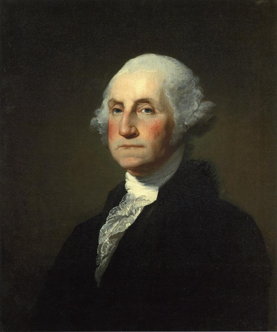
 George Washington
Washington County wurde am 18. Januar 1838 original als Slaughter County gebildet. Kurze Zeit später wurde in Washington County umbenannt, zu Ehren von George Washington.
Demografische Daten
Historische Einwohnerzahlen Census Einwohner ± in % 1840 1594 — 1850 4957 200 % 1860 14.235 200 % 1870 18.952 30 % 1880 20.374 8 % 1890 18.468 -9 % 1900 20.718 10 % 1910 19.925 -4 % 1920 20.421 2 % 1930 19.822 -3 % 1940 20.055 1 % 1950 19.557 -2 % 1960 19.406 -0,8 % 1970 18.967 -2 % 1980 20.141 6 % 1990 19.612 -3 % 2000 20.670 5 % 2010 21.704 5 % Vor 1900[2] Nach der Volkszählung im Jahr 2000 lebten im Washington County 20.670 Menschen in 8.056 Haushalten und 5.631 Familien. Die Bevölkerungsdichte betrug 14 Einwohner pro Quadratkilometer. Ethnisch betrachtet setzte sich die Bevölkerung zusammen aus 97,04 Prozent Weißen, 0,29 Prozent Afroamerikanern, 0,19 Prozent amerikanischen Ureinwohnern, 0,25 Prozent Asiaten, 0,03 Prozent Bewohnern aus dem pazifischen Inselraum und 1,51 Prozent aus anderen ethnischen Gruppen; 0,68 Prozent stammten von zwei oder mehr Ethnien ab. 2,73 Prozent der Bevölkerung waren spanischer oder lateinamerikanischer Abstammung, die verschiedenen der genannten Gruppen angehörten.
Von den 8.056 Haushalten hatten 31,4 Prozent Kinder und Jugendliche unter 18 Jahre, die bei ihnen lebten. 60,3 Prozent waren verheiratete, zusammenlebende Paare, 6,7 Prozent waren allein erziehende Mütter, 30,1 Prozent waren keine Familien, 26,4 Prozent waren Singlehaushalte und in 12,5 Prozent lebten Menschen im Alter von 65 Jahren oder darüber. Die Durchschnittshaushaltsgröße betrug 2,50 und die durchschnittliche Familiengröße lag bei 3,04 Personen.
Auf das gesamte County bezogen setzte sich die Bevölkerung zusammen aus 26,1 Prozent Einwohnern unter 18 Jahren, 7,0 Prozent zwischen 18 und 24 Jahren, 26,8 Prozent zwischen 25 und 44 Jahren, 22,3 Prozent zwischen 45 und 64 Jahren und 17,9 Prozent waren 65 Jahre oder darüber. Das Durchschnittsalter betrug 39 Jahre. Auf 100 weibliche kamen statistisch 93,0 männliche Personen. Auf 100 Frauen im Alter von 18 Jahren oder darüber kamen 90,1 Männer.
Das jährliche Durchschnittseinkommen eines Haushalts betrug 39.103 USD, das Durchschnittseinkommen der Familien betrug 45.636 USD. Männer hatten ein Durchschnittseinkommen von 29.592 USD, Frauen 22.818 USD. Das Pro-Kopf-Einkommen betrug 18.221 USD. 5,1 Prozent der Familien und 7,6 Prozent der Bevölkerung lebten unterhalb der Armutsgrenze. [5]
Städte und Gemeinden
- Ainsworth
- Brighton
- Coppock1
- Crawfordsville
- Daytonville
- East Pleasant Plain
- Germanville
- Grace Hill
- Haskins
- Joetown
- Kalona
- Pleasant Plain
- Richmond
- Riverside
- Washington
- Wellman
- West Chester
- Williamstown
- Wyman
1 - teilweise im Henry und im Jefferson County
Einzelnachweise
- ↑ GNIS-ID: 465280. Abgerufen am 22. Februar 2011 (englisch).
- ↑ U.S. Census Bureau - Census of Population and Housing. Abgerufen am 15. März 2011
- ↑ Auszug aus Census.gov Abgerufen am 16. Februar 2011
- ↑ United States Census 2010 Abgerufen am 7. März 2011
- ↑ Washington County, Iowa, Datenblatt mit den Ergebnissen der Volkszählung im Jahre 2000 bei factfinder.census.gov.
Weblinks
-
 Commons: Washington County, Iowa – Sammlung von Bildern, Videos und Audiodateien
 - Offizielle Webseite
- www.city-data.com

Liste der Countys in Iowa
Adair | Adams | Allamakee | Appanoose | Audubon | Benton | Black Hawk | Boone | Bremer | Buchanan | Buena Vista | Butler | Calhoun | Carroll | Cass | Cedar | Cerro Gordo | Cherokee | Chickasaw | Clarke | Clay | Clayton | Clinton | Crawford | Dallas | Davis | Decatur | Delaware | Des Moines | Dickinson | Dubuque | Emmet | Fayette | Floyd | Franklin | Fremont | Greene | Grundy | Guthrie | Hamilton | Hancock | Hardin | Harrison | Henry | Howard | Humboldt | Ida | Iowa | Jackson | Jasper | Jefferson | Johnson | Jones | Keokuk | Kossuth | Lee | Linn | Louisa | Lucas | Lyon | Madison | Mahaska | Marion | Marshall | Mills | Mitchell | Monona | Monroe | Montgomery | Muscatine | O'Brien | Osceola | Page | Palo Alto | Plymouth | Pocahontas | Polk | Pottawattamie | Poweshiek | Ringgold | Sac | Scott | Shelby | Sioux | Story | Tama | Taylor | Union | Van Buren | Wapello | Warren | Washington | Wayne | Webster | Winnebago | Winneshiek | Woodbury | Worth | Wright
Wikimedia Foundation.
Schlagen Sie auch in anderen Wörterbüchern nach:
Washington County, Iowa — Infobox U.S. County county = Washington County state = Iowa seallink = map size = 250 founded = 1838 seat = Washington largest city = area total sq mi = 571 area total km2 = 1478 area land sq mi = 569 area land km2 = 1473 area water sq mi = 2… … Wikipedia
National Register of Historic Places listings in Washington County, Iowa — Location of Washington County in Iowa This is a list of the National Register of Historic Places listings in Washington County, Iowa. This is intended to be a complete list of the properties and districts on the National Register of Historic… … Wikipedia
Washington Township, Iowa — Washington Township is the name of forty nine townships in Iowa:* Washington Township, Adair County, Iowa * Washington Township, Adams County, Iowa * Washington Township, Appanoose County, Iowa * Washington Township, Black Hawk County, Iowa *… … Wikipedia
Washington County Sheriff's Office — could refer to several sheriffs departments in the United States including:*Washington County, Alabama Sheriff s Office *Washington County, Arkansas Sheriff s Department *Washington County, Colorado Sheriff s Office *Washington County, Florida… … Wikipedia
Washington County — heißen: Washington County (Alabama) Washington County (Arkansas) Washington County (Colorado) Washington County (Florida) Washington County (Georgia) Washington County (Idaho) Washington County (Illinois) Washington County (Indiana) Washington… … Deutsch Wikipedia
Iowa County (Iowa) — Iowa County Courthouse in Marengo, gelistet im NRHP Nr. 81000247[1] Verwaltung … Deutsch Wikipedia
Washington County — See also: List of counties in Washington for counties in the state of Washington. Washington County is the name of 30 counties and one parish in the United States of America: Contents 1 Extant counties 2 Extinct counties 3 Other … Wikipedia
Iowa County, Iowa — Infobox U.S. County county = Iowa County state = Iowa seallink = map size = 250 founded = 1843 seat = Marengo largest city = area total sq mi = 587 area total km2 = 1521 area land sq mi = 586 area land km2 = 1519 area water sq mi = 1 area water… … Wikipedia
Washington County Courthouse — bezeichnet mehrere gleichnamige, im NRHP gelistete, Objekte: Washington County Courthouse (Alabama), ID Nr. 97000655 Washington County Courthouse (Arkansas), ID Nr. 72000212 Washington County Courthouse (Georgia), ID Nr. 80001260 Washington… … Deutsch Wikipedia
Washington County Courthouse — may refer to one of these United States courthouses:* Washington County Courthouse (Alabama) * Washington County Courthouse (Arkansas) * Washington County Courthouse (Florida) * Washington County Courthouse (Georgia) * Washington County… … Wikipedia
Washington County (Iowa)

18+
© Academic, 2000-2024
- Kontaktieren Sie uns: Unterstützung, Werbung
Wörterbücher Export, schritte mit PHP, Joomla, Drupal, WordPress, MODx.