Washakie County (Wyoming)
- Washakie County (Wyoming)
-
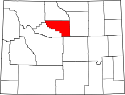
Washakie County ist ein County im US-Bundesstaat Wyoming. Der Sitz der Countyverwaltung (County Seat) ist in Worland.
Geschichte
Das County wurde im Jahre 1911 gegründet.
Geografie
Das County hat eine Fläche von 5.809 km² (2.243 mi²), davon sind 7 km² (3 mi²) Wasserflächen.
Demografie
Am 1. Juli 2005 hatte Washakie County 7.933 Einwohner.
Altersstruktur
- unter 18 Jahre = 27,20 %
- von 18-24 Jahre = 6,49 %
- von 25-44 Jahre = 25,20 %
- von 45-64 Jahre = 25,30 %
- über 65 Jahre = 15,90 %
Das durchschnittliche Alter beträgt 39 Jahre.
Angrenzende Countys
Städte und Orte
- Worland
- West River
- Winchester
Wikimedia Foundation.
Schlagen Sie auch in anderen Wörterbüchern nach:
Washakie County, Wyoming — Infobox U.S. County county = Washakie County state = Wyoming map size = 250 founded = 1911 seat = Worland | area total sq mi =2243 area water sq mi =3 area percentage = 0.12% census yr = 2000 pop = 8289 density km2 =1 web = www.washakiecounty.net … Wikipedia
National Register of Historic Places listings in Washakie County, Wyoming — Location of Washakie County in Wyoming This is a list of the National Register of Historic Places listings in Washakie County, Wyoming. It is intended to be a complete list of the properties and districts on the National Register of Historic… … Wikipedia
Washakie Ten, Wyoming — Infobox Settlement official name = Washakie Ten, Wyoming settlement type = CDP nickname = motto = imagesize = image caption = image |pushpin pushpin label position =left pushpin map caption =Location within the state of Wyoming pushpin mapsize =… … Wikipedia
Washakie County — Verwaltung US Bundesstaat: Wyoming Verwaltungssitz: Worland Gründung: 1911 Demographie Einwohner: 7933 (1. Juli 2005) … Deutsch Wikipedia
Fremont County, Wyoming — Infobox U.S. County county = Fremont County state = Wyoming map size = 250 founded = 1884 seat = Lander | area total sq mi =9266 area water sq mi =84 area percentage = 0.90% census yr = 2000 pop = 35804 density km2 =2 web =… … Wikipedia
Big Horn County, Wyoming — Infobox U.S. County county = Big Horn County state = Wyoming map size = 250 founded = 1896 seat = Basin | area total sq mi =3159 area water sq mi =22 area percentage = 0.70% census yr = 2000 pop = 11461 density km2 =1 web =… … Wikipedia
Hot Springs County, Wyoming — Infobox U.S. County county = Hot Springs County state = Wyoming map size = 225 founded = 1911 seat = Thermopolis | area total sq mi =2006 area land sq mi =2004 area water sq mi =2 area percentage = 0.31% census yr = 2000 pop = 4882 density km2 =1 … Wikipedia
Fremont County (Wyoming) — Verwaltung US Bundesstaat: Wyoming Verwaltungssitz: Lander Gründung: 1884 Demographie Einwohner: 36.491 � … Deutsch Wikipedia
Natrona County, Wyoming — For other uses, see Natrona (disambiguation). Natrona County, Wyoming Location in the state of Wyoming … Wikipedia
Goshen County (Wyoming) — Verwaltung US Bundesstaat: Wyoming Verwaltungssitz: Torrington Adresse des Verwaltungssitzes: Gründung … Deutsch Wikipedia