- Warwick (Rhode Island)
-
Warwick 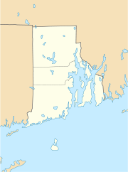

Warwick Lage in Rhode IslandBasisdaten Gründung: 1642 Staat: Vereinigte Staaten Bundesstaat: Rhode Island County: Koordinaten: 41° 42′ N, 71° 25′ W41.699297222222-71.41529722222211Koordinaten: 41° 42′ N, 71° 25′ W Zeitzone: Eastern Standard Time (UTC−5) Einwohner: 87.233 (Stand: 2005) Bevölkerungsdichte: 948,8 Einwohner je km² Fläche: 128,52 km² (ca. 50 mi²)
davon 91,94 km² (ca. 35 mi²) LandHöhe: 11 m Postleitzahlen: 02886-02889 Vorwahl: +1 401 FIPS: 44-74300 GNIS-ID: 1220018 Webpräsenz: www.warwickri.gov Bürgermeister: Scott Avedisian Die Stadt Warwick ist mit rund 85.000 Einwohnern die zweitgrößte Stadt im US-Bundesstaat Rhode Island. Sie verfügt mit dem T. F. Green Airport über einen zentral gelegenen Flughafen.
Warwick liegt südlich der Stadt Providence.
Geschichte
Die Stadt wurde 1642 von Samuel Gorton gegründet. Er wählte den Namen nach Sir Robert Rich, dem zweiten Earl of Warwick.
In den Jahren zwischen 1675 und 1676 während des King Philip's War wurde Warwick stark geschwächt. Auch wurde in Warwick der erste Schuss der Amerikanische Unabhängigkeitsbewegung abgefeuert: am 9. Juni 1772 auf das britische Kriegsschiff HMS Gaspée.
Aus Warwick stammen zudem die Generäle Nathaniel Greene aus der Amerikanischen Unabhängigkeitsbewegung und George S. Greene aus dem Sezessionskrieg.
Söhne und Töchter der Stadt
- Dave Capuano, Eishockeyspieler
- Tom Cavanagh, Eishockeyspieler
- Lincoln Chafee, Politiker und US-Senator
- Ray Greene, US-Senator
- William Greene, Politiker und während des Unabhängigkeitskrieges Oberkommandierender des Militärs von Rhode Island und späterer Gouverneur
- Walter Mossberg, Journalist, bekannt durch seine Kolumnen im Wall Street Journal
- William Sheldon, Mediziner und Psychologe
- Ken Vandermark, Jazzsaxofonist und Klarinettist
- Jason Hawes und Grant Wilson, Gründer von TAPS
Weblinks
Kategorien:- Ort in Rhode Island
- Kent County (Rhode Island)

Wikimedia Foundation.