Walgett Shire

Walgett Shire
Shire of Walgett
Australia-Map-NSW-LGA-MoreePlains.png
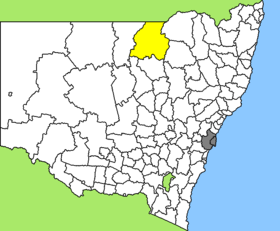
Lage des Walgett Shire in New South Wales
Gliederung
Staat: Australien Australien
Bundesstaat: Flag of New South Wales.svg New South Wales
Verwaltungssitz: Walgett
Daten und Zahlen
Fläche: 22.336 km²
Einwohner: 6.944 (2006) [1]
Bevölkerungsdichte: 0,3 Einwohner je km²
-29.833333333333148.2

Walgett Shire ist ein lokales Verwaltungsgebiet (LGA) im australischen Bundesstaat New South Wales. Das Gebiet ist 22.336 km² groß und hat etwa 7.000 Einwohner.

Walgett liegt in der North-Western-Region des Staates an der Grenze zu Queensland etwa 650 km nordwestlich der Metropole Sydney und 690 km südwestlich von Brisbane. Das Gebiet umfasst 62 Ortsteile und Ortschaften, darunter Bairnkine, Caramia, Carinda, Come By Chance, Cumborah, Cryon, Lightning Ridge, Pokataroo und Walgett sowie Teile von Burren Junction, Collarenebri, Pilliga und Rowena. Der Sitz des Shire Councils befindet sich in der Ortschaft Walgett im Zentrum der LGA, wo etwa 1.700 Einwohner leben.

Verwaltung

Der Walgett Shire Council hat 12 Mitglieder, die von den Bewohnern der LGA gewählt werden. Walgett ist nicht in Bezirke untergliedert. Aus dem Kreis der Councillor rekrutiert sich auch der Mayor (Bürgermeister) des Councils.

Nach Konflikten zwischen den Vertretern der Stadt Lightning Ridge und dem Rest des Shires und weiteren Vorfällen war der Council nicht mehr arbeitsfähig und wurde deshalb 2004 von der Staatsregierung aufgelöst. Bis zu Neuwahlen im September 2008 wird Walgett von einem eingesetzten Administrator und vier Managern verwaltet.

Weblinks

Einzelnachweise

  1. Australian Bureau of Statistics (25. Oktober 2007): Walgett (A) (Local Government Area) (Englisch). 2006 Census QuickStats. Abgerufen am 6. April 2010.

Wikimedia Foundation.

Игры ⚽ Поможем написать реферат

Schlagen Sie auch in anderen Wörterbüchern nach:

  • Walgett Shire Council — Infobox Australian Place | type = lga name = Walgett Shire state = nsw caption = Location in New South Wales pop = 8,279 density = 0.37 area = 22336 est = seat = Walgett (77 Fox Street) mayor = region = Orana url = http://www.walgett.nsw.gov.au… …   Wikipedia

  • Walgett — Staat: Australien Bundesstaat …   Deutsch Wikipedia

  • Walgett, New South Wales — Infobox Australian Place | type = town name = Walgett state = nsw caption = Main street, Walgett, NSW lga = Walgett Shire Council county = Baradine postcode = 2832 est = pop = 1,735 elevation= 133 maxtemp = 26.9 mintemp = 12.5 rainfall = 475.6… …   Wikipedia

  • Walgett — /ˈwɒlgət/ (say wolguht) noun a town and shire in northern NSW, near the junction of the Barwon and Namoi rivers; transport centre for the surrounding pastoral area. {Australian Aboriginal; Ngiyampaa: hawk} …  

  • Wakool Shire — Shire of Wakool New South Wales Location in New South Wales Population: 4,427(2009) …   Wikipedia

  • Moree Plains Shire — New South Wales Location in New South Wales Population …   Wikipedia

  • Narrabri Shire — New South Wales Population: 13,693(2009) …   Wikipedia

  • Coonamble Shire — New South Wales Location in New South Wales Population …   Wikipedia

  • Moree Plains Shire Council — Infobox Australian Place | type = lga name = Moree Plains Shire state = nsw caption = Location in New South Wales pop = 15,680Census 2001 AUS|id=LGA15300|name=Moree Plains (A) (Local Government Area)|accessdate=2007 06 30] area = 17928 est = seat …   Wikipedia

  • Narrabri Shire Council — Infobox Australian Place | type = lga name = Narrabri Shire state = nsw caption = pop = 13,800 Census 2001 AUS|id=LGA15750|name=Narrabri (A) (Local Government Area)|accessdate=2007 06 30|quick=on] area = 13031 est = seat = Narrabri (46 48… …   Wikipedia

Share the article and excerpts

Direct link
Do a right-click on the link above
and select “Copy Link”