- Wakulla County
-
Verwaltung US-Bundesstaat: Florida Verwaltungssitz: Crawfordville Adresse des
Verwaltungssitzes:County Courthouse
P.O. Box 1263
Crawfordville, FL 32326-1263Gründung: 11. März 1843 Gebildet aus: Leon County Vorwahl: 001 850 Demographie Einwohner: 22.863 (2000) Bevölkerungsdichte: 12,6 Einwohner/km² Geographie Fläche gesamt: 1.906 km² Wasserfläche: 93 km² Karte 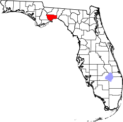
Website: www.wakullacounty.org Das Wakulla County[1] ist ein County im Bundesstaat Florida der Vereinigten Staaten von Amerika. Der Verwaltungssitz (County Seat) ist Crawfordville.
Inhaltsverzeichnis
Geschichte
Das Wakulla County wurde am 11. März 1843 aus Teilen des Leon County gebildet. Benannt wurde es wahrscheinlich nach einem Wort der Timucua-Indianer und bedeutet so viel wie „geheimnisvolles Wasser“.
Teile des 1936 ausgewiesenen Nationalforstes Apalachicola National Forest erstrecken sich im County.
Geografie & Sehenswürdigkeiten
Das County hat eine Fläche von 1.906 Quadratkilometern, wovon 334 Quadratkilometer Wasserfläche sind. Es grenzt im Uhrzeigersinn an folgende Countys: Franklin County, Liberty County, Gadsden County, Leon County und Jefferson County.
Die bekannteste Attraktion des Countys sind die Wakulla Springs, eine der größten Süßwasserquellen der Welt.
Demografische Daten
Historische Einwohnerzahlen Census Einwohner ± in % 1850 1955 — 1860 2839 50 % 1870 2506 -10 % 1880 2723 9 % 1890 3117 10 % 1900 5149 70 % 1910 4802 -7 % 1920 5129 7 % 1930 5468 7 % 1940 5463 -0,09 % 1950 5258 -4 % 1960 5257 -0,02 % 1970 6308 20 % 1980 10.887 70 % 1990 14.202 30 % 2000 22.863 60 % Vor 1900[2] 1900–1990[3]
Nach der Volkszählung im Jahr 2000 lebten im Wakulla County 22.863 Menschen in 8.450 Haushalten und 6.236 Familien. Die Bevölkerungsdichte betrug 15 Einwohner pro Quadratkilometer. Ethnisch betrachtet setzte sich die Bevölkerung zusammen aus 86,10 Prozent Weißen, 11,51 Prozent Afroamerikanern, 0,59 Prozent amerikanischen Ureinwohnern, 0,25 Prozent Asiaten, 0,03 Prozent Bewohnern aus dem pazifischen Inselraum und 0,29 Prozent aus anderen ethnischen Gruppen; 1,23 Prozent stammten von zwei oder mehr Ethnien ab. 1,94 Prozent der Gesamtbevölkerung waren spanischer oder lateinamerikanischer Abstammung.
 Alterspyramide für das Wakulla County
Von den 8.450 Haushalten hatten 35,6 Prozent Kinder und Jugendliche unter 19 Jahre, die bei ihnen lebten. 57,1 Prozent waren verheiratete, zusammenlebende Paare, 12,4 Prozent waren allein erziehende Mütter und 26,2 Prozent waren keine Familien. 22,0 Prozent waren Singlehaushalte und in 7,0 Prozent lebten Menschen im Alter von 65 Jahren oder darüber. Die Durchschnittshaushaltsgröße betrug 2,57 und die durchschnittliche Familiengröße betrug 2,99 Personen.
25,6 Prozent der Bevölkerung waren unter 18 Jahre alt, 7,6 Prozent zwischen 18 und 24, 31,7 Prozent zwischen 25 und 44, 24,7 Prozent zwischen 45 und 64 und 10,3 Prozent der Bevölkerung war 65 Jahre oder älter. Das Durchschnittsalter betrug 37 Jahre. Auf 100 weibliche Personen kamen statistisch 107,3 männliche Personen und auf 100 Frauen im Alter von 18 Jahren oder darüber kamen 106,8 Männer.
Das jährliche Durchschnittseinkommen eines Haushalts betrug 37.149 USD, das Durchschnittseinkommen der Familien 42.222 USD. Männer hatten ein Durchschnittseinkommen von 29.845 USD, Frauen 24.330 USD. Das Prokopfeinkommen betrug 17.678 USD. 9,3 Prozent der Familien und 11,3 Prozent der Bevölkerung lebten unterhalb der Armutsgrenze.[4]
Die wichtigsten Städte
- Crawfordville
- Sopchoppy
- St. Marks
Einzelnachweise
- ↑ GNIS-ID: 306912. Abgerufen am 22. Februar 2011 (englisch).
- ↑ U.S. Census Bureau - Census of Population and Housing. Abgerufen am 15. März 2011
- ↑ Auszug aus Census.gov. Abgerufen am 14. Februar 2011
- ↑ Walkulla County, Florida, Datenblatt mit den Ergebnissen der Volkszählung im Jahre 2000 bei factfinder.census.gov.
Weblinks
 Commons: Wakulla County, Florida – Sammlung von Bildern, Videos und Audiodateien
Liste der Countys in Florida
Alachua | Baker | Bay | Bradford | Brevard | Broward | Calhoun | Charlotte | Citrus | Clay | Collier | Columbia | De Soto | Dixie | Duval | Escambia | Flagler | Franklin | Gadsden | Gilchrist | Glades | Gulf | Hamilton | Hardee | Hendry | Hernando | Highlands | Hillsborough | Holmes | Indian River | Jackson | Jefferson | Lafayette | Lake | Lee | Leon | Levy | Liberty | Madison | Manatee | Marion | Martin | Miami-Dade | Monroe | Nassau | Okaloosa | Okeechobee | Orange | Osceola | Palm Beach | Pasco | Pinellas | Polk | Putnam | Santa Rosa | Sarasota | Seminole | St. Johns | St. Lucie | Sumter | Suwannee | Taylor | Union | Volusia | Wakulla | Walton | Washington
Wikimedia Foundation.
Schlagen Sie auch in anderen Wörterbüchern nach:
Wakulla County — Admin ASC 2 Code Orig. name Wakulla County Country and Admin Code US.FL.129 US … World countries Adminstrative division ASC I-II
County Road 372 (Wakulla County, Florida) — County Road 372 is a county highway in southern Wakulla County, Florida. It was formerly State Road 372.It runs from U.S. Route 319 near Sopchoppy with U.S. Route 98 in Ochlockonee Bay, and continues through Mash Island ending at Mashes Sands… … Wikipedia
County Road 372B (Wakulla County, Florida) — County Road 372B is a county highway in Wakulla County, Florida, running from US 98 in Panacea to a boat ramp on Levy Bay. It is a former minor state route, and was known as State Road 372B.County Road 372B does not connect to its nominal parent … Wikipedia
County Road 372A (Wakulla County, Florida) — County Road 372A is a county highway consisting of two separate sections in southern Wakulla County, Florida. It was formerly State Road 372A.The first section is known as Bottoms Road, and runs southeast from U.S. Route 98 north of Panacea to a… … Wikipedia
Wakulla County, Florida — Infobox U.S. County county = Wakulla County state = Florida founded = 11 March 1843 seat = Crawfordville | area total sq mi =736 area water sq mi =36 area percentage = 17.54% census yr = 2000 pops = 22,863 density km2 =15 web =… … Wikipedia
County Road 368 (Wakulla County, Florida) — State Road 368 is a former state route, now a county highway in Wakulla County, Florida, running west from Crawfordville. It is former secondary state road, formerly known as State Road 368.There are two segments to the route; the eastern segment … Wikipedia
List of county roads in Wakulla County, Florida — The following is a list of county roads in Wakulla County, Florida. All county roads are maintained by the county in which they reside. This transport related list is incomplete; you can help by expanding it. County routes in Wakulla County #… … Wikipedia
National Register of Historic Places listings in Wakulla County, Florida — Location of Wakulla County in Florida This is a list of the National Register of Historic Places listings in Wakulla County, Florida. This is intended to be a complete list of the properties and districts on the National Register of Historic… … Wikipedia
Old Wakulla County Courthouse — U.S. National Register of Historic Places … Wikipedia
Newport, Wakulla County, Florida — Newport, Florida Coordinates … Wikipedia
Wakulla County


18+
© Academic, 2000-2024
- Kontaktieren Sie uns: Unterstützung, Werbung
Wörterbücher Export, schritte mit PHP, Joomla, Drupal, WordPress, MODx.