Vaindloo

Vaindloo

Vorlage:Infobox Insel/Wartung/Bild fehltVorlage:Infobox Insel/Wartung/Fläche fehltVorlage:Infobox Insel/Wartung/Höhe fehlt

Vaindloo
Gewässer Finnischer Meerbusen
Geographische Lage 59° 49′ 6″ N, 26° 21′ 48″ O59.81833333333326.363333333333Koordinaten: 59° 49′ 6″ N, 26° 21′ 48″ O
Vaindloo (Estland)
Vaindloo
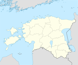
Länge 600 m
Breite 200 m

Vaindloo (deutsch und schwedisch Steenskär) ist eine estnische Ostsee-Insel im Finnischen Meerbusen. Sie gehört verwaltungsmäßig zum Dorf Vainupea in der Landgemeinde Vihula im Kreis Lääne-Viru.

Vaindloo ist Estlands nördlichste Insel. Sie ist 600 m lang und 200 m breit. Bekannt ist Vaindloo wegen seines 17 hohen Leuchtturms; er wurde 1871 errichtet (Vorgängerbau aus Holz von 1718). Daneben befindet sich eine Station des estnischen Grenzschutzes mit einem 50 m hohen Beobachtungsturm und einem Radar auf der Insel.

Weblinks


Wikimedia Foundation.

Игры ⚽ Поможем сделать НИР

Schlagen Sie auch in anderen Wörterbüchern nach:

  • Vaindloo — (alternately: Vaindloo saar) is a small island located in the Gulf of Finland in the Baltic Sea, belonging to the country of Estonia. Its coordinates are coord|59|48|51|N|26|21|43|E|. [ [http://www.birdlife.org/datazone/sites/index.html?action=Sit… …   Wikipedia

  • Vaindloo — es una isla báltica de Estonia en el Golfo de Finlandia. Administrativamente pertenece al municipio rural de Vihula, en el condado de Lääne Viru. Las coordenadas de Vaindloo son: 59°49′″N 26°21′″E / <span class= geo dec geo title= Fotos,… …   Wikipedia Español

  • Вайндло — Vaindloo …   Википедия

  • Extreme points of Estonia — This is a list of the extreme points of Estonia: the points that are farther north, south, east or west than any other location. Estonia* North : Vaindloo (coord|59|49|17|N|26|21|31|E|type:landmark region:EE|name=Vaindloo (North)) * South :… …   Wikipedia

  • Liste der Inseln Estlands — Die Liste der Inseln Estlands gibt einen Überblick über zahlreiche kleine und große Inseln. Vor der estnischen Ostseeküste liegen 1520 Inseln, von denen aber nur 19 bewohnt sind.Die größte ist Saaremaa. Die größten Inseln Estlands… …   Deutsch Wikipedia

  • Viol — Gutsanlage von Vihula Vihula (deutsch: Viol) ist eine Landgemeinde im estnischen Kreis Lääne Viru mit einer Fläche von 364,91 km². Sie hat 2144 Einwohner (1. Januar 2006). Vihula wurde erstmals 1241 urkundlich erwähnt. 60% der Fläche gehören zum… …   Deutsch Wikipedia

  • Saaremaa — This article is about the island. For the village in Võru County, see Saaremaa, Võru County. Saaremaa …   Wikipedia

  • Hiiumaa — Tahkuna peninsula is the most northern part of Hiiumaa Geography …   Wikipedia

  • List of islands of Estonia — This is a list of islands of Estonia. There are 1521 islands. This is not a complete list. CompactTOC10|sections= A B C D E F G H I J K L M N O P Q R S Š Z Ž T U V W Õ Ä Ö Ü X YAAbruka Adralaid Aegna (Wulf) Ahelaid Aherahu (Atla) Aherahu Ahessäär …   Wikipedia

  • Vormsi — Estonia s fourth largest island, Vormsi (German: Worms, Swedish: Ormsö), is located between Hiiumaa and the mainland with a total area of 93 square kilometers. It is part of a rural municipality Vormsi Parish. From mainland, Vormsi is separated… …   Wikipedia

Share the article and excerpts

Direct link
Do a right-click on the link above
and select “Copy Link”