- Thomas County (Georgia)
-
Verwaltung US-Bundesstaat: Georgia Verwaltungssitz: Thomasville Adresse des
Verwaltungssitzes:Thomas County Administration
P.O. Box 920
Thomasville, Georgia, 31799-0920Gründung: 23. Dezember 1825 Gebildet aus: Decatur County
Irwin CountyVorwahl: 001 229 Demographie Einwohner: 42.737 (2000) Bevölkerungsdichte: 30,1 Einwohner/km² Geographie Fläche gesamt: 1.430 km² Wasserfläche: 10 km² Karte 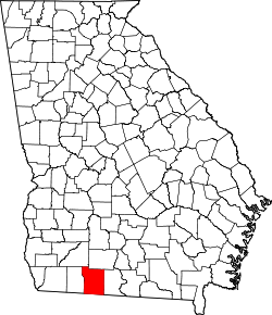
Website: www.thomascountyboc.org Das Thomas County[2] ist ein County im Bundesstaat Georgia der Vereinigten Staaten von Amerika. Der Verwaltungssitz (County Seat) ist Thomasville. Bei der Volkszählung im Jahr 2000 hatte das County 42.737 Einwohner und eine Bevölkerungsdichte von 30 Einwohner pro Quadratkilometer.
Inhaltsverzeichnis
Geografie
Das County liegt im Süden von Georgia, an der Nordgrenze von Florida und hat eine Fläche von 1430 Quadratkilometern, wovon 10 Quadratkilometer Wasserfläche sind und grenzt im Uhrzeigersinn an folgende Countys: Colquitt County, Brooks County, Grady County und Mitchell County.
Geschichte
Thomas County wurde am 23. Dezember 1825 als 63. County in Georgia aus Teilen des Decatur County und des Irwin County gebildet. Benannt wurde es, ebenso wie Thomasville, nach General Jett Thomas, einem Helden des Indianerkrieges von 1812. Er erbaute auch das erste Universitätsgebäude in Athens.
Demografische Daten
Historische Einwohnerzahlen Census Einwohner ± in % 1830 3299 — 1840 6766 100 % 1850 10.103 50 % 1860 10.765 7 % 1870 14.523 30 % 1880 20.597 40 % 1890 26.154 30 % 1900 31.076 20 % 1910 29.071 -6 % 1920 33.044 10 % 1930 32.612 -1 % 1940 31.289 -4 % 1950 33.932 8 % 1960 34.319 1 % 1970 34.515 0,6 % 1980 38.098 10 % 1990 38.986 2 % 2000 42.737 10 % Vor 1900[3]  Alterspyramide für das Thomas County
Nach der Volkszählung im Jahr 2000 lebten im Thomas County 42.737 Menschen in 16.309 Haushalten und 11.465 Familien. Die Bevölkerungsdichte betrug 30 Einwohner pro Quadratkilometer. Ethnisch betrachtet setzte sich die Bevölkerung zusammen aus 58,98 Prozent Weißen, 38,86 Prozent Afroamerikanern, 0,29 Prozent amerikanischen Ureinwohnern, 0,41 Prozent Asiaten, 0,06 Prozent Bewohnern aus dem pazifischen Inselraum und 0,54 Prozent Angehörigen anderer ethnischer Gruppen. 0,85 Prozent stammten von zwei oder mehr Ethnien ab. 1,72 Prozent der Bevölkerung waren spanischer oder lateinamerikanischer Abstammung.
Von den 16.309 Haushalten hatten 32,7 Prozent Kinder und Jugendliche unter 18 Jahren, die bei ihnen lebten. 47,9 Prozent waren verheiratete, zusammenlebende Paare, 18,4 Prozent waren allein erziehende Mütter und 29,7 Prozent waren keine Familien. 25,8 Prozent waren Singlehaushalte und in 10,6 Prozent lebten Menschen im Alter von 65 Jahren oder darüber. Die Durchschnittshaushaltsgröße betrug 2,55 und die durchschnittliche Familiengröße betrug 3,06 Personen.
27,1 Prozent der Bevölkerung waren unter 18 Jahre alt, 8,1 Prozent zwischen 18 und 24, 28,2 Prozent zwischen 25 und 44, 22,9 Prozent zwischen 45 und 64 und 13,7 Prozent waren 65 Jahre oder älter. Das Durchschnittsalter betrug 36 Jahre. Auf 100 weibliche Personen kamen statistisch 88,9 männliche Personen und auf 100 Frauen im Alter von 18 Jahren oder darüber kamen 84,8 Männer.
Das jährliche Durchschnittseinkommen eines Haushalts betrug 31.115 USD, das Durchschnittseinkommen der Familien 39.239 USD. Männer hatten ein Durchschnittseinkommen von 28.395 USD, Frauen 21.344 USD. Das Prokopfeinkommen betrug 16.211 USD. 13,6 Prozent der Familien und 17,4 Prozent der Bevölkerung lebten unterhalb der Armutsgrenze. [6]
Siehe auch
Einzelnachweise
- ↑ Auszug aus dem National Register of Historic Places. Abgerufen am 13. März 2011
- ↑ GNIS-ID: 343835. Abgerufen am 22. Februar 2011 (englisch).
- ↑ U.S. Census Bureau - Census of Population and Housing. Abgerufen am 15. März 2011
- ↑ Auszug aus Census.gov. Abgerufen am 28. Februar 2011
- ↑ Auszug aus factfinder.census.gov Abgerufen am 28. Februar 2011
- ↑ Thomas County, Georgia, Datenblatt mit den Ergebnissen der Volkszählung im Jahre 2000 bei factfinder.census.gov.
Weblinks
- georgia.gov, dort unter „Local Information | Counties“ (englisch)

Liste der Countys in Georgia
Appling | Atkinson | Bacon | Baker | Baldwin | Banks | Barrow | Bartow | Ben Hill | Berrien | Bibb | Bleckley | Brantley | Brooks | Bryan | Bulloch | Burke | Butts | Calhoun | Camden | Candler | Carroll | Catoosa | Charlton | Chatham | Chattahoochee | Chattooga | Cherokee | Clarke | Clay | Clayton | Clinch | Cobb | Coffee | Colquitt | Columbia | Cook | Coweta | Crawford | Crisp | Dade | Dawson | Decatur | DeKalb | Dodge | Dooly | Dougherty | Douglas | Early | Echols | Effingham | Elbert | Emanuel | Evans | Fannin | Fayette | Floyd | Forsyth | Franklin | Fulton | Gilmer | Glascock | Glynn | Gordon | Grady | Greene | Gwinnett | Habersham | Hall | Hancock | Haralson | Harris | Hart | Heard | Henry | Houston | Irwin | Jackson | Jasper | Jeff Davis | Jefferson | Jenkins | Johnson | Jones | Lamar | Lanier | Laurens | Lee | Liberty | Lincoln | Long | Lowndes | Lumpkin | Macon | Madison | Marion | McDuffie | McIntosh | Meriwether | Miller | Mitchell | Monroe | Montgomery | Morgan | Murray | Muscogee | Newton | Oconee | Oglethorpe | Paulding | Peach | Pickens | Pierce | Pike | Polk | Pulaski | Putnam | Quitman | Rabun | Randolph | Richmond | Rockdale | Schley | Screven | Seminole | Spalding | Stephens | Stewart | Sumter | Talbot | Taliaferro | Tattnall | Taylor | Telfair | Terrell | Thomas | Tift | Toombs | Towns | Treutlen | Troup | Turner | Twiggs | Union | Upson | Walker | Walton | Ware | Warren | Washington | Wayne | Webster | Wheeler | White | Whitfield | Wilcox | Wilkes | Wilkinson | Worth
Wikimedia Foundation.
Schlagen Sie auch in anderen Wörterbüchern nach:
Thomas County, Georgia — Infobox U.S. County county = Thomas County state = Georgia seallink = map size = 225 founded year = 1825 founded date = December 24 seat = Thomasville largest city = Thomasville area total sq mi = 552 area total km2 = 1430 area land sq mi = 548… … Wikipedia
National Register of Historic Places listings in Thomas County, Georgia — This is a list of properties and districts in Thomas County, Georgia that are listed on the National Register of Historic Places (NRHP). Map of all coordinates from Google Map of all coordinates from Bing … Wikipedia
Thomas County Central High School — Address 4686 US Hwy 84 Bypass Thomasville, Georgia, Thomas, 31792 United States Coordinates … Wikipedia
Thomas County — is the name of several counties in the United States:* Thomas County, Georgia * Thomas County, Kansas * Thomas County, Nebraska … Wikipedia
Thomas County Courthouse — Infobox nrhp | name =Thomas County Courthouse nrhp type = caption = location= Thomasville, Georgia lat degrees = 30 lat minutes = 50 lat seconds = 20 lat direction = N long degrees = 83 long minutes = 58 long seconds = 55 long direction = W… … Wikipedia
Thomas County — Es gibt in den Vereinigten Staaten drei Countys mit dem Namen Thomas County: Thomas County (Georgia) Thomas County (Kansas) Thomas County (Nebraska) Diese Seite ist eine Begriffsklärung … Deutsch Wikipedia
Thomas County Courthouse — bezeichnet mehrere gleichnamige, im NRHP gelistete, Objekte: Thomas County Courthouse (Georgia), ID Nr. 70000224 Thomas County Courthouse (Kansas), ID Nr. 76000842 Thomas County Courthouse (Nebraska), ID Nr. 90000971 Diese Seite ist eine … Deutsch Wikipedia
Brooks County, Georgia — Infobox U.S. County county = Brooks County state = Georgia map size = 225 seallink = founded = 1858 seat = Quitman largest city = Quitman area total sq mi = 498 area total km2 = 1289 area land sq mi = 494 area land km2 = 1278 area water sq mi = 4 … Wikipedia
Grady County, Georgia — Infobox U.S. County county = Grady County state = Georgia seallink = map size = 225 founded = August 17,1905 seat = Cairo largest city = Cairo area total sq mi = 460 area total km2 = 1192 area land sq mi = 458 area land km2 = 1187 area water sq… … Wikipedia
Henry County (Georgia) — County Courthouse in McDonough, gelistet im NRHP Nr. 80001092[1] Verwaltung US Bundesstaat … Deutsch Wikipedia
Thomas County (Georgia)


18+
© Academic, 2000-2024
- Kontaktieren Sie uns: Unterstützung, Werbung
Wörterbücher Export, schritte mit PHP, Joomla, Drupal, WordPress, MODx.