South County (Rhode Island)
- South County (Rhode Island)
-
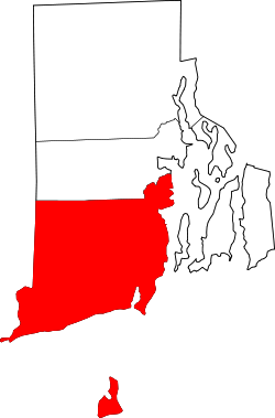
Washington County ist ein County im US-Bundesstaat Rhode Island. Im Jahr 2000 hatte das County 123.546 Einwohner und eine Bevölkerungsdichte von 143 Einwohner / km². Der Sitz der Countyverwaltung (County Seat) ist in West Kingston.
Geografie
Das County hat eine Fläche von 1458 km², wovon 596 km² Wasserfläche ist. Es grenzt im Norden an Kent County und im Westen an New London County.
Geschichte
Washington County wurde 1729 als Kings County aus Teilen von Providence County gebildet und 1781 nach Washington County umbenannt. Washington County ist ebenfalls als South County bekannt.
Bevölkerungsentwicklung
| 1980 |
1990 |
2000 |
2005 |
| 93.183 |
110.006 |
123.546 |
128.463 |
Städte und Gemeinden
Wikimedia Foundation.
Schlagen Sie auch in anderen Wörterbüchern nach:
South County (Rhode Island) — South County is a common vernacular name for Washington County, Rhode Island. It should be noted that in popular usage, the term South County can also can also include nearby towns such as West Greenwich [ [http://www.cshell.com/aboutsc.html]… … Wikipedia
South Kingstown, Rhode Island — Infobox Settlement official name = South Kingstown, Rhode Island settlement type = Town nickname = motto = imagesize = image caption = image mapsize = 250px map caption = Location of South Kingstown in Rhode Island mapsize1 = map caption1 =… … Wikipedia
Washington County, Rhode Island — Infobox U.S. County county = Washington County state = Rhode Island map size = 125 founded = 1729 seat = N/A| area total sq mi =563 area land sq mi =333 area water sq mi =230 area percentage = 40.87% census yr = 2000 pop = 123546 density km2 =143 … Wikipedia
Newport County, Rhode Island — Location in the state of Rhode Island … Wikipedia
Washington County (Rhode Island) — Verwaltung US Bundesstaat: Rhode Island Verwaltungssitz: West Kingston Gründung: 1729 Demographie Einwohner: 123.546 (2000) … Deutsch Wikipedia
Providence County, Rhode Island — Infobox U.S. County county = Providence County state = Rhode Island map size = 150 founded = 1729 seat = N/A | area total sq mi =436 area land sq mi =413 area water sq mi =23 area percentage = 5.18% census yr = 2000 pop = 621602 density km2 =581… … Wikipedia
Bristol County, Rhode Island — Infobox U.S. County county = Bristol County state = Rhode Island map size = 150 founded = 1747 seat = N/A largest city = Bristol area total sq mi =45 area land sq mi =25 area water sq mi =20 area percentage = 44.80% census yr = 2000 pop = 50648… … Wikipedia
Kent County, Rhode Island — Infobox U.S. County county = Kent County state = Rhode Island map size = 175 founded = seat = | area total sq mi =188 area land sq mi =170 area water sq mi =18 area percentage = 9.53% census yr = 2000 pop = 167090 density km2 =379 web = |Kent… … Wikipedia
National Register of Historic Places listings in Washington County, Rhode Island — Location of Washington County in Rhode Island This is a list of the National Register of Historic Places listings in Washington County, Rhode Island. This is intended to be a complete list of the properties and districts on the National Register… … Wikipedia
National Register of Historic Places listings in Newport County, Rhode Island — Location of Newport County in Rhode Island This is a list of the National Register of Historic Places listings in Newport County, Rhode Island. This is intended to be a complete list of the properties and districts on the National Register of… … Wikipedia