Solway Firth

Solway Firth
Der Solway Firth

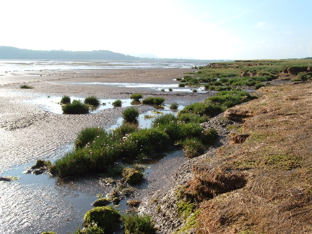
Der Solway Firth ist der Meeresarm, der das nordwestlichste County in England (Cumbria) vom südwestlichsten Schottlands (Dumfries and Galloway) trennt. Er erstreckt sich von St. Bees Head direkt südlich von Whitehaven in Cumbria bis zum Mull of Galloway am westlichen Ende von Dumfries und Galloway. Westlich des Firth liegt die Irische See.

Die Küstenlinie wird charakterisiert durch flache Hügel. Auf weite Strecken wird sie häufig als eine der schönsten Küsten der britischen Inseln angesehen. Die Gegend ist hauptsächlich ländlich geprägt. In der regionalen Wirtschaft spielen die Fischerei und die Landwirtschaft immer noch die wesentliche Rolle, obwohl der Tourismus eine wachsende Bedeutung erlangt.

Das Gewässer selbst ist normalerweise harmlos, man hat hier keine größeren Gefahren zu erwarten, mit Ausnahme vielleicht des Watts, das häufig gefährliche Flecken von Treibsand aufweist. Es wird Besuchern empfohlen, in dem Gebiet nicht ohne sachkundige Führung zu wandern.

Caerlaverock Natural Nature Reserve

Im Solway Firth gibt es mehr als 750 Quadratkilometer von wissenschaftlichem Interesse (Sites of Special Scientific Interest, SSSIs) und fünf Naturreservate (National Nature Reserves), darunter das Caerlaverock NNR.

Weblinks

54.75-3.6666666666667

Wikimedia Foundation.

Игры ⚽ Нужно решить контрольную?

Schlagen Sie auch in anderen Wörterbüchern nach:

  • Solway Firth — (spr. ßóll ŭē förth), Golf des Irischen Meeres, zwischen England und Schottland, schneidet in nordöstlicher Richtung 53 km tief in das Land ein und enthält viele Lachse und Heringe. Während der Ebbe kann der obere Teil des S. fast trockenen Fußes …   Meyers Großes Konversations-Lexikon

  • Solway Firth — (spr. ßollwĕ förth), Golf des Irischen Meers, trennt das südwestl. Schottland von England …   Kleines Konversations-Lexikon

  • Solway Firth —   [ sɔlweɪ fəːθ], seichte Meeresbucht der Irischen See, trennt Südwestschottland von Nordwestengland.   …   Universal-Lexikon

  • Solway Firth — [säl′wā] arm of the Irish Sea, between England & Scotland: c. 40 mi (64 km) long …   English World dictionary

  • Solway Firth — The Solway Firth is a firth that forms part of the border between England and Scotland, between Cumbria (including the Solway Plain) and Dumfries and Galloway. It stretches from St Bees Head, just south of Whitehaven in Cumbria, to the Mull of… …   Wikipedia

  • Solway Firth — Pour les articles homonymes, voir Firth. Solway Firth Carte du Solway Firth. Géographie humaine …   Wikipédia en Français

  • Solway Firth — Sp Sòlvėjaus fjòrdas Ap Solway Firth L įl. Airijos j. tarp Anglijos ir Škotijos, Jungtinė Karalystė, D. Britanija …   Pasaulio vietovardžiai. Internetinė duomenų bazė

  • Solway Firth Spaceman — Jim Templeton s photograph. The Solway Firth Spaceman (also known as the Solway Spaceman and the Cumberland Spaceman) refers to a photograph taken by Jim Templeton in 1964 at Burgh Marsh, situated near Burgh by Sands and overlooking the Solway… …   Wikipedia

  • Solway Firth — noun a large firth on the west coast of Britain between England and Scotland • Instance Hypernyms: ↑firth • Part Holonyms: ↑Great Britain, ↑GB …   Useful english dictionary

  • Solway Firth — /sɒlweɪ ˈfɜθ/ (say solway ferth) noun an arm of the Irish Sea between south western Scotland and north western England. 60 km long …  

Share the article and excerpts

Direct link
Do a right-click on the link above
and select “Copy Link”